NCSNOW
Member
- Joined
- Dec 2, 2016
- Messages
- 9,547
- Reaction score
- 18,994
I count 16 out of 30. Lot of big boys. Thanks for postingMultiple hits
I count 16 out of 30. Lot of big boys. Thanks for postingMultiple hits
I'd like to see more smaller hits in the mix I learned the hard way with the last storm.I count 16 out of 30. Lot of big boys. Thanks for posting
Yeah I count 13 of 30 for mby if you include the miss to south. Be nice to keep this look up on the 6z and 12zI count 16 out of 30. Lot of big boys. Thanks for posting


No doubt some of the best in regards to amounts....but CAD alone doesn't normally result in snow....you need another cold source, especially at the 850mb level. Not saying it can't work, its just not ideal for the Southeast....a lot better for those in the MA.Some of the Carolina Piedmont and SC upstate best snowstorms have come from CAD
Maybe for northern GA, but here in the Carolina Piedmont and I’m sure the SC upstate crowd would agree, I always prefer CAD above anything else to get a good push. The reason being is that we don’t have to worry about the cold air getting delayed coming over the mountains. Keep in mind and Webb has pointed this out a number of times, for the western half of the NC Piedmont, the Foothills, and the SC upstate miller B storms on average produce the most snowfall. The reason being is that they are set up by strong CAD.No doubt some of the best in regards to amounts....but CAD alone doesn't normally result in snow....you need another cold source, especially at the 850mb level. Not saying it can't work, its just not ideal for the Southeast....a lot better for those in the MA.
NC has gotten its biggest snows from cold air damming setups, it’s often the way to score east of the appsNo doubt some of the best in regards to amounts....but CAD alone doesn't normally result in snow....you need another cold source, especially at the 850mb level. Not saying it can't work, its just not ideal for the Southeast....a lot better for those in the MA.
Again, im not saying that it wont work....when it does, its often big events, but 99% of the time, there is a cold air source outside of CAD that aids in the upper levels. Its often hard to score east of the Apps without CAD due to the cold air pooling that happens to the NW.NC has gotten its biggest snows from cold air damming setups, it’s often the way to score east of the apps
I understand a big chunk of that is coming next Sunday/Monday in rain so hope not too skewed for the longer period.
Hopefully it can stay on a cycle and we get the 12-13....19-20...and then a 3rd shot at 25-27thI understand a big chunk of that is coming next Sunday/Monday in rain so hope not too skewed for the longer period.
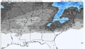
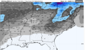
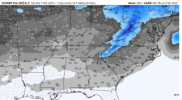
it's tough manCan't complain about how the Brad P. storm is looking this morning. All 3 major ensemble groups are over a 1 inch mean for CAD areas(even columbia has a 1 inch mean on all three!) from snow falling in the 270-360hr timeframe. That's about as solid of a signal as you can hope for that far out. In fact, I'm not sure how far back you'd have to go to find a run cycle where all 3 major ensembles featured over an inch snow mean for the same time period. I think several years.
View attachment 145523View attachment 145524View attachment 145525
Same here. One thing you can count on is the daytime temp forecast always goes down if it's frozen and within 5 days.I now have some snow in the forecast for 3 days on TWC app. The 18th, 19th and 20th. Hee hee. It's fun to look at at least.
Sorry for the lay question--Referring to the suppression or the gfs run that was already in Va?Pretty good northward jump on that Feb 14 snow footprint
