Um this system was never really suppose to be much of anything anyways, it’s coming at the tail end of a subtropical ridge, it’s never really had a favorable look
-
Hello, please take a minute to check out our awesome content, contributed by the wonderful members of our community. We hope you'll add your own thoughts and opinions by making a free account!
You are using an out of date browser. It may not display this or other websites correctly.
You should upgrade or use an alternative browser.
You should upgrade or use an alternative browser.
Pattern February 2024
- Thread starter SD
- Start date
NCSNOW
Member
- Joined
- Dec 2, 2016
- Messages
- 9,547
- Reaction score
- 18,994
Oh yea , no doubt. Just hunting a stake to pitch the hoarse shoes to besides the pattern chase. Good news is the DC swamp gets a nice cold rain out of it.Um this system was never really suppose to be much of anything anyways, it’s coming at the tail end of a subtropical ridge, it’s never really had a favorable look
I think I like where this run is headed down the line. Good piece wants to drop in. Looks like a good mechanism stretching to the pole for an eastern cold plunge. Hopefully no fantasy whammy here 
Yep. Now set the table. Or don’t 
TPV in the same spot as January. We toss 
Whammy ridge. NextTPV in the same spot as January. We toss View attachment 145496

Need that TPV around Maine otherwise we run into the same issue we always run intoWhammy ridge. NextView attachment 145497
CMC looks much more better with the progression Vs the GFS 

Backend table scraps for our NC peeps. You guys deserve it

That’s the best TPV I’ve seen modeled on the OP in some time. Pretty good setup for someone to get smoked on the east coast
That’s the best TPV I’ve seen modeled on the OP in some time. Pretty good setup for someone to get smoked on the east coast
Where’s that trailing wave when you need it…
JLL1973
Member
Hell yeah @Myfrotho704_ we need the Canadian progression here. Night and day 
End of the CMC looked like the path to victory 
Aleutian low was rotating back in. PNA stretched out in a good spot, and the TPV was about to drop the hammer. Panovich in big trouble with this look.
Ens are loaded tonight, notable storm signal starting to appear at D11-12 on the geps/gefs with the Gulf of Mexico slug of moisture and 50/50 low/confluence 


Huge western ridge this euro run. Big ol cold 1050 dropping in 

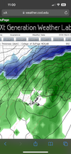
Now a legit storm signal on the EPS around the 18th-21st. All 3 major ensembles all highlighting this timeframe with overrunning precipitation associated with the low amp southern stream wave emerging out from the Baja/Mexico and a strong northern stream trough/50-50 low to our NE with sfc high pressure on top favorable for cold air damming. It’s about to get fun in here over the next couple of days 


LickWx
Member
Looks like a classic Piedmont storm, that southwest to northeast gradient is strong… the same one that breaks @Rain Cold and @SD hearts as well as mine . Though it probably means we get at least a little something even if it ain’t Greensboros 8 inchesNow a legit storm signal on the EPS around the 18th-21st. All 3 major ensembles all highlighting this timeframe with overrunning precipitation associated with the low amp southern stream wave emerging out from the Baja/Mexico and a strong northern stream trough/50-50 low to our NE with sfc high pressure on top favorable for cold air damming. It’s about to get fun in here over the next couple of days View attachment 145515View attachment 145516View attachment 145517View attachment 145518View attachment 145519
iGRXY
Member
Ens are loaded tonight, notable storm signal starting to appear at D11-12 on the geps/gefs with the Gulf of Mexico slug of moisture and 50/50 low/confluence View attachment 145511View attachment 145512View attachment 145507View attachment 145508View attachment 145509View attachment 145510

Multiple hits
I now have some snow in the forecast for 3 days on TWC app. The 18th, 19th and 20th. Hee hee. It's fun to look at at least.