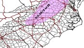
CMC is winter weather advisory for most of upstate SC and all the NC foothills and western Piedmont counties
-
Hello, please take a minute to check out our awesome content, contributed by the wonderful members of our community. We hope you'll add your own thoughts and opinions by making a free account!
You are using an out of date browser. It may not display this or other websites correctly.
You should upgrade or use an alternative browser.
You should upgrade or use an alternative browser.
Wintry Feb 6-8 2022 Winter Potential
- Thread starter SD
- Start date
12z cmc also has stayed consistent with onset ice along with the RGEM everyone says it’s good with CAD around here until it’s on an island .. we will see I guessRGEM continues to be off it's rocker and yet it was so good just a few weeks ago
View attachment 112899
HurricaneSolomon
Member
- Joined
- Dec 6, 2021
- Messages
- 132
- Reaction score
- 237
And of course the famous words... “Wintry mix north and west of the Triangle” are being echoed across the local weather reports. “North and west... North and west”.
Sent from my iPad using Tapatalk
Sent from my iPad using Tapatalk
YetAnotherRDUGuy
Member
Yep. Better chance of pingers toward the "climatologically favored areas of the NW piedmont."And of course the famous words... “Wintry mix north and west of the Triangle” are being echoed across the local weather reports. “North and west... North and west”.
Sent from my iPad using Tapatalk
12z cmc also has stayed consistent with onset ice along with the RGEM everyone says it’s good with CAD around here until it’s on an island .. we will see I guess
Keep in mind the loop that @Ollie Williams posted yesterday (reposting below) that showed an obvious strong cold bias of the RGEM vs the NAM/GFS/WRF and what I then said about it:
“If this doesn’t show how cold biased the RGEM is, I don’t know what would. Don’t just focus on your area. Look at how much colder it is in VA, TN, etc. Also, Jackson, MS, for example, where it has 16 vs 30 for the other models. It has Birmingham at 23 vs low 30s on others. Washington, DC, at 12 vs 20s others.”
So, IF the RGEM is on an island being colder than the others, I’d strongly suspect it is because of its cold bias. There’d need to be other models to be about as cold for me to not want to throw it out.
This loop was for today at 7AM EST/6 AM CST. I will shortly see what Jackson, Birmingham, and DC were actually at to see how these models did:
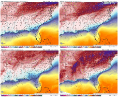
Edit:
1. Washington, DC/Baltimore area (Dulles/Andrews AFB/BWI) at 7 AM was actually 18-21. RGEM had 12 and others had 23-25. So, RGEM was ~7 F too cold but others were ~5 F too warm.
2. Birmingham/Shelby County airport at 6AM CST were actually 30-32 though the earlier lows were colder at 26-30. RGEM had 23 vs low 30s on others at 6AM. So, RGEM was at 6AM ~8 F too cold while others were almost perfect.
3. Jackson, MS, at 6 AM CST was actually 23-25 (with earlier lows at 21-24). At 6AM CST, RGEM had 16-17 vs 30-34 on others. So, RGEM was ~7 F too cold but others were ~8 F too warm.
Last edited:
Tarheelwx
Member
HRR and RAP both have wet bulbs in the triad in the 28-30 range from 6-10 am in the morning. Seems it’s just a matter of how quickly the precip moves in. I’m putting my money on a wwa for the triad tomorrow morning from 6am to noon. I suspect there to be school disruptions.
TW
TW
Tarheelwx
Member
I think your map lines up with where I think the wwa will be - at least for NC.
TW
YetAnotherRDUGuy
Member
GSP updated ice forecast. Throws some glazing along north CLT and 85 N and E.
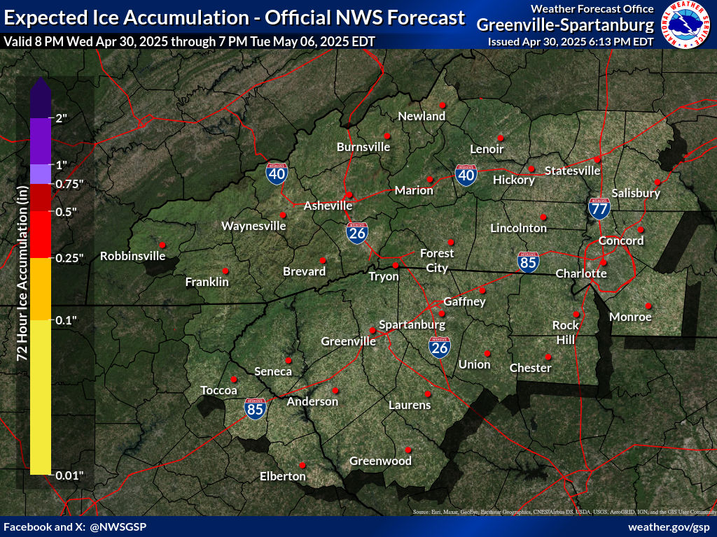
RAH's map hasn't been updated since early AM (shows no amounts yet).

RAH's map hasn't been updated since early AM (shows no amounts yet).
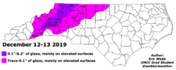
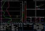
Wet bulb temperatures on soundings all along the shaded areas on my map when precip is moving in is at and below 32, it’s not really bullish having a small T-0.05 And considering areas tonight further north have radiational cooling including the triad before clouds move in, also there’s a stout dry layer in the foothills and mountains limiting precipitation further west.I think that’s too bullish IMO. It’s likely going to follow climo which would mean that it would likely setup like this, with less in the mountains.
View attachment 112927
 my map even goes with GSPs thought
NCSNOW
Member
- Joined
- Dec 2, 2016
- Messages
- 9,582
- Reaction score
- 19,103
RAH will update tommorow morning.GSP updated ice forecast. Throws some glazing along north CLT and 85 N and E.

RAH's map hasn't been updated since early AM (shows no amounts yet).
Worth Remember if your near freezing (33 for ex but your wet bulb temp is at or below 32 F, ZR on elevated surfaces is possible
I think temps will be above freezing before anything meaningful hits the ground this is all driven by lift too so we're saturating the column from the top down.
Maybe I'm just a little salty, but I can't think of a time when I've been following models where ZR accumulation was more than expected; it always verified to the NW fringing me. I could be wrong, but that's my opinion from personal experience.Wet bulb temperatures on soundings all along the shaded areas on my map when precip is moving in is at and below 32, it’s not really bullish having a small T-0.05 And considering areas tonight further north have radiational cooling including the triad before clouds move in, also there’s a stout dry layer in the foothills and mountains limiting precipitation further west. View attachment 112928 my map even goes with GSPs thought
Im in the heart of cad even if the qpf was more on the models I still wouldn't worry these things hardly ever materialize in this type setup this thing died a long time ago ensembles never supported it.Theres just no support among the models except maybe rgem maybe elevated surfaces see a very very light glaze u have to rub ur fingers on to feel.Maybe I'm just a little salty, but I can't think of a time when I've been following models where ZR accumulation was more than expected; it always verified to the NW fringing me. I could be wrong, but that's my opinion from personal experience.
Out ur way and to the NE along 85 is the best location to see a glaze I think ur map is spot on.Wet bulb temperatures on soundings all along the shaded areas on my map when precip is moving in is at and below 32, it’s not really bullish having a small T-0.05 And considering areas tonight further north have radiational cooling including the triad before clouds move in, also there’s a stout dry layer in the foothills and mountains limiting precipitation further west. View attachment 112928 my map even goes with GSPs thought
NCSNOW
Member
- Joined
- Dec 2, 2016
- Messages
- 9,582
- Reaction score
- 19,103
Precip is up to Columbia. Should be at state line by 10pm per this future radar. Lite, but scattered echoes.

