accu35
Member
- Joined
- Jan 5, 2017
- Messages
- 8,447
- Reaction score
- 9,967
There are a few decent hits in SC. Man it would be awesome to see them guys score @Meteorologist1999 @Mitch West @Snow Sucks! @who ever else lives there
What we been waiting to see! now wheres the 75-125 mile NW trend? If this was over our head, you know it (nw trend) would come.Shocked no one posted this
View attachment 144622
And we know if anywhere is gonna squeeze out precip, it’s Brevard and that area of the state18z Euro was a stronger with the southern low, precip field further north at hr90. These globals are going to start jackpotting the SW mountains/foothills soon I think. 18z GFS had a little spot of snow there.
The thing is if that band makes it up there, it could pivot in the same spot for 12-18 hours and drop 2-3 inches of liquid. The upside potential while very unlikely is through the roof there.
Also worth noting the highest GEFS snow mean for anybody is that area of the southern mountains around Brevard
If we could just get that ne low back to long island about another 80-100 miles.Classic trend to something painfully close View attachment 144635
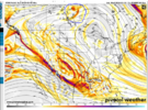
You mean this loaded ferris wheel seat pointed out earlier right?The euro is the only model with this energy on top of our block. May or may not matter. I think its what causing it to be the least phased as it shows up an dillutes any energy from our ne low getting yanked down at precisely the worst time
View attachment 144636

Man how long is this week signal gonna keep showing up.
