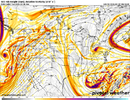
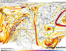
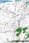
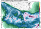
Yeah, I could easily see this trending “better” and ending with just a light cold rain for folks east of I-95. Almost the most depressing result possible.I am not quite ready to give up on this event at the coast. We are a 50-100 mile shift from seeing some precip and at ~100 hr forecast time, that is well within the range of modeling error. I am more concerned about the lack of real cold air at the coast.
-
Hello, please take a minute to check out our awesome content, contributed by the wonderful members of our community. We hope you'll add your own thoughts and opinions by making a free account!
You are using an out of date browser. It may not display this or other websites correctly.
You should upgrade or use an alternative browser.
You should upgrade or use an alternative browser.
Pattern FEB 3-6 2024 System
- Thread starter SD
- Start date
- Status
- Not open for further replies.
- Joined
- Jan 5, 2017
- Messages
- 3,769
- Reaction score
- 5,966
big win for apostles of the church of "we should worry about suppression". come join, plenty of room in this welcoming congregation
No doubt! It's more like "we should worry about anything and everything that can go wrong with this system because it probably will"
Storms like this is what made me step away from weather and weather forums many years ago. Of course, once in your blood, you will always keep an eye on things, but hard to believe the amount of ways I've seen us fail over the years.
dsaur
Member
There is a reason for the reminiscing about past storms...because good wide spread storms seem to be mostly in the past. Too warm now overall...too hard to find timing between the so many disparate parts that it takes for a deep south storm. Want your house down to the pad? Want Ala to get covered in sleet? We can give you that in the south, but wide spread ip/sn...better have a good memory, lol. Oh, we'll get anomalous all south storms...and some may be huge...but they'll be further apart. My last good sledding storm was in 05. The endless spring and summer lovers are winningYep...why I am not bullish for rest of winter. We haven't even sniffed anything remotely close to snow and what could go wrong has gone wrong. Some winters it wants to snow and some it works hard not to.
But I can handle much further apart as long as they are all blizzards, lol. I'd trade all my one inch snows for one 93 blizzard again. And that was mid March. Anything major is possible 'til mid March by climo. But 50 years between big time storms is kind of hard to take when the average life span is less than twice that. A storm my mother and grandmother always talked about in Atl. was in the 40's when the snow was up to the trolley steps, lol. It was deep, I have the pictures. So that's 50 years from 93, and that's before it go hot. My theory is that all this heat will flip a switch and the whole of Ga will get two feet, or more. Hope I'm not 6 feet under it when it happens, lol. Even if I make it to the full 50 years, I'll probably be drooling, and surely not sledding....unless they strap me down and give the sled a kick. Hmmm...I bet not many go out that way
Last edited:
carolinachaos
Member
There is a reason for the reminiscing about past storms...because good wide spread storms seem to be mostly in the past. Too warm now overall...too hard to find timing between the so many disparate parts that it takes for a deep south storm. Want your house down to the pad? Want Ala to get covered in sleet? We can give you that in the south, but wide spread ip/sn...better have a good memory, lol. Oh, we'll get anomalous all south storms...and some may be huge...but they'll be further apart. My last good sledding storm was in 05. The endless spring and summer lovers are winning
But I can handle much further apart as long as they are all blizzards, lol. I'd trade all my one inch snows for one 73 blizzard again. And that was mid March. Anything major is possible 'til mid March by climo. But 50 years between big time storms is kind of hard to take when the average life span is less than twice that. A storm my mother and grandmother always talked about in Atl. was in the 40's when the snow was up to the trolley steps, lol. It was deep, I have the pictures. So that's 50 years from 93, and that's before it go hot. My theory is that all this heat will flip a switch and the whole of Ga will get two feet, or more. Hope I'm not 6 feet under it when it happens, lol. Even if I make it to the full 50 years, I'll probably be drooling, and surely not sledding....unless they strap me down and give the sled a kick. Hmmm...I bet not many go out that way
73 Blizzard was in February…
Sent from my iPhone using Tapatalk
WEATHERBOYROY
Member

3K NAM looks like tropical storm force winds as she comes in at the Fla panhandle
Ive been in 3 seperate 15+ inch storms in NC. One in March, one on feb 27'-28th, other late Jan.73 Blizzard was in February…
Sent from my iPhone using Tapatalk
lexxnchloe
Member
lexxnchloe
Member
Maybe this begins the weekends last grasp at a miracle
WolfpackHomer91
Member
And for the record. Looks like the cold air showed up for this one. 2ms below freezing as well in NC on this frame. Our ull just to far south.
View attachment 144933
I mean technically we got 3 days lmao

Sent from my iPhone using Tapatalk
dsaur
Member
Sorry. 93.73 Blizzard was in February…
Sent from my iPhone using Tapatalk
Game over. If some last second miracle happens I'll open it back up..
- Status
- Not open for further replies.

