-
Hello, please take a minute to check out our awesome content, contributed by the wonderful members of our community. We hope you'll add your own thoughts and opinions by making a free account!
You are using an out of date browser. It may not display this or other websites correctly.
You should upgrade or use an alternative browser.
You should upgrade or use an alternative browser.
WolfpackHomer91
Member
We are down to 1 inch in the western piedmont. Will that increase or be flurries? I still think the storms comes NW some. Any thoughts? Thanks again to all for this forum.
Disregarding a low prob scenario like an early phase … our best shot is one Fro mentioned …. Tilt the axis of Precip SW -> NE and see if we can get any influx. Outside of that West of 77 for now is a 1-2”
Deal East of 77 over to I-73 I’d say 2-4” for now
Sent from my iPhone using Tapatalk
Mahomeless
Member
- Joined
- Oct 17, 2023
- Messages
- 900
- Reaction score
- 2,158
This has heartbreak city written all over it.
yet the nam can't see it.
broken025
Member
Maybe @Rain Cold really is cursed
jetstream30
Member
I’ll enjoy my 1-2. Thanks Wolfpack
Bigedd09
Member
It's only good when it shows what we don't want. SMHMaybe the AI is good after all. It’s been locked in for a couple of days now
View attachment 169775View attachment 169776
packfan98
Moderator
Starting to get in range of the fun winter graphics from the NWS.


NBAcentel
Member
That band is gonna be a menace wherever it sets up behind the low 
LickWx
Member
My first forecast for totals :
Jackpot hasn’t changed, Zebulon wake forest and ne
highest amounts will be 24-28 inches in gates county, metwannabe has a real shot at 2 feet
Here in wake I’ll go with wake forest 16-20 and Zebulon 14 inches or so . Brick unfortunately will be the winner
Shane has a real shot at a foot as well but I’m going with 8 inches, Pittsboro 4-6 and anything further west is cooked
First call
rburrel2
Member
It's probably bogus, but the Rgem/CMC, Ukmet, and Arpege develop some pretty serious streamer activity thursday morning. Would be enough to drop an inch or so of powder(maybe?) for some lucky people.


I expect to see those total go down for Virginia. More like 1 to 3 Roanoke back into Abingdon VA.Starting to get in range of the fun winter graphics from the NWS.
Even in the January storm it flexed a bit in the last 36-48 hours. Hence the snow was pushed well inland after being forecast to be confined to the Coastal Plain.True, it’s always there but it’s weak , it was there too during that jan storm, just all the way down in the Caribbean. Cold air is dense , it’ll keep pushing it down
Yep, but the Euro and EPS now have gone far enough south I've got a little wiggle room. Man I hope I don't watch 20 model runs of significant accums only for this thing to rocket NW 11th hour, been a long time since I've had a big dog... c'mon K let's reel it in!Its inevitable
interestedclimatist
Member
Then why are they saying an inch with the NWSMy first forecast for totals :
Jackpot hasn’t changed, Zebulon wake forest and ne
highest amounts will be 24-28 inches in gates county, metwannabe has a real shot at 2 feet
Here in wake I’ll go with wake forest 16-20 and Zebulon 14 inches or so . Brick unfortunately will be the winner
Shane has a real shot at a foot as well but I’m going with 8 inches, Pittsboro 4-6 and anything further west is cooked
First call

I
This winter will live in infinity as the year of wall to wall SE trends, not NW. Feels like twilight zone. Never see SE trends Now its become standard, atleast this season lol.
This winter will live in infinity as the year of wall to wall SE trends, not NW. Feels like twilight zone. Never see SE trends Now its become standard, atleast this season lol.
rburrel2
Member
I'd caution that pinning down/predicting coastal development isn't the same as predicting a precip shield expansion in an overrunning set up.
This doesn't have to tick back Northwest a bit. It could go any direction from here.
In fact I think a lot of times the back edge is rather sharp in these set ups and can leave some people who thought they would do well, hung out to dry. You're either in the hammer zone or you aren't.
This doesn't have to tick back Northwest a bit. It could go any direction from here.
In fact I think a lot of times the back edge is rather sharp in these set ups and can leave some people who thought they would do well, hung out to dry. You're either in the hammer zone or you aren't.
1/10 chance we have NW trend starting either tonight or tomorrow midday runs.I
This winter will live in infinity as the year of wall to wall SE trends, not NW. Feels like twilight zone. Never see SE trends Now its become standard, atleast this season lol.

NCHighCountryWX
Member
- Joined
- Dec 28, 2016
- Messages
- 700
- Reaction score
- 1,921
For Patreon subscribers Greg Fishel has a superb write up within the last hour on his icing concerns. I would like to post it but it’s paid subscribers content.I still believe in icing concerns for non-mountain areas. Good news for snow lovers sleet will let the snow live a few days longer than normal. Some will see ZR but focus may be shifting below Raleigh? We shall see.
iwantsouthernsnow123
Member
The HP is just over powering
View attachment 169778This is a bad trend for the Mid Atlantic, but it could a huge trend for further south such as Northern MS, Northern AL, Northern GA and Upstate SC. This is not locked in at all yet for anybody honestly, and trends are probably gonna continue this back and forth situation. We may not know what'll happen specifically until 24 hours until the event. IF that.
If you live along and east of a line from GSO to CLT disconnecting the waves here and allowing the southern/leading wave to survive and act independently may end to being the trend of a lifetime
can you tell us at least where he has those concerns or is just 'accumulating ice is bad' or somethingFor Patreon subscribers Greg Fishel has a superb write up within the last hour on his icing concerns. I would like to post it but it’s paid subscribers content.
Aren’t you in the dead center of this snow max?Yep, but the Euro and EPS now have gone far enough south I've got a little wiggle room. Man I hope I don't watch 20 model runs of significant accums only for this thing to rocket NW 11th hour, been a long time since I've had a big dog... c'mon K let's reel it in!

iwantsouthernsnow123
Member
What about NE GA in this scenerio?If you live along and east of a line from GSO to CLT disconnecting the waves here and allowing the southern/leading wave to survive and act independently may end to being the trend of a lifetimeView attachment 169786
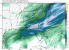
This is something I’ve been noticing since last night. The globals often underestimate the moisture response with this. Happened back in the 1/21 stormI think one thing a lot of people (NWS RAH included) are sleeping on is just how strong this upper level jet is. These jet dynamics are going to really enhance the precipitation shield further west (Euro is probably doing a pretty good job of it) from the coastal.
View attachment 169765
NBAcentel
Member
Amazing how the DC-north crew lost this one just like that 
WolfpackHomer91
Member
I expect to see those total go down for Virginia. More like 1 to 3 Roanoke back into Abingdon VA.
What intern made these? How can expected be higher than the 1/10 chance ?
Sent from my iPhone using Tapatalk
I think we want to keep this picture KyloG. It's 87hrs out but I don't know if we will see anything better under 100
It's drier but colderWhat about NE GA in this scenerio?
It will get back NW imo to some degree. Still a few subtle changes to go. Tilt,orientaion,track heading just a smidge, 1 degree changes everything. SER placement, etc.1/10 chance we have NW trend starting either tonight or tomorrow midday runs.
Energy isnt even over the conus raob yet. Small changes are coming. Could be opposite direction, but evidence weighted heavily suggest back to NW.
Again it will change some back NW Im just not sure how much. I personally just need dribble to get back to .5 qpf.
I'll tell u what if Wake County ends up with that much snow I'm not complaining about any winter storm misses for the next 3 years
Sent from my SM-S156V using Tapatalk
NCSnowFan777
Member
Has the EPS come out yet?
interestedclimatist
Member
you know the NWS doesn’t know what’s going to happen when they say Raleigh is getting less than an inch
a_gilmore88
Member
Starting to get in range of the fun winter graphics from the NWS.
What’s going on with that sliver of lesser totals in southern Rowan County? Makes no sense for just west of us to have a higher forecast with this setup IMO
Love seeing the euro trend stronger with the jet
Last edited:
SimeonNC
Member
Did you notice that SW tick in the snow axis between the last two panels?Amazing how the DC-north crew lost this one just like that View attachment 169789
Not true. Raleigh prob knows sleet and ZR will cut into snow. Better to wait another day before increasing snow amounts to 1-3”.you know the NWS doesn’t know what’s going to happen when they say Raleigh is getting less than an inch
This would make since. That’s pretty dynamic upper low. Very similar to 12/26/2010. That one while the coast low was bombing out and dumping on ENC, a strong upper low in the same general was producing a fairly steady light snow back across the Piedmont for most of the dayIt's probably bogus, but the Rgem/CMC, Ukmet, and Arpege develop some pretty serious streamer activity thursday morning. Would be enough to drop an inch or so of powder(maybe?) for some lucky people.
View attachment 169781View attachment 169785View attachment 169783
LickWx
Member
I made a first call , what’s yours ? Or too premature? Tbf this wave hasn’t even been sampled yet and won’t be till what tomorrow afternoon?Not true. Raleigh prob knows sleet and ZR will cut into snow. Better to wait another day before increasing snow amounts to 1-3”.