Tsappfrog20
Member
Not really, the trend has not slowed down at all, what’s stopping it? Richmond was the jackpot yesterday now they are eating cirrus almost and that’s a day ago! Another day of trends like this and it’s down to new Bern and hatteras
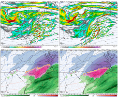
I like18z euro is accelerating the colder trend aloft View attachment 169751
Sure does. As long as the Euro holds steady we're good.Triangle looks good…
View attachment 169756
View attachment 169749
Well for starters this feature would probably raise qpf a bit, also it's a known rule that globals underdo qpf on the NW portion of the storm.
I keep mentioning the gulf storm but we managed to pull a dusting of snow out of a system that came close to whiffing even the coast in the modelling before that. We are in a much more favorable position, will someone be screwed by the transfer? Probably, but we're looking at a probably warning level storm even without the massively high qpf amounts.
I'm just appreciative that we in Charlotte have gone from a sleet-to-ZR fest to possibly a couple inches of snow.
You can look at the 500 mb charts and still the SER ridge lurking.Not really, the trend has not slowed down at all, what’s stopping it? Richmond was the jackpot yesterday now they are eating cirrus almost and that’s a day ago! Another day of trends like this and it’s down to new Bern and hatteras
although probably won't matter for my area18z euro is accelerating the colder trend aloft View attachment 169751
Is this where we want to start the nw trend tomorrow night?
True, it’s always there but it’s weak , it was there too during that jan storm, just all the way down in the Caribbean. Cold air is dense , it’ll keep pushing it downYou can look at the 500 mb charts and still the SER ridge lurking.
@1300m sorry I doubted you here.The “ Ole dry slot” making a big time appearance.View attachment 169761

Its inevitableIs this where we want to start the nw trend tomorrow night?
I think something much folks didn’t notice is that while yes slightly less QPF, notice the orientation /axis of snow bent back a little bit, likely due the that embedded southern wave consolidating a bit and slightly more tilted, this is why I like the cold trend we’ve had because something simple like this can turn this up several notches if it continues View attachment 169763
The coastal completely robs the Upstate on the 18z Euro. Ouch. Eerily similar to the 2004 epic screw job, just shifted a little further East.
View attachment 169759View attachment 169760
That's a 999 out there. whew!
Didn't you just say an ice storm for everyone south of you? lolDon’t think the dry slot is done trending usually it’s very expansive along the Lee and across state lines into VA. Gonna be a big storm down east. Are we traveling to Raleigh?
Triangle looks good…
View attachment 169756
Looks to be trending towards the AIFS in general. Pretty remarkable.
I still believe in icing concerns for non-mountain areas. Good news for snow lovers sleet will let the snow live a few days longer than normal. Some will see ZR but focus may be shifting below Raleigh? We shall see.Didn't you just say an ice storm for everyone south of you? lol
