NBAcentel
Member
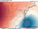
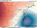
I know the RGEM is generally more revered compared to the NAM, but it's also a shorter range model that really isn't in its wheelhouse. But it does show the same general idea of a lot of the other modeling, although it's really skimpy out further west, like you said.RDPS pretty dog water save ENC/SEVAView attachment 169729
All the models have been advertising a minima between the dying out precip shield and the new one that develops from the coastal. The GFS just has that minima further East than some of the other modeling.Check out qpf total map on 18z gfs. Has 0.00 Moore county. Everyone.1-.2, something is off
Still playing catchup to the Euro.Undoubtedly a better run for C / E NC. May not be where we want it, but it's better than it's been. DC snow weenies in shambles, too.
oh nooooo, not the snow weenines in shambles who live in the area thats gotten some of the best snow of the entire Eastern section of the country this winterUndoubtedly a better run for C / E NC. May not be where we want it, but it's better than it's been. DC snow weenies in shambles, too.
Insanely good way,break in good or bad way, is the question
Insanely good way,
Insanely good way,
Insanely good way,
Am I missing something. This shows nothing
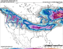
look at that mega block of snow trying to come into near ALL of NC, damnnnn
For how long though…The euro and gfs are so far apart on precip its crazy
Til 00z when eero goes to .2” all across ncFor how long though…
With that last frame it looks like it’s about to be a massive overrunning event right up I-85Yea it’s got Snow dang near to Atlanta Suburbs
Sent from my iPhone using Tapatalk


I'm not 100% what GRAF goes to, but I kind of assume they cut it off early, but idk for sure.Sounds like the GRAF must go out further than that shows (only until 5 am Wednesday), since the other Tweet mentioned it going to 1 pm on Wednesday. But extrapolated forward, I think that one that goes until 5 am would be pretty darn good, too.
The GFS is a little scary in the QPF department. I think we may be kissing the 1-2" QPF bomb goodbye. But we'll take the greater snow chances. The more optimistic models still keeps the Triangle near 1" QPF, which is great if that holds.
It's getting better each run, but just taking forever to catch up to the Euro, UK and Canadian.Nice to see low/mid levels aren’t torching at my locale anymore on the GFS View attachment 169736
Competely agree on the “dead zone” sentiment. Uncanny valley of forecastingWouldn't take much change at H5 for the low to be temporarily captured by the cutoff crashing in through the OH Valley, it's certainly trended in a more favorable orientation to do it over the past 24hrs. I feel like we are kind of in that dead zone between the globals and cams, where guidance has a habit of either loosing systems, or diminishing the expected impacts to sensible weather. The EPS shows we are still far away from locking down a track and strength, which will determine what, where and what everyone cares about, how much. I see some 970s in there tucked close, 980s, lots of 990s. We have a ways to go, I wouldn't write this off just yet, quite the opposite.
View attachment 169739
View attachment 169737
I think it's possible Snow could make it to the ground in Atlanta Wednesday morning. Their issue is they do have a rather thick boundary layer, but being pre-dawn and with a surface that's not torching that much, it's certainly possible under heavier rates.With that last frame it looks like it’s about to be a massive overrunning event right up I-85
I’ll put those odds @ 2.5%
Get it here early and we may be able to overperform the way Atlanta did back in early January. Assuming everything doesn’t go to sh** in the next 48 hoursThe GFS has me at 36/30 at 7am Wedsneday morning at which point it starts ripping snow at a moderate rate for the next 3 hours. Yet my surface temp stays at 34 degrees for that.... no chance. I'm not even a little concerned about the boundary layer here at this point.

Probably gonna decrease qpf18z ukmet is lot colder than it was at 12z. Hr 66
Probably gonna decrease qpf
Hey burrel. You think I could get some good accumulation in sw Rutherford county or you think I will get the dreaded dry slot. I think you will get a good front end thump for sure down your way. Thanks buddy.The GFS has me at 36/30 at 7am Wedsneday morning at which point it starts ripping snow at a moderate rate for the next 3 hours. Yet my surface temp stays at 34 degrees for that.... no chance. I'm not even a little concerned about the boundary layer here at this point.
