Mitch thoughts on CAEMan Raleigh has been just dunking on Charlotte over the years. Goodness..
-
Hello, please take a minute to check out our awesome content, contributed by the wonderful members of our community. We hope you'll add your own thoughts and opinions by making a free account!
You are using an out of date browser. It may not display this or other websites correctly.
You should upgrade or use an alternative browser.
You should upgrade or use an alternative browser.
At least Charlotte got its own January 2000 since then, February 2004. Raleigh did not get that much from that one comparatively.If you go back to January 2000, then yes. Raleigh gets some benefit of the Atlantic moisture that Charlotte does not, therefore the 2 inch higher average. The past 10 years, just north of Raleigh has scored, like in 2018, but otherwise snow drought here as well.
SimeonNC
Member
The whinging from the mountain folks is funny considering those dudes legit get a snow event whenever the wind blows a certain direction. and they tend to cash out in storm set ups that would never work for us lower elevation people in a million years. They'll be fine
I'm smoking on the Mid Atlantic's pack. Screw them lol.
I don't get why people from the CLT area and points east are worried about qpf, this isn't like the gulf coast storm where we were praying for flurries to an inch of snow at best. We still have qpf, it just won't be the super storm models had it earlier. Which is better for us when it comes to snow vs. an ice storm or just plain rain
Snowlover34
Member
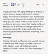
I am thinking rain around 32°-35°. Could see areas just Northeast of CAE seeing some icing. Cold source will actually be better North & kinda Northeast of us. Could also see us getting a light glaze, just don’t see it being a huge deal.Mitch thoughts on CAE
Sure, love the changes on modeling today, but I’ve been around long enough to not get too excitedI bet you’re happy then for this system
wow
Member
You guys bored in here? 
Brent
Member
14 inches possible in Southwest Missouri!
Last edited:
SimeonNC
Member
Does the storm come ashore tonight or sometime tomorrow?
Avalanche
Member
Doesn’t matter much for our area. WRAL said low impact event with melting on Thursday with a high upper 30’s.Does the storm come ashore tonight or sometime tomorrow?
LickWx
Member
That sun angle is no joke, if its clear itll zap itDoesn’t matter much for our area. WRAL said low impact event with melting on Thursday with a high upper 30’s.
I am still very concerned about ice south of Raleigh, even down around Fayetteville just south of me. Although if the snow line keeps nudging closer there may be more sleet involved down this way.
The air will be plenty cold after this storm and there are already rumblings about another storm this coming weekend. My wife's birthday is Saturday. I have been married twenty three years and this will be the first time I have seen snow on the ground for her birthday since I've been married.
WolfpackHomer91
Member
Doesn’t matter much for our area. WRAL said low impact event with melting on Thursday with a high upper 30’s.
No chance …. It’s 100% gonna have some sort of impact in both metros
Sent from my iPhone using Tapatalk
WolfpackHomer91
Member
Sure. But Raleigh has scored better with moderate to major systems. 2018 Dec was a prime example. A storm that should have worked out much better for Charlotte.
I think @Shawn was right the other day …. If you wanna feel safe in Charlotte bare minimum Chester and areas like that need to be in the game under you for your buffer
Sent from my iPhone using Tapatalk
Avalanche
Member
Just quoting the woman on 101.5. Think her name is Katty with the WRAL news centerNo chance …. It’s 100% gonna have some sort of impact in both metros
Sent from my iPhone using Tapatalk
Cad Wedge NC
Member
My latest NWS forecast .... What do they know that we don't?
Wednesday:
Snow, possibly mixed with freezing rain and sleet before 2pm, then snow between 2pm and 5pm, then snow, freezing rain, and sleet likely after 5pm. The snow could be heavy at times. High near 33. Chance of precipitation is 90%.
Wednesday:
Snow, possibly mixed with freezing rain and sleet before 2pm, then snow between 2pm and 5pm, then snow, freezing rain, and sleet likely after 5pm. The snow could be heavy at times. High near 33. Chance of precipitation is 90%.
NCWeatherhound
Member
interestedclimatist
Member
Tsappfrog20
Member
Just quoting the woman on 101.5. Think her name is Katty with the WRAL news center
Those aren’t updated till later in the day. So it would of been there thought from yesterday afternoon most likely
Sent from my iPhone using Tapatalk
NBAcentel
Member
NAM is coming in even more warm and amped so far. Lmao
Avalanche
Member
Yeah she may have changed her, um, positionThose aren’t updated till later in the day. So it would of been there thought from yesterday afternoon most likely
Sent from my iPhone using Tapatalk
Idk GSP changed my forecast in the evening update. This is for Morganton, NC (Foothills)
Snow, mainly after 9am. The snow could be heavy at times. High near 34. Chance of precipitation is 90%.
Snow, mainly after 9am. The snow could be heavy at times. High near 34. Chance of precipitation is 90%.
interestedclimatist
Member
I wouldn’t look at NAM until Monday night or TuesdayNAM is coming in even more warm and amped so far. Lmao
You beat me too it! I think they are banking on climo as per last nights discussion. That says a lot as conservative they are.My latest NWS forecast .... What do they know that we don't?
Wednesday:
Snow, possibly mixed with freezing rain and sleet before 2pm, then snow between 2pm and 5pm, then snow, freezing rain, and sleet likely after 5pm. The snow could be heavy at times. High near 33. Chance of precipitation is 90%.
Had to because look at this:Yeah she may have changed her, um, position
WolfpackHomer91
Member
NAM definitely looks more amped and warmer
ChattaVOL
Member
Ward Cleaver
Member
RAH’s hourly graph gives me 7.7” all snow IMBY. A pessimist is never disappointed, so I’m just not buying that yet. I’d cash out for 2” or 3” and start cheering for spring.
lol yes well WRAL was still claiming the triangle wouldnt see any snow except "maybe a few flurries" about an hour before the storm hit us in late January.Doesn’t matter much for our area. WRAL said low impact event with melting on Thursday with a high upper 30’s.
iGRXY
Member
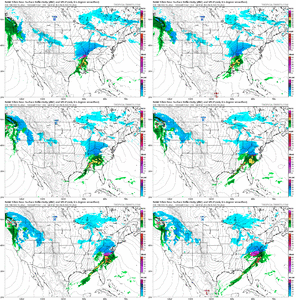
NAM is a cold rain all the way up until you get o the VA/NC border counties lol
interestedclimatist
Member
They did say the word “significant” though so that’s progresslol yes well WRAL was still claiming the triangle wouldnt see any snow except "maybe a few flurries" about an hour before the storm hit us in late January.
NAM is a Joe Bastardi special. He gonna dunk on us?
No science involved in this statement, just personal experience. The first January event, the ÑAM pushed the low into Alabama and said we were getting just rain. We ended up with 3 inches of white stuff. The ÑAM is on my poop list.
NAM is irrelevant at this range. No snow for SE VA or NE NC. Not too much for VA unless you are in NE VA.
Kind of a meh setup for us, haven't seen much to be excited about here in Huntsville. Not a lot to say about it IMO. There's already enough model run images posted in the thread by our more easterly brethren.Surprised with how quiet the TN/northern MS/AL/GA crew has been the last several days. One would think that nothing at all is going on over here lol. Overall setup is good for a potential light to moderate snowfall event for Memphis, Nashville, Knoxville, Huntsville, and Chattanooga. The northern burbs of Birmingham and Atlanta can't be ruled out either. Less precip to work with for those of us west of the Apps, but, timing is pointing to a mainly overnight/morning event which is definitely preferable for mid-February.
NBAcentel
Member
ICON already suppressing the height field further early in its run. Lol
I wouldn’t pay attention to nam until another cam joins its camp


