Bigedd09
Member
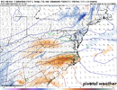
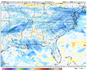
Defintley looked weaker and further south for sure. Trend needs to chill or else nc ain't gonna get muchProbably gonna decrease qpf
Defintley looked weaker and further south for sure. Trend needs to chill or else nc ain't gonna get muchProbably gonna decrease qpf
It looked about same hard to say at hr 66 it stopsProbably gonna decrease qpf
exactly. there's really no way for a big dogCold = Weaker / Warmer = Stronger …. Time to pick a side, we’re not getting both imo.
Sent from my iPhone using Tapatalk
The GFS is horrible at catching the effects of dynamic cooling on 2m temps. Some years back there was a series of runs where it had CLT getting snow for 30 straight and keeping the temp at 33 degreesThe GFS has me at 36/30 at 7am Wedsneday morning at which point it starts ripping snow at a moderate rate for the next 3 hours. Yet my surface temp stays at 34 degrees for that.... no chance. I'm not even a little concerned about the boundary layer here at this point.
Someone is going to get 6-12” from this. In my book, that’s a big dog, albeit not a historic one.exactly. there's really no way for a big dog
exactly. there's really no way for a big dog
Someone is going to get 6-12” from this. In my book, that’s a big dog, albeit not a historic one.
The NAM is your best hopeOk, I'm ready to barter. How much to get .5" of qpf for the CLT metro? We can take up a collection. Is that so hard? I don't need a full inch, just a half ok? Geez.
So an earlier phase is out of the question, what's our last hope to fill in the precip further west? Exit region streaking jets? Any hope left at all metrologically for WNC?
Do we? All we have seen this year is further and further SE why do you think this will be any different? I’m thinking more SE, the trend has not shown any signs of stopping for like 500 runs now . Richmond is going to be sweating rn , I’m sticking to my call congrats Zebulon to wake forest and northeastwardDraw a Line from Reidsville NC to Williamsburg VA …. There’s your hot pocket for now imo.
South Boston VA if I was placing a bet currently …. Allowing for some wiggle back to West which we know is coming
Sent from my iPhone using Tapatalk
We don't need .5" qpf for a good storm, also you realize that models that the qpf will more likely than not be higher than depicted in the globals.Ok, I'm ready to barter. How much to get .5" of qpf for the CLT metro? We can take up a collection. Is that so hard? I don't need a full inch, just a half ok? Geez.
So an earlier phase is out of the question, what's our last hope to fill in the precip further west? Exit region streaking jets? Any hope left at all metrologically for WNC?
QPF decreasing still I imaging though?lol UK snowing down near just north of Birmingham now View attachment 169748View attachment 169747
They really needa be on their guard. SC and Georgia too. Not feeling great about the piedmont of nclol UK snowing down near just north of Birmingham now View attachment 169748View attachment 169747
I think you may want to start rooting for an 18z GFS like solution that gets us .25 and doesn't rely on anything related to the coastal stuff. Those numbers can easily be juiced up .3-.4 with some luck.Ok, I'm ready to barter. How much to get .5" of qpf for the CLT metro? We can take up a collection. Is that so hard? I don't need a full inch, just a half ok? Geez.
So an earlier phase is out of the question, what's our last hope to fill in the precip further west? Exit region streaking jets? Any hope left at all metrologically for WNC?
We don't need .5" qpf for a good storm, also you realize that models that the qpf will more likely than not be higher than depicted in the globals.
Insanely good way,
I got the Euro.
lol UK snowing down near just north of Birmingham now View attachment 169748View attachment 169747
Close to the GRAF house modellol UK snowing down near just north of Birmingham now View attachment 169748View attachment 169747
I got the Euro.
Why do you say amounts will be higher than shown on the globals? You think it'll be higher than the EPS which is usually rock solid? .2 or so for our back yard?
Yeah, .5 is what I'm shooting for for a memorable moderate event. Generally we'll need .4 probably to get to a warning criteria storm. Less than that will be an advisory event IMO

I'm sorry, but you lose all credibility when you say a 0.5" to 1.5" all frozen QPF event would be more of a nuisance event. WTH someone please explain that one to me?Here’s the afternoon discussion from NWS in Raleigh:
LONG TERM /WEDNESDAY THROUGH SUNDAY/...
As of 400 PM Sunday...
A southern stream shortwave will move east from the southern Plains
on Tuesday night to the Deep South on Wednesday, while a separate
northern stream closed mid/upper low drifts SE from the Northern
Plains to the Upper Great Lakes region. The southern wave and upper
divergence from the right entrance region of an associated upper jet
streak will spawn a surface low that develops on a cold front along
the Gulf Coast on Tuesday night and early Wednesday. This low will
then deepen and moves NE in a classic "Miller A" track along or just
off the Southeast US coast on Wednesday afternoon and evening. With
a cold dry air mass in place ahead of the system, confidence is
increasing in a period of frozen precipitation across most of
central NC from late Wednesday morning into Wednesday evening.
However, how impactful it is still remains to be seen, with both
precipitation types and amounts will very much up in the air. This
does not look like an all snow event, as there is almost definitely
going to be significant warming aloft with southerly flow at 850 mb.
At this time, the most likely part of the region to stay all or
mostly snow is the far northern Piedmont, with a fairly large
corridor of mainly sleet and freezing rain to the south. Our
southern tier of counties including FAY are most likely to stay all
or mostly rain.
A lot will depend on the degree of phasing that can occur between
the southern stream and northern stream wave, the latter of which
also has an associated jet streak which dives into the Central
Plains and mid-MS Valley. The ECMWF (and to some degree the
Canadian) has a faster and deeper northern stream mid/upper low
compared to the GFS, allowing for stronger height falls and greater
energy interaction between the two systems. This results in a deeper
coastal low and would bring a high impact winter storm to central
NC, with colder temperatures and greater QPF amounts. The GFS would
be more of a moderate/nuisance type event that only lasts for 6-12
hours before we are quickly dryslotted after 00z Thursday. This is
borne out in their respective ensembles as well, with the EPS
ensembles depicting a 50+% probability of warning criteria snow (>=
3 inches) across roughly the northern half of the region while the
GEFS only have 20-40% probabilities that are confined to our
northern tier of counties. Deterministic and ensemble guidance has
also been depicting potential for significant amounts of freezing
rain somewhere across central NC, perhaps exceeding a quarter inch,
with the greatest probabilities from around Raleigh to the south and
east. The NAM is surprisingly the warmest out of all guidance, with
mostly liquid for a good part of the area, but considering this
storm is at the very end of its range, will mostly disregard it at
this time.
It should be noted that neither the GFS or ECMWF has complete
phasing between the two waves, and the overall trend in both
deterministic and ensemble guidance has been slightly downward in
terms of overall QPF with a faster exit of precip, so will need to
see if this trend continues. Yesterday the ensemble mean QPF was in
the 1 to 2 inch range, while today it is more like the 0.5 to 1.5
inch range, lowest west and highest east. If this trend continues,
we would be looking at more of a nuisance type event like the GFS
has, but that is a big if. Stay tuned as details should become
clearer, hopefully by tomorrow when the southern wave reaches the
West Coast and we can get better sampling. As for timing,
precipitation still looks to start from SW to NE on Wednesday
morning, ending from SW to NE during the evening or early overnight
hours. Temperatures will be highly dependent on the ultimate
evolution of the system, but Wednesday is likely to be quite chilly
with temperatures stuck in the lower-to-mid-30s during the day,
maybe even upper-20s in the far north. Forecast lows Wednesday night
are in the upper-teens to mid-20s.
What do the green lines signify?View attachment 169749
Well for starters this feature would probably raise qpf a bit, also it's a known rule that globals underdo qpf on the NW portion of the storm.
I keep mentioning the gulf storm but we managed to pull a dusting of snow out of a system that came close to whiffing even the coast in the modelling before that. We are in a much more favorable position, will someone be screwed by the transfer? Probably, but we're looking at a probably warning level storm even without the massively high qpf amounts.
I'm just appreciative that we in Charlotte have gone from a sleet-to-ZR fest to possibly a couple inches of snow.
The colder temperatures look good for keeping what might fall in the snow category. Now the question is can we keep the QPF?18z euro is accelerating the colder trend aloft View attachment 169751
Yeah, lots colder all around. Now can we keep the moisture?18z euro is accelerating the colder trend aloft View attachment 169751

My call exactlyTriangle looks good…
View attachment 169756
