WolfpackHomer91
Member
Just don’t think it’s your storm man
I can never tell if Ross has a level of sarcasm and troll to him like me or if it’s his actual analysis …. But I like it lol
Sent from my iPhone using Tapatalk
Just don’t think it’s your storm man
It was 24 hours agoJust don’t think it’s your storm man
 Euro had 10+ over us. Now 3 or 4 if lucky. NW trend come back
How yall feeling about Raleigh?

I think it's going to be one of those storms where the cutoff line for snow and ice is going to be at the southern border of Wake and very sharp cutoffs in amount from south to north through Wake.How yall feeling about Raleigh?
It willIt was 24 hours ago

It will probably trend a little stronger as it comes in view of the short range and hi res models.Weird CAD look with this storm. Deep Ice into SE NC but doesn’t dig deep into SC.
Edit. It does like the Pee Dee of SC with some models.
I’m just not sure how much of a NW trend we’ll see with this one in the last 48 hours. There will be some. There always is, but we are seeing a legitimately strong block in place up top that pressing things southeast.It will

not trolling, just been reading hemingway. enjoy using 7 words to say what others can in 50I can never tell if Ross has a level of sarcasm and troll to him like me or if it’s his actual analysis …. But I like it lol
Sent from my iPhone using Tapatalk
")
i don't know if the euro monsters will verify for you and that's ok. euro is a great model but i think it's overdone some storms this year. the theme (wave turning into coastal development) is unkind for your neck of the woods. i could see some enhancement with cad flow around your neck of the woods but frankly i forgot wytheville's tendencies (i used to live in and forecast for bluefield). weaker/flatter trend does not help you. if i were to offer encouragement, we've done pretty good at pulling northwest trends out of our back pocket when all looked lost this year- certainly after i had thrown dirt on things. but point remains- don't think this is your stormIt was 24 hours ago
9 times out of 10 there is a NW trend so I am not concerned just yet. Just means the difference between 3 or 4 inches and 8 or 9 inches.not trolling, just been reading hemingway. enjoy using 7 words to say what others can in 50
i don't know if the euro monsters will verify for you and that's ok. euro is a great model but i think it's overdone some storms this year. the theme (wave turning into coastal development) is unkind for your neck of the woods. i could see some enhancement with cad flow around your neck of the woods but frankly i forgot wytheville's tendencies (i used to live in and forecast for bluefield). weaker/flatter trend does not help you. if i were to offer encouragement, we've done pretty good at pulling northwest trends out of our back pocket when all looked lost this year- certainly after i had thrown dirt on things. but point remains- don't think this is your storm
Miller A's have traditionally produced the biggest snowstorms for WNC and Western Va. WNC and Western Va are usually not in a screw zone unless the storm is weak or tracks far to the south. This particular storm may indeed favor the NE part of the state. There have been so few Miller A storms lately anyway.In Miller A's those are often the screw zones. I said a couple days ago that this favors the northeastern part of the state
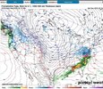
That's a really pathetic precip shield directly north of the low. But it is a weak low.
A bit worried about coastal convection racing out ahead and cutting off moisture influx inland. Will this dry slot before it even gets going?Just does not look all the impressive.
Miller A's have traditionally produced the biggest snowstorms for WNC and Western Va. WNC and Western Va are usually not in a screw zone unless the storm is weak or tracks far to the south. This particular storm may indeed favor the NE part of the state. There have been so few Miller A storms lately anyway.


if OBX scores another 8+ inches while central and Western NC get nary an inch or two, i swear to god...
I could be wrong but this appears to be moving from a classic Miller A to just overrunning followed by strengthening low once it hits the Atlantic. A weak overrunning at that, given the low totals west.That's a really pathetic precip shield directly north of the low. But it is a weak low.
Dude, that’s just so beautiful. Good rates, 23F, below freezing through the whole column. Really starting to like where we’re sitting now. May not be as big of a QPF bomb but that was always going to result in more ZR/IP, anyways.Despite RGEM ptype maps showing sleet, RGEM soundings are clearly snow all hours at RDU (hr 81 got close, but would be mostly snow). P.S. Certainly dangerous (unwise) to be analyzing RGEM soundings at the end of the run, but for now, it's all we've got as a first look at thermals. RGEM most likely too cold at the surface, but our biggest concern is aloft.
View attachment 169619
View attachment 169621
View attachment 169618
too many people are moving hereHow yall feeling about Raleigh?