• Hello, please take a minute to check out our awesome content, contributed by the wonderful members of our community. We hope you'll add your own thoughts and opinions by making a free account!

Wintry Feb. 19-20

Well we've definitely carved out some space for a north trend.

One issue with the weaker solutions is even though height fields are lower... we aren't taking advantage of any dynamic cooling because we only have light precip. So the profiles aren't improving all that much. Some subtle shifts north/stronger will actually help to cool the column for area's right on the line.
 
People are worried about the NAM. Let’s not forget I proved it wrong with the last system. Just as a reminder, NAM can be good with figuring out the column about 24 hours before the storm, but outside of that it overestimates WAA and pushes precip too far north.
 
People are worried about the NAM. Let’s not forget I proved it wrong with the last system. Just as a reminder, NAM can be good with figuring out the column about 24 hours before the storm, but outside of that it overestimates WAA and pushes precip too far north.
The 84 hour NAM is like the 240 hour GFS.
 
People are worried about the NAM. Let’s not forget I proved it wrong with the last system. Just as a reminder, NAM can be good with figuring out the column about 24 hours before the storm, but outside of that it overestimates WAA and pushes precip too far north.
It's good with resolving thermal profiles, but only when it's actually showing the correct 500mb solution.

I think if/when the NAM comes back to reality it's actually gonna be a good bit colder than the globals with the initial column cooling. It's already very close to starting out as heavy snow here even with the ridiculous solution it's spitting out.
 
Noise or not, we need any and all slight SE shifts right now, we're not gonna wiff with no qpf.
Yeah, for sure...have we ever had a phased costal not tick NW inside 36...

But this does have a super block and off the charts cold air mass to it's west.

You can see that insane 1050hp ticking east some...and actually little stronger.

ecmwf-ensemble-avg-conus-mslp-1739685600-1739988000-1739988000-20.gif
 
This is all that's keeping this area from being all snow on the 06z Euro. Every other layer is below freezing. And this area stays around 1C at 850mb for like the entire storm.

Edited to add: There's probably a stronger push of warm air around 800mb around Raleigh later on in the storm. (but maybe not, I don't have sounding data).

View attachment 169557
I was just looking at the 850 thermals for the storm on the Euro for the RDU area and they start out at -2 C and as the storm progresses and as the LP rides along the coast they warm to 0 C and 1 C. It is going to be a close call as far as what the predominant precipitation type will be for the majority this storm. There are still plenty of model runs to come but I'm still concerned about heavy freezing rain despite the positive trends that were seen yesterday.
 
I was just looking at the 850 thermals for the storm on the Euro for the RDU area and they start out at -2 C and as the storm progresses and as the LP rides along the coast they warm to 0 C and 1 C. It is going to be a close call as far as what the predominant precipitation type will be for the majority this storm. There are still plenty of model runs to come but I'm still concerned about heavy freezing rain despite the positive trends that were seen yesterday.
I’ve said it before and I’ll say it again, most of what these models are depicting as ZR will most likely be sleet. From a climo standpoint Miller A storms only have a very narrow of ZR if any at all. Now that narrow corridor can see a significant accrual… I experienced that in January 2017.
 
The blocking and confluence are doing work. Things should hopefully start to stabilize by tomorrow as all the players should be well-sampled.

A few more trends like the last 36-48 hours, and we're looking at a coastal event.

And for the life of me, I can't understand after all these years why anyone is worried about the 84 hr NAM.
 
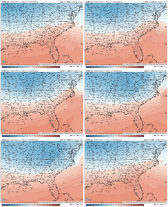
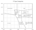
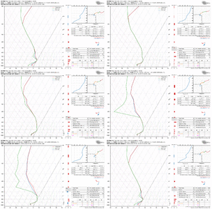
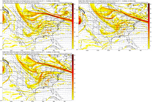
06z Euro still too warm in the mid-levels from CLT to RDU for all snow. 850-700mb partial thicknesses at 1550m (considering cold 1000-850mb layer) would suggest predominant ptype would be a sleet/snow mix transitioning to all sleet. Soundings agree.
ecmwf-deterministic-se-thck_850-700-1739685600-1739988000-1740063600-40.gif

updated.nomogram.labels.png
ecmwf-deterministic-KRDU-sounding-1739685600-1739977200-1740020400-40.gif
 
Last edited:
0a05424714e335a05ae8ff02620516bf.jpg

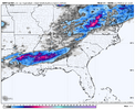
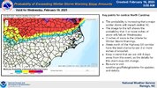
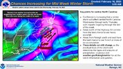
40% chance of moderate impacts from snow/ice for parts of central NC


Sent from my iPhone using Tapatalk

These guys are useless…. I learned that in Jan and even now look at them. So according to that map only RAH/Triad have an impactful event. Yea ok….. where do some of these dudes go to school to work at these places?


Sent from my iPhone using Tapatalk
 
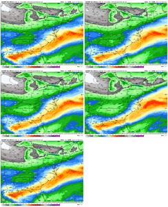
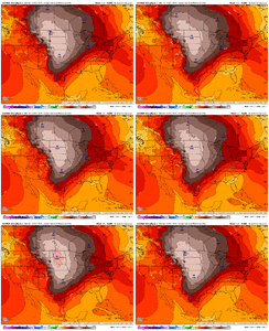
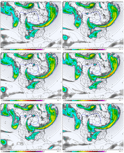
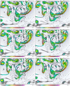
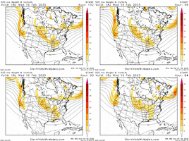
6z AI v/s 6z EPS...

Can see on the EPS the west coast ridge broadening out shoving things east a tad. Other than it's fairly close. A blend of the two is probably coming...whether it's 80/20 or 50/50 or somewhere in between.


ecmwf-ensemble-avg-namer-vort500_z500-1739685600-1739944800-1739944800-20.gif


ecmwf-aifs-all-namer-vort500_z500-1739685600-1739944800-1739944800-20.gif
 
6z AI v/s 6z EPS...

Can see on the EPS the west coast ridge broadening out shoving things east a tad. Other than it's fairly close. A blend of the two is probably coming...whether it's 80/20 or 50/50 or somewhere in between.


View attachment 169577


View attachment 169576
I have been wondering if there was any way it could be shoved east enough along with a late phase so that we could get a humdinger here in central and eastern NC. None of the models have shown this, but we are still not far away from that solution.
 
I have been wondering if there was any way it could be shoved east enough along with a late phase so that we could get a humdinger here in central and eastern NC. None of the models have shown this, but we are still not far away from that solution.
I don't want to overeact to the off hour run of the Euro but it was trending they way we wanted...let's see how today's runs go.

Can see the southern energy tick a little weaker on the 6z...but it's one run.

709e982c-4841-4ce8-879b-2b732573feb2.gif
 
12z runs finna be very interesting I think. Grab the popcorn

Sent from my A600DL using Tapatalk
Yeah, we're close enough now we should start getting closer alignments of the models today. Of course QPF and fine details will go down to the wire.
 
go ahead and take your Dramamine in the next 30-45mins. We’re about to seperate the haves and the have nots here soon. No one is safe atm

Agree, hope all of yall that wish casted a weak toddler system into existence bc you’d rather have 1-3”
Of All snow than a memorable mixed bag get your wish…. Bc it’s coming another weak strung out piece of garbage that somehow finds the courage to blossom for the Coastal plain. This could’ve been a Banner event in GSO/Winston/Statesville/Foothills ect


Sent from my iPhone using Tapatalk
 
From GSP.
Different guidance brings snow totals farther
south; e.g., ECMWF more bullish with snow amounts, GFS is more like
what snow? (except for the NC mountains of course). Ensemble members
of each are slightly different but in general there does seem to be
a dividing line around the NC/SC state line. Uncertainty of course
remains quite high on extent of accumulating snow, amounts, how much
ice may (or may not) mix in. Miller-A type systems are typically
less likely to have "mixed bag" p-types with the location of the low
across the coast, so taking pattern recognition into account vs pure
model output, will be interesting to see how the forecast evolves.
 
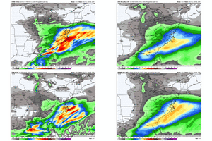
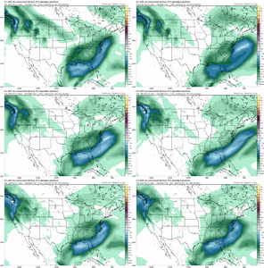
0z Euro had the highest precip amounts and coldest at the surface of recent runs for central and eastern NC

Sfc temps in low and mid 20’s at 4pm Wed for Charlotte / Greensboro / Raleigh

View attachment 169503

View attachment 169504

Given this storm will be happening during the day in mid-February, I think these low surface temps are really good to see. Sun angle doesn’t have nearly the effect with getting wintry precip to stick when it’s <25 degrees compared to when it’s 32. Plus, precip looks heavy which makes it less of an issue, anyways.
 
Yes, I would be very happy with 3-5 event.
I kinda get Dec 2017 vibes with this system. Not the same setup but yesterday's Euro putting us in the bullseye shows us what's possible. I'm just thankful to have a Miller A. I think the precipitation will be there based off climatology.
 
I rarely post on discussion threads, usually only observation threads. Mainly because I can report on what I’m seeing rather than extrapolating what the models show, I will leave that to those who are more experienced than I am on that.

I have been posting and reading here since the AccuWeather forum days, and I can say this is a first. “Wishcasting” does not influence what the weather is going to be doing, and yes, it still has the ability to change even this close, for better or worse.

You can move this to banter or whatever you’d like, just giving my two cents on this post.
 
I am in the camp of "give me more precipitation, and I will take my chances with the thermals". Give me 1" of QPF and if it's a cold rain, then so be it.
Yeah I'm not worried about thermals I think us guys along I-40 west of 77 are looking good for mostly snow. The question is how much QPF do we get back our way. At the end of the day I like where we sit.
 
Agree, hope all of yall that wish casted a weak toddler system into existence bc you’d rather have 1-3”
Of All snow than a memorable mixed bag get your wish…. Bc it’s coming another weak strung out piece of garbage that somehow finds the courage to blossom for the Coastal plain. This could’ve been a Banner event in GSO/Winston/Statesville/Foothills ect


Sent from my iPhone using Tapatalk
I think a lot of us are in the CLT area are remembering the fact that it’s been 3 years since we’ve seen a snowfall of 1” or more. It’s been 10 years since we had a legit February storm. Also let’s remember moisture more back to the NW than what is modeled on the globals at this range.
 
Back
Top