NBAcentel
Member
Looks like the EC AI came in with another small QPF increase. Last 3 runs View attachment 169517
If you’re wondering why the storm is a late bloomer, here on the Euro you can see how the positive-tilt and broad-based southern stream wave over the 4 corners sharpens and turns negative tilt as it treks east into the SE states, with some weak phasing from the northern stream diving in
View attachment 169510
Also, the jet streak over the Mid-Atlantic re-strengthens with curvature, with the lower Mid-Atlantic and Carolinas in the right entrance region of the jet streak (upper level divergence promoting lift).
Now to get more modeling on board
View attachment 169511

Yeah, definitely colder at the surface. 850’s looked worse unfortunately.06z GEFS punching ice a lot deeper in to SC.


Noise or not, we need any and all slight SE shifts right now, we're not gonna wiff with no qpf.Can see just subtle shifts s/e...seems like mostly noise, especially in the off hour runs
View attachment 169551View attachment 169552
If there's a system that will shift NW 11th hour, it's an amped up storm like this. Personally I'd live to see it keep shifting S/SE next 24-48 hrs to give me wiggle room when it comes back NW
View attachment 169553
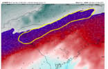
06z was a smidge weaker but also a smidge warmer aloft, transition line slight NW jog. More in line with classic SW/NE orientation splitting Wake down the middle992 LP on the 00z run, didn’t realize it was that strong till now… interesting
Sent from my iPhone using Tapatalk
06z Rgem was slightly stronger/more qpf than the 00z run. Thermals stayed the same if not better though. Good signs.
View attachment 169554
It could be on to something b/c it matches up very well with the Euro AI/Graphcast.I personally like that look of the RGEM, just don’t know long that’s going to last.
Sent from my iPhone using Tapatalk
It could be on to something b/c it matches up very well with the Euro AI/Graphcast.


I think you’re just seeing a model consensus forming of 3-5 inches.Foothills region is drying up quickly on all models . Not good , at this rate we will have very limited moisture to work with . Plenty of time to change , but a trend is a trend .
Looks like more of a qpf issue than anything else.6z eps went the wrong direction like the op
View attachment 169558
