SnowNiner
Member
4 models in a row not looking good for western NC.
I was fringe to the south, now I’m fringe to the east.
4 models in a row not looking good for western NC.
Nice dry slot in western NC
Yea I completely agree. People still think our area does the "best outside the mountains" which just isn't true anymore. Starting to think the4 models in a row not looking good for western NC.
Yea I completely agree. People still think our area does the "best outside the mountains" which just isn't true anymore. Starting to think theput a curse around here
Really hoping the southern trend didn't start too early and we can amp this up slightly instead of the continuing trend south.
Plenty of time BF. Think euro. You don’t want to be sweating temps in 36 hours like most of this board is going to be. Lock it in. You’ve got the wiggle room. We don’t4 models in a row not looking good for western NC.
Yup, looks like it’s gonna be slightly more amped and warmer in the mid levels againThe height field seems higher initially this euro run, could signal a pause in the trend overall but we’ll see
Yeah, Upstate SC and NE georgia literally needs everything to connect perfectlyPlenty of time BF. Think euro. You don’t want to be sweating temps in 36 hours like most of this board is going to be. Lock it in. You’ve got the wiggle room. We don’t
Not liking even that slight northern tick.. Hopefully that does not continue, there's no wiggle room in NE GA.
Our area has been getting that dry slot to show up on every storm, so was just waiting for first signs.If I'm going to die on model runs, I said earlier need to stop the southward trend so far GFS and ICON has cut my totals in half. Getting a bad feeling about this now, that's why I never get excited anymore until maybe 2 days before event. I feel a big dry slot in the foothills.
6+ hrs of solid snow with a sleet finisher and a little extra snow on the backend for dessert? id take that in a heartbeat
0z Euro had the highest precip amounts and coldest at the surface of recent runs for central and eastern NC
View attachment 169503
View attachment 169504
10:1 probably still sounds about right there. Probably good lift producing dendrites, but the flakes would rime with warm nosing approaching 0 deg C before going into the near surface cold layer. But 4 days out too so things will change of course with temperatures and mixed precip typesAt 23 (As depicted) even though it’s late season wouldn’t that be 12/13 to 1? Ik normally Feb/March is paste bombs at like 6-8/1
Sent from my iPhone using Tapatalk
Myfrotho, I know your concentrated on your area, but will you do a moving ptype map for my area around memphis tn of the 0z euro please? From Arkansas moving east. Maybe the proper name is animation lol


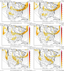
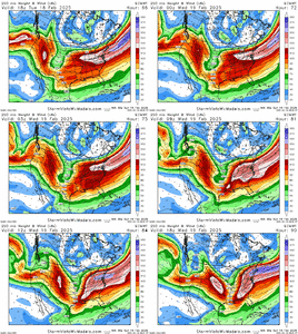
If you’re wondering why the storm is a late bloomer, here on the Euro you can see how the positive-tilt and broad-based southern stream wave over the 4 corners sharpens and turns negative tilt as it treks east into the SE states, with some weak phasing from the northern stream diving in
View attachment 169510
Also, the jet streak over the Mid-Atlantic re-strengthens with curvature, with the lower Mid-Atlantic and Carolinas in the right entrance region of the jet streak (upper level divergence promoting lift).
Now to get more modeling on board
View attachment 169511

Earlier phase would likely lead to more precip, but add warmth aloft, with a north adjustment to storm track. However, we’re probably late in the game here to see big changes associated with stream phasingWould an earlier phase back west kick slight negative tilt ?
Sent from my iPhone using Tapatalk
