• Hello, please take a minute to check out our awesome content, contributed by the wonderful members of our community. We hope you'll add your own thoughts and opinions by making a free account!

Wintry Feb. 19-20

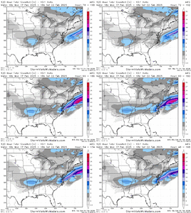
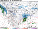
Euro AI went a smidge south and west with precip amounts at 18z. More precip for most of the forum. It's getting fairly consistent now, looking through recent runs.View attachment 169400
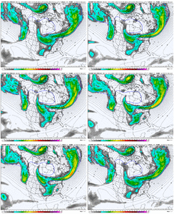
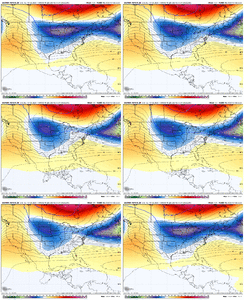
You can see the confluence in the Atlantic is stronger with the frontal feature poking down more with the isobars poking south more
 
That’s some wicked contouring on the EPS..gonna be a messy storm I think and someone is going to experience a lot of pain when it’s all said and done. Fun times ahead though.

CLT is always right there on the fringes, 85 line. I’m about 40 miles north of center city and I feel like I’m on the outside looking in.

Glad to see 18z euro double down, not just a one run fluke. But I’m completely ready for it to stop 🛑
 
10” in American village from that one. 8” Sunday and 2” with the wave on Monday.
used to live right around there! by dec 2018 i was more north durham but i was near american village for that solid half foot dump of snow in jan 2017
 
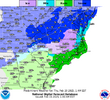
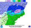
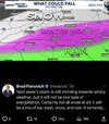
This is odd. They're backing off?
i dont think theyre backing off at all -- the shift from earlier forecast map to current one shows that they initially had a huge swath of NC clocked for only rain/zr, with a very small NW section of all snow. in the latest map, they've expanded snow/rain or snow/zr mix to a way bigger area, even extending down to the tip top of SC
 
@Myfrotho704_ you mentioned Dec 2018?

Pain. Biggest bust i’ve ever seen here. By a long shot

Backend dusting with this radar depiction all through the night. I almost cried. Travelers Rest got 6+. About a 15-20min drive from my house. This was late arriving cold and it still leaves a bad taste in my mouth.View attachment 169401
I got 6 inches here imby for that one,
Guy I worked with at the time lived in Simpsonville and said they had flurries.
It didn't cover the tops of the cars in his subdivision.
That's not the only time I've seen sharp a gradient in GVL County.
 
Last edited:
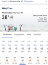
You guys and your phone apps smh 😆
I told my gf about this potential threat a few days ago. She nodded politely then changed the subject.

She matter of factly brought it up again today, but only because a snowflake showed up in her phone app for Wed. 😏 🤷‍♂️

While were on the subject, my weather app says 14'' combined for Wed/Thurs. 🤣
 
@griteater I’d love to hear your thoughts. Is that snow meter moving up for you?
Lot of good analysis on here as usual. The continued early trend of more Atlantic confluence moving the east coast heights south is the one that is most interesting to me (better starting point for the cold air)

Safe to assume that the Euro suite is taking a lead role here, but we still need to see more model consensus to gain confidence in the forecast

Precip duration and 500mb evolution suggest high end totals will be tough to achieve, though more potential as you get closer to the coast

Temperature wise, my belief is that these colder trends will stabilize by tomorrow and climb north some Mon-Tue

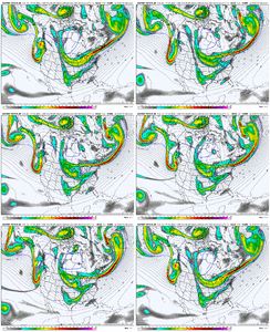
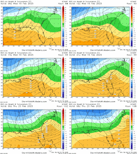
Here’s the 850 low track and temperatures on the 18z Euro. Green to blue is the 0 deg C line. Gotta believe the hi-res models will add warm nose warmth aloft along that line once they come into view

614A6A86-1019-4B01-85D5-D12D996E8C6B.gif
 
But it's so purity! Foreca really is a pretty decent app most of the time. Not saying it is this time by no means, but it matches up pretty close with models today.
Had a friend call me the other day and said his apple app weather was showing 19-21 inches in Winston Salem lol
 
@wxBradley respecting the setup View attachment 169430
unless things start drastically trending back the other way, i dont see GSO getting predominantly a wintry mix. im HOPING even here in durham/chapel hill/raleigh proper we wont have too much mixing, but i know thats partially just selfish hopes n dreams. i genuinely dont see a big mixing event happening for greensboro though, completely unbiased take there.
 
Back
Top