rburrel2
Member
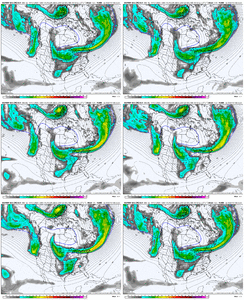
You can't unsee these after looking.About as you'd expect. The big dog solutions seem to favor some late development, making that map distribution look different.
View attachment 169285View attachment 169286
Sometimes you just have a little luck on your side…about the only way to explain such favorable trends here on the Euro suiteConfluence over NE trending strong, also further south consolidated southern energy.
View attachment 169262
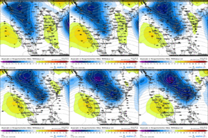
Ya'll are gonna laugh at me, but this goes back to what those smoothed 5h mean anamoly maps were printing 8 to 10 days out.Sometimes you just have a little luck on your side…about the only way to explain such favorable trends here on the Euro suite
What about RDU’s?There’s no way this whiffs, right?
View attachment 169299
Uh, you are missing the decimals I believe. That’s 9.8” and 24” is the highest member.Using the EPS 12z ensembles for Mount Airy there are 14 out of the 50 that have more than 5 feet of snow with one at 98”. I can’t recall any ensembles runs in NC with those high numbers before. Obviously they are skewing the mean.
View attachment 169300
Not quite. The highest one i see is 17 inches. The mean is not skewed.Using the EPS 12z ensembles for Mount Airy there are 14 out of the 50 that have more than 5 feet of snow with one at 98”. I can’t recall any ensembles runs in NC with those high numbers before. Obviously they are skewing the mean.
View attachment 169300
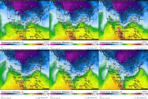
Interesting seeing the big 50/50 low pushed west, not escaping as fast, holding the northern energy back west and allowing the southern energy to get out ahead for later phase.Sometimes you just have a little luck on your side…about the only way to explain such favorable trends here on the Euro suite
Thanks. I could not see the decimals on the phone screen. I will delete the postNot quite. The highest one i see is 17 inches. The mean is not skewed.
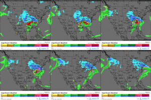
Lol never ever ever ever say that!There’s no way this whiffs, right?
View attachment 169299
reminds me of the MadMen scene with Roger, Don and Pete CampbellLol never ever ever ever say that!
I’m so far behind teaching my AP Calculus curriculum that I’m fine with a whiff or rain. There’s still some changes in store. We’ve seen lots of changes over the years once inside 84 hours and the NAM gets involved. If the main players hold, I would think that the cold could become more deeply entrenched. We will see.Lol never ever ever ever say that!
Zero chance this whiffs Greensboro. If anything a tick or two west almost always happens inside 48 hours.I’m so far behind teaching my AP Calculus curriculum that I’m fine with a whiff or rain. There’s still some changes in store. We’ve seen lots of changes over the years once inside 84 hours and the NAM gets involved. If the main players hold, I would think that the cold could become more deeply entrenched. We will see.
Absolutely. Outside of the NC mountains, it’s the best bet for an all snow footprint.Well, I had to give in and re up on weather bell with this monster winter storm coming up. Trends have been great for middle Tennessee as we get to within 3 and half days until go time.
View attachment 169278View attachment 169279
And if I'm not mistaken didn't GSO get like a foot of snow with that storm?
Sent from my SM-S156V using Tapatalk


Just looking at the ICON makes me so mad. It’s sometimes a good model but why is it so stuck on a warmer system
84 Euro
Sent from my iPhone using Tapatalk
Yep every little adjustment to get lower heights over us helps. Rarely does the south trend not stop and bump back north though, unfortunatelyInteresting seeing the big 50/50 low pushed west, not escaping as fast, holding the northern energy back west and allowing the southern energy to get out ahead for later phase.
View attachment 169301
We are probably used to that trend of them scooting out near go time because the last several setups our 50/50 lows have had no true -NAO block with themInteresting seeing the big 50/50 low pushed west, not escaping as fast, holding the northern energy back west and allowing the southern energy to get out ahead for later phase.
View attachment 169301
What about #14 with a 22” followed by 4”? I’m not sure which one would be more historic.
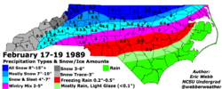
I can definitely see us getting a Feb 17-19 1989-type storm here in the Carolinas. Good to see that analog generally panned out this month with exceptional volatility and a shift towards more wintry weather mid to late month
It has a warm biasJust looking at the ICON makes me so mad. It’s sometimes a good model but why is it so stuck on a warmer system
That was issued before the Euro came in.... bet it changes.Latest update. Central Virginia for the win!
View attachment 169313
It probably will shift a tad south but this type of setup favors VA even if this thing trends south or back north.That was issued before the Euro came in.... bet it changes.
Yeah been shifting south all dayIt probably will shift a tad south but this type of setup favors VA even if this thing trends south or back north.
