-
Hello, please take a minute to check out our awesome content, contributed by the wonderful members of our community. We hope you'll add your own thoughts and opinions by making a free account!
You are using an out of date browser. It may not display this or other websites correctly.
You should upgrade or use an alternative browser.
You should upgrade or use an alternative browser.
broken025
Member
Shot per mile? Those are rookie numbers.Just went on this 90 minute walk with 3 shots of really good scotch in the cup, covered 3.5 miles in the heaviest snow of the day, this is why we do this
I remember Jan 2000 and the 20” that fell in Rock Hill, and I think 2ft in Raleigh? Was that setup in any way shape or form like what’s going on tonight and in the am with the ULL approaching ?
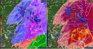
Interesting features within this band looks like eddies or perhaps mini meso lows ?
It fires right on top of me
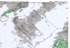
Something to keep in mind about this ULL is that areas that see snow it will likely be fairly high ratio powder, say 15-20:1.
I remember Jan 2000 and the 20” that fell in Rock Hill, and I think 2ft in Raleigh? Was that setup in any way shape or form like what’s going on tonight and in the am with the ULL approaching ?
No, it was a late blooming coastal more akin to today’s system. January 23, 2003, on the other hand…
- Joined
- Jan 23, 2021
- Messages
- 4,602
- Reaction score
- 15,197
- Location
- Lebanon Township, Durham County NC
BUFKIT has been showing that. The max QPF on the HRRR was .17. At 20:1 that’s just about 4”Something to keep in mind about this ULL is that areas that see snow it will likely be fairly high ratio powder, say 15-20:1.
Iceagewhereartthou
Member
Yeah, even if those precip streamers occur, and even if they occur over our houses, and even if they put down snow instead of rain... it may not do us any good. I haven't been below freezing yet and its still 36.5 degrees with nowhere to wetbulb too.nice little rain shower here just now.
astroworld123
Member
How bad are we expecting the roads to be tomorrow afternoon? Had planned a trip up north, but not sure it’s smart to go now..
Sent from my iPhone using Tapatalk
Sent from my iPhone using Tapatalk
- Joined
- Jan 23, 2021
- Messages
- 4,602
- Reaction score
- 15,197
- Location
- Lebanon Township, Durham County NC
It’s gonna be cloudy and cold most of the day tomorrow so I can imagine not a whole lot of improvementHow bad are we expecting the roads to be tomorrow afternoon? Had planned a trip up north, but not sure it’s smart to go now..
Sent from my iPhone using Tapatalk
rburrel2
Member
We should be around freezing when those bands possibly develop, but yea... we're always begging for scraps here. I hate this storm.Yeah, even if those precip streamers occur, and even if they occur over our houses, and even if they put down snow instead of rain... it may not do us any good. I haven't been below freezing yet and its still 36.5 degrees with nowhere to wetbulb too.
iGRXY
Member
It’s still snowing here. Nothing on radar though
broken025
Member
I would think main roads would be OK late afternoon.How bad are we expecting the roads to be tomorrow afternoon? Had planned a trip up north, but not sure it’s smart to go now..
Sent from my iPhone using Tapatalk
Is it down east, or out east, or is it eastern NC?
WolfpackHomer91
Member
Funny story about Tomm ULL .... Sort of Sad bc had this Southern Wave didn't choose to dig and make like "Whitesnake" and Walk Alone as modeled Saturdays EURO.... this would been the redux of FEB 2014. 7-10 Widespread across NC and the ones that get lucky with the ULL jumped 3-4" the next day. It was also a Weds night and ULL was Thursday.... Just sayin. I may never track another monster like PAX again but that's the one I discovered wxforums. I wish I still had all the screenshots I took of those epic runs and my point forecast from NWS 24hrs prior to go time. "Snow, Snow will be heavy at times Total Daytime Snow Accumulations of 6-8" Weds Night "Snow, Snow could be heavy at times Total Nighttime Snow Accumulation of 6-8" Thursday Snow Showers Possible Total Daytime Snow accumulations 1-3"
I77 Iredell is prime target for tomorrow obviously. Easy to chase north and south and best timing there with development at its prime. The clouds will form over the brushy mountains  and just pour out heavy snow. I actually see enough to warrant a winter storm warning for Iredell and Mecklenburg Counties and maybe 1 tier of counties east of those. For 2-4”. - bird
astroworld123
Member
I hope so. I guess it would be smarter to take I-85 rather than 95 as there was more sleet on the east side.I would think main roads would be OK late afternoon.
Avalanche
Member
It will have more effect in the westIs it down east, or out east, or is it eastern NC?
I know . My question was more a native NC confusion of what to call “that” part of NCIt will have more effect in the west
WolfpackHomer91
Member
You playing with us Bird ? LKN Lake effect for me @SnowNinerI77 Iredell is prime target for tomorrow obviously. Easy to chase north and south and best timing there with development at its prime. The clouds will form over the brushy mountainsand just pour out heavy snow. I actually see enough to warrant a winter storm warning for Iredell and Mecklenburg Counties and maybe 1 tier of counties east of those. For 2-4”. - bird

Downeast or eastern NC, never heard out east lolI know . My question was more a native NC confusion of what to call “that” part of NC
Hey Bird what about Wilkes, Surry, Yadkin Counties?I77 Iredell is prime target for tomorrow obviously. Easy to chase north and south and best timing there with development at its prime. The clouds will form over the brushy mountainsand just pour out heavy snow. I actually see enough to warrant a winter storm warning for Iredell and Mecklenburg Counties and maybe 1 tier of counties east of those. For 2-4”. - bird

Webberweather53
Meteorologist
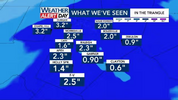
I got the precipitation type wrong over RDU, but the amounts were generally correct. Can't be too upset given how hard this storm was to forecast.
Yadkin may outdue Surry/Wilkes with an inch or so. A dusting to a coating for Wilkes/Surry altho need to monitor the brushy mountains they could pick up 1-4” as it just dumps on Iredell. That small micro mountain chain is really important in this type of setup as it snows itself out south and east.Hey Bird what about Wilkes, Surry, Yadkin Counties?
Avalanche
Member
I always say down east which usually means “east of Raleigh” to me. But everyone at the beach or coastal plain will be use to being called “down east” folksI know . My question was more a native NC confusion of what to call “that” part of NC
lcpdk
Member
I hope it tosses Forsyth County a little dusting so we can get the storm total to over 1 inch. INT apparently is reporting .77 in (per the local news media) and that's consistent with what we received today.Yadkin may outdue Surry/Wilkes with an inch or so. A dusting to a coating for Wilkes/Surry altho need to monitor the brushy mountains they could pick up 1-4” as it just dumps on Iredell. That small micro mountain chain is really important in this type of setup as it snows itself out south and east.
LickWx
Member
Down east is technically Carteret county but to me anything east of 95 is down east. I consider eastern wake county the end of the Piedmont and the fall line as a weird zone , I know it’s technically Piedmont but it feels nothing to me like Lexington greensboro and more like Wilson rocky mount NashvilleI always say down east which usually means “east of Raleigh” to me. But everyone at the beach or coastal plain will be use to being called “down east” folks
Sctvman
Member
Flurries flying and a good time is being had at the court of Carolina
Avalanche
Member
Yeah 95 is a good marker for being “down east”Down east is technically Carteret county but to me anything east of 95 is down east
Seeing a few isolated outages pop up in Duplin, Lenoir and Beaufort counties, nothing crazy, ranging from a couple hundred in Beaufort to 700 in Duplin.
lexxnchloe
Member
Well DoneI got the precipitation type wrong over RDU, but the amounts were generally correct. Can't be too upset given how hard this storm was to forecast.
rburrel2
Member
Technically, it is Carteret County east of Beaufort, where the people are still a little.... differentDown east is technically Carteret county but to me anything east of 95 is down east. I consider eastern wake county the end of the Piedmont and the fall line as a weird zone , I know it’s technically Piedmont but it feels nothing to me like Lexington greensboro and more like Wilson rocky mount Nashville
lexxnchloe
Member
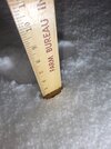
Still all sleet?Closing in on 3" of sleet...still pouring sleet
View attachment 170968
NBAcentel
Member
Still getting flurries lol. Been snowing/flurrying for hours
mx3gsr92
Member
Guys. . . A foot might happen


