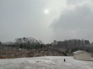
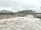
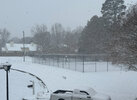
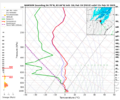
From RAH. The sleet part tonight actually sounds "cool":
.NEAR TERM /THROUGH THURSDAY/...
As of 300 PM Wednesday...
* Winter Storm Warnings and Advisories remain in effect until 1 PM
Thursday.
* Greatest threat for hazardous travel will be from this afternoon
through 8 PM to 10 PM tonight.
Regional
radar imagery shows the well advertised mixed p-type wintry
event is well underway with widespread precipitation across central
NC. KRAX dual polarization data shows the frozen/liquid line
stretching from the southern Sandhills, through Harnett County, into
southern Johnston, and northern Wayne county. Precipitation across
the area is expected to increase in intensity as a better overlap of
WAA and isentropic ascent develops over the area through 8 to 10 PM.
Freezing rain: South of this delineating line,
SPC Mesoanalysis data
shows the wetbulb freezing line just south of our area and will
likely result in a swath of accumulating freezing rain.
Diurnal
timing is not particularly favorable for efficient ice accrual, but
ice is expected to be marginally sufficient especially on elevated
surfaces through this afternoon. Ice accrual will become more
efficient after sunset and through roughly 8 PM to 10 PM across this
area and result in additional accumulations of a tenth to up to a
third of an inch, highest in Wayne and Sampson counties. Overall
precipitation rates will begin to lessen after 8 PM, but point
soundings still show a relatively deep saturated layer and inferred
WAA throughout, so lingering light drizzle and/or freezing drizzle
will be possible.
Snow and sleet: Accompanying the increased
WAA will be warming
temperatures aloft and result in
a swath of mostly sleet wintry mix
developing across central NC from Charlotte, through the Triangle
and into the northern Coastal Plain, mainly north of the snow/liquid
line described above. A significant amount of sleet will be possible
within this area and was a large contributor to the upgrade to a
Winter Storm Warning for Raleigh and Wayne counties earlier this
morning. We could see sleet accumulations of a couple tenths to
upwards of over 0.5". Additionally, WPC snowband probability tool
shows the potential for a band of efficient snow/sleet rates that
may lead to a narrow corridor of enhanced totals and localized
greater impacts. Additional snow/sleet accumulations 1 to 4 inches
are expected, mainly from Raleigh north and east into northeastern
NC.
The main shield of wintry precipitation will begin to shift eastward
late tonight with an overall lull in measurable precipitation with
lingering drizzle/freezing-drizzle possible into early Thurs
morning. Some trimming of the Winter Weather Warnings/Advisories may
be able to be done overnight to better capture the threat into Thurs
morning. An approaching strong upper
trough and steepening lapse
rates will result in the redevelopment of snow showers Thurs morning
with greatest chances towards the northwest Piedmont into the
Triangle and towards the
NC/VA border.
Overall snow accumulations
will be minor, but a very cold ground, deep saturation in the DGZ,
and high snow ratios can result in efficient and quick accumulations
up to an inch in spots, but mostly a dusting is expected. As this
area moves east and downsloping drying takes over behind a cold
front, strong wind gusts of 20 to 30 mph with infrequent gusts up to
35 mph possible. Some gustiness may continue overnight due to
continued
CAA, but may be more infrequent and lower than during the
afternoon/evening. Lows tonight will settle in the 20s with highs on
Thurs in the 30s. Increasing sunshine through the afternoon will
help to melt some snow/ice before sunset.


