Some of the taller trees have ice around kannapolis, I wonder how that works
-
Hello, please take a minute to check out our awesome content, contributed by the wonderful members of our community. We hope you'll add your own thoughts and opinions by making a free account!
You are using an out of date browser. It may not display this or other websites correctly.
You should upgrade or use an alternative browser.
You should upgrade or use an alternative browser.
Wintry Feb 17-19 Smastsmasher Snow/Ice
- Thread starter SD
- Start date
Barely any ZR here. I told you all so would get shut out.
The sun is coming out here what in the world

Sent from my iPhone using Tapatalk

Sent from my iPhone using Tapatalk
NCSNOW
Member
- Joined
- Dec 2, 2016
- Messages
- 9,540
- Reaction score
- 18,968
Sun didnt show up for a week when it was 33 and raining everyday. You get below 32 and it finds a way to make it out from behind the clouds LOL.The sun is coming out here what in the world
Sent from my iPhone using Tapatalk
Dunkman
Member
We are not accruing efficiently on the bottom of the limbs--still at 1/16" there. BUT--I just measured 1/4" on the tops of the limbs in places.
I noticed the same thing here. We’ve had a lot of super cooled raindrops freezing on contact it seems. I’d say about 0.15” right now here.
Not getting any sleet so far in this heavier band in N High Point.
What's crazy is King had inch of sleet I heard, I'm NW of them zero sleet! lolSun didnt show up for a week when it was 33 and raining everyday. You get below 32 and it finds a way to make it out from behind the clouds LOL.
NCSNOW
Member
- Joined
- Dec 2, 2016
- Messages
- 9,540
- Reaction score
- 18,968
Forecast,models have verefied very well here near airport. Raining moderately, occasional sleet pellet 30 mins ago. Easily over the .25 threshold.What's crazy is King had inch of sleet I heard, I'm NW of them zero sleet! lol
What was a beautiful bush just split.

Heavy batch of frzrn and sleet right now...I haven't ventured outside to measure, yet, but everything is very icy.

NCSNOW
Member
- Joined
- Dec 2, 2016
- Messages
- 9,540
- Reaction score
- 18,968
Yea its coming down and really accumulating fast . Good ole fashion ice storm today, no doubtHeavy batch of frzrn and sleet right now...I haven't ventured outside to measure, yet, but everything is very icy.
packfan98
Moderator
Update from NWS Raleigh:
.NEAR TERM /THIS AFTERNOON THROUGH TONIGHT/...
As of 955 AM Thursday...
...No changes to the current Winter Storm Warning and Winter Weather
Advisories.
Icing has been limited to mostly elevated surfaces, thus far. Most
of the significant icing reports of 0.1 to 0.18 have been from
Forsyth, Guilford, Granville, Vance, and Person Counties (in the
heart of the Winter Storm Warning). The temperatures have been
rather marginal again, with mostly readings in the 30-32 range in
the Warning Area, thus limiting the icing especially on roads. The
temperatures bottomed out around daybreak and have been steady or
slowly been creeping back toward 32 in the Warning area. However,
there continued to be a feed of dry and cold air from northern and
central VA into north-central NC. This is courtesy of the parent
high pressure of nearly 1030 mb located over NY/NJ, extending south
deep into our Piedmont damming region. Low level near surface
trajectories continue to be directed from where temperatures were in
the mid 20s in central VA.
Radar showed showery precipitation with large gaps in the heavier
rates, reducing to drizzle in the gap areas. Thus, it will take a
much of the day for the ice to reach Warning criteria on average
(0.25 or greater) in the heart of the Warning. That will be
challenging given the solar insolation and the temperatures so close
to 32. Some of the heavier showers will contain some thunderstorms
(as there is some instability noted aloft). In addition, some ice
pellets will be mixed with the heavier rain rates in the showers.
It appears that the icing will be a self limiting event in the
Advisory area (Albemarle to Raleigh to near Roanoke Rapids) where
readings should teeter between 32-33 with the CAA at the surface and
the solar insolation / higher rain rates offsetting and limiting
icing to north facing and elevated surfaces.
Models continue to show a lull late morning and much of the
afternoon in the west or northwest, with the steady and heavier
precipitation shifting into the east. Then, another wave aloft will
bring renewed precipitation later this afternoon and evening. Temps
should still be 32 or 31 over portions of the Warning area, thus
additional ice accrual is expected.
The Advisory area is in question unless we can tap into the low
level cold air a bit more in the next few hours
The flash flooding risk appears lower now - given the heavy QPF will
likely be in the south and east (lower end of the main stem rivers),
with lighter QPF of 0.25 to 0.50 over much of the Piedmont.
D
Deleted member 1449
Guest
my measurement is .18" here and we have risen to 31.5.
D
Deleted member 1449
Guest
we are probably not going to make it to .25--which is fine with me.
Stormlover
Member
Flotown
Member
was about to ask does anybody think that in n miss gonna make it to bamaWinter Weather Advisory north Miss/west tenn for up to another inch today
SASQUATCH
2-Time Defending SouthernWX Fantasy Football Champ
Member
2024 Supporter
2017-2023 Supporter
was about to ask does anybody think that in n miss gonna make it to bama
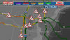
North Alabama Folks, look back to the West this morning. Might be our last chance to see frozen precip later on today/tonight. It's light but still juicy at 700mb. Weak frontal boundary set to come through here.
View attachment 76125
View attachment 76126
I feel bad for DC! They were supposed to get 5-8”, only got about an inch of sleet! The MA meltdowns, have to be epic!!?
That’s freaking awesome !!! Let’s goI feel bad for DC! They were supposed to get 5-8”, only got about an inch of sleet! The MA meltdowns, have to be epic!!?
This dude is a huge and I mean huge weenie, lol