iGRXY
Member
Looks like even severe weather season is going to get cut into and our best shot is going to be about a 4 week period.We’re saved! Late March fun on the way ?View attachment 113356
Looks like even severe weather season is going to get cut into and our best shot is going to be about a 4 week period.We’re saved! Late March fun on the way ?View attachment 113356
That can honestly increase the chances of severe wx via a more active pattern, April 2020 had a similar setup and the TPV was consistently in SE Canada. not to mention this year we have a very + pacific meridional mode which is sometimes a pre-cursor to El Niño’s, and the +PMM itself can amp up the subtropical jet streamLooks like even severe weather season is going to get cut into and our best shot is going to be about a 4 week period.
Day 10/Hour 366 ensemble over op anyday, probably a cold shot in between the torch it’s still winter
Oof crickets golf volcano pants mickey mouse buffet
Cold April. Checks out. ?We’re saved! Late March fun on the way ?View attachment 113356
Is this for the Lacrosse threat!Hard to say, still in a fuzzy idea phase. But my personal educated guess on experience. Says far south as the Louisiana marshes up to Kentucky. GFS only shows instability up to the Tennessee Alabama state line, but it's really hard to take that as gospel because of other environmental factors and history. GFS always underestimates cape at the begging and then slowly makes its way up. Kinda my idea on threat area as of now. Probably will extend further east some. But this is all a crapshoot being 7 days out. Just a fuzzy general idea. The marked area is where I would expect the higher risked area. View attachment 113314
hmmm... I think i'm in love.
Something weird happened this morning. I was the warmest spot in the whole northern half of the state. I only dipped to 37 last night, and there were no clouds. Even Greensboro was cooler (35).29.5 this morning. Wen torch
Also that's my 30th morning low below freezing in 22. Well done
Day 10/Hour 366 ensemble over op anyday, probably a cold shot in between the torch it’s still winter
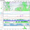
One model one run but after the 18th it doesn't look too terribly bad down here for couple of days, all things considered ...I agree with your general idea. A quick cold/BN shot has been suggested by even the various ensembles for a couple of days to be centered near 2/19-2/20 for the last few days of runs. It appears a little stronger today but it is still short-lived and nothing extreme as it stands now. It will be interesting to see if GSO can then get a 7th week in a row of wintry then. What has also been suggested is that after the upcoming cold shot for 2/13-15, that it would warm up 2/16-8.
So, the general idea on the ensemble runs is for a cold 2/13-5, a mild 2/16-8, a cold ~2/19-21, and then finally a more sustained mild 2/22-25++. This is consistent with the last few days of indices, which have been showing for late month a (slight?) -PNA/rising WPO vs the recent +PNA/-WPO, continued solid +AO/+NAO, and a move to typically mild MJO phase 4 from the recent/current coolish phases 2-3.
I'd prefer it to remain cold every day. I want to keep the bugs at bay and I enjoy being outside more when dewpoints are 40s or lower. But unfortunately for me and other cold lovers, it still appears a more sustained warmer pattern is on the way for late month. Of course, I'd love for this to be wrong and thus will be rooting for this idea to be wrong.
After the expected warmer pattern for late month that should go into early March while the MJO likely is rotating through still warm phases, I remain hopeful for a cooler pattern by mid March and going into late March as the MJO hopefully then rotates into phases 8/1/2/3.

At least we can squeeze some progressive CAD in there with all that ridging along the east coast and GL. Should mitigate some of the torch at least east of apps for a day or 2 here and there.Blueprints are there for a torch, GOA ridge, western trough, donut on top the GOA ridge View attachment 113417
