-
Hello, please take a minute to check out our awesome content, contributed by the wonderful members of our community. We hope you'll add your own thoughts and opinions by making a free account!
You are using an out of date browser. It may not display this or other websites correctly.
You should upgrade or use an alternative browser.
You should upgrade or use an alternative browser.
Pattern Failbruary Thread
- Thread starter SD
- Start date
rburrel2
Member
Meanwhile the gfs is close to a major winter storm on day 9/10
Didn’t he say in December winter wasn’t coming? ?
There isn't one person anywhere who is any better at seasonal forecasting that a magic 8 ball.
HSVweather
Member
HSVweather
Member
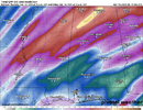
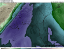
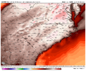
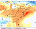
Just realized I posted the 06Z GFS above, 12Z showing similar PWAT but 1-2” instead.2-4” rain possible in north Alabama with the system next Thursday. PWAT projected high
View attachment 113281
View attachment 113282
Combo of MJO (phase 4), NAO/AO (remaining strongly positive), and PNA (headed from positive to negative) still suggests warmth dominating the SE US after around 2/20-21. If the MJO would move steadily enough, perhaps it will get around back to the cold March phases of 8-1-2-3 by 3/10 or so (allowing an average of 4-5 days per phase) and then lasting til late March. By then, prime climo for SE wintry precip will have ended a week or so earlier. However, occasionally mid to late March has produced some notable SE storms like in 1914, 1924, 1940, 1960, 1971, 1974, 1981, 1983, 1993, and 2018. Of those, ATL had big mid to late March hits in 1924, 1960, 1971, 1983, and 1993. Also, I believe ATL had a nice one in the late 1800s though I have to check. So, about once every 12 or so years in a place like NC and about once every 25 years in ATL. For what it’s worth (not much admittedly), ATL is due. Keep hope alive as once every 12-25 years for something big and a good bit more often than that for something smaller means it isn’t just a pipe dream.
Last edited:
Z
Zander98al
Guest
May be a severe threat. Just saw a local meteorligist tweet about it. Been looking at the snow chance and didnt realize there may be severe weather down the line.2-4” rain possible in north Alabama with the system next Thursday. PWAT projected high
View attachment 113281
View attachment 113282
Z
Zander98al
Guest
May be a severe threat. Just saw a local meteorligist tweet about it. Been looking at the snow chance and didnt realize there may be severe weather down the line.
Everything looks to be vertically stacked, looking more like a north Alabama into Kentucky and Arkansas/Tennessee threat right now though. Sounding out of Mississippi. Geez Louis better setup by far than the one last week. High ceiling event by the looks right now . A bit
of a skinny cape profile on the sounding though. But winter time events that's pretty good.

smast16
Member
pcbjr
Member
NCSNOW
Member
- Joined
- Dec 2, 2016
- Messages
- 9,582
- Reaction score
- 19,103
Gotta keep the weekly streak alive. This Sunday would be #6 and 2/20 would be #7 in a row with accumulating frozen precip, if the GFS where to be right lol.Mickey Mouse wedge View attachment 113289
rburrel2
Member
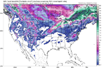
12z Euro is close to a storm as well at 240hrs.Gotta keep the weekly streak alive. This Sunday would be #6 and 2/20 would be #7 in a row with accumulating frozen precip, if the GFS where to be right lol.
Mickey Mouse wedge View attachment 113289
rburrel2
Member
An impressive 6 of 20 GFS ensemble members(using COD weather members) have a direct winter storm hit for Upstate, SC in the 216-240hr timeframe. A few more members are a little too warm for SC, but give the NC piedmont a decent ice hit.
Z
Zander98al
Guest
Z
Zander98al
Guest
Intresting, may be a dryline associated with the system next week. How far east it makes. Don't know, usually your bigger events have a dry line associated with it. Tapping into all available moisture.

