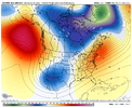
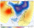
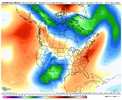
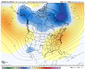
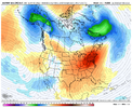
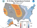
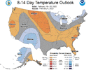
Last two runs of GFS bufkit gave CLT 7”
-
Hello, please take a minute to check out our awesome content, contributed by the wonderful members of our community. We hope you'll add your own thoughts and opinions by making a free account!
You are using an out of date browser. It may not display this or other websites correctly.
You should upgrade or use an alternative browser.
You should upgrade or use an alternative browser.
Pattern Failbruary Thread
- Thread starter SD
- Start date
bigstick10
Member
KATL even semi honking??
The main focus has
been on the weekend where models have had quite a bit of
discrepancy and run-to-run inconsistency on how amplified the
upper trough gets over the region and amount of possible enhanced
moisture gets phased in. For this set of runs, the GFS
deterministic run is quite robust with even cutting off the upper
trough and allowing for significant snow potential enhanced with
a deformation axis by Sunday/Sunday night.
Thick fog this morning
ATLwxfan
Member
KATL even semi honking??
The main focus has
been on the weekend where models have had quite a bit of
discrepancy and run-to-run inconsistency on how amplified the
upper trough gets over the region and amount of possible enhanced
moisture gets phased in. For this set of runs, the GFS
deterministic run is quite robust with even cutting off the upper
trough and allowing for significant snow potential enhanced with
a deformation axis by Sunday/Sunday night.
Does sort of remind me of the mid January system where there were essentially two waves. 12z ensembles are going to either will this into existence or put it to bed.
Sent from my iPhone using Tapatalk
iGRXY
Member
Nothing is getting put to bed at day 6.Does sort of remind me of the mid January system where there were essentially two waves. 12z ensembles are going to either will this into existence or put it to bed.
Sent from my iPhone using Tapatalk
Darklordsuperstorm
Member
Anybody gotta early idea about what the weather is gonna look like next week Thursday-Saturday on the emerald coast?
NCSNOW
Member
- Joined
- Dec 2, 2016
- Messages
- 9,582
- Reaction score
- 19,103
Wow!
-88 windchill. Shy of the record -101

-88 windchill. Shy of the record -101

The main indices, like yesterday, still imply that after the forecasted cold for the first half of next week that much of 2/17-22+ will more than likely be mild with a declining PNA at least toward neutral in combo with a raging +AO and a pretty strong +NAO then. Also, the MJO at least appears to be headed for the often mild phase 4 by around 2/22 at the latest. So, golfers, get your clubs ready. Then perhaps we get one or two last good shots of cold in March, which happens in a lot of years.
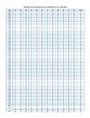
So based on this, let’s hope the 2/12-14 system turns out to be something of note for at least some of the SE because there’s no telling whether or not it could turn out to be the last widespread wintry threat for the SE this winter. Regardless, climo says that the chances of significant wintry precip for the bulk of the SE don’t start dropping significantly until after the first few days of March. ATL’s absolute peak major snow/sleet climo is 2/10-16 based on number of storms (an impressive 9 of them have occurred then and that doesn’t even include the many moderate or weaker storms) although a good number of major storms have occurred after that through March 2nd. RDU’s absolute peak in frequency of 6”+ snow actually doesn’t end til March 3rd as they’ve had 8 big ones 2/26-3/3 along with many moderate or weak then.
So based on this, let’s hope the 2/12-14 system turns out to be something of note for at least some of the SE because there’s no telling whether or not it could turn out to be the last widespread wintry threat for the SE this winter. Regardless, climo says that the chances of significant wintry precip for the bulk of the SE don’t start dropping significantly until after the first few days of March. ATL’s absolute peak major snow/sleet climo is 2/10-16 based on number of storms (an impressive 9 of them have occurred then and that doesn’t even include the many moderate or weaker storms) although a good number of major storms have occurred after that through March 2nd. RDU’s absolute peak in frequency of 6”+ snow actually doesn’t end til March 3rd as they’ve had 8 big ones 2/26-3/3 along with many moderate or weak then.
Last edited:
pcbjr
Member
pcbjr
Member
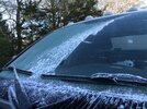
Best mega frost of the season this morning
packfan98
Moderator
Same. Covered everything including the tops of houses. 3 of these would equal a trace of snow no doubt.Best mega frost of the season this morning
Best mega frost of the season this morning
Yeah solid white this morning, some trees got coated as well, definitely agree was the most mega frost of the season. Usually means warmer temps are on the waySame. Covered everything including the tops of houses. 3 of these would equal a trace of snow no doubt.
smast16
Member
Now that is a sight for sore eyes and cold bones.H5 pattern is basically October ?? View attachment 113092View attachment 113093
Pretty heavy frost in Concord as well. Bottomed out at 26 degrees which was 3 degrees lower then forecast.Best mega frost of the season this morning
HSVweather
Member

