LickWx
Member
67/54 at RDU as of 1051. Heading for mid 70s perhaps . Wedge to the west breaking down , seeing 60s now across Greensboro and Charlotte .
As we’re used to this year the pattern changes are usually delayed 1-2 weeks I could see this change occurring in the March 4-7 time range vs Feb 28-March 2 time frame
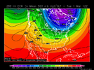
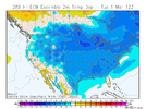
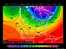
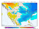
@GaWx Here ya go Larry ...
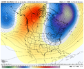
CPC is really hinting at it ... much like your 288 GFS and ECM ...
View attachment 113833

Heh...would be fitting to end meteorological winter record warm in Deep South just like December was. Bookends basically.I’m still looking for a decent shot at near record or record highs here (just like has occurred in recent Febs) and nearby toward the middle of next week with a solid SER before any cooling precip reaches the area.
Regarding the potential of cold finally penetrating the SER pattern and getting into the SE near the end of Feb, models seem undecided on this, including the timing. We appear to have -EPO driven cold ready to hit much of the US. But sometimes the SER blocks the bulk of -EPO driven cold, especially during La Niña and moreso late in the winter. The SER seems to want to resist at least somewhat. Will the cold be mainly low level and be relegated to a Carolina/NE GA wedge? Or will the H5 trough axis actually fight off the SER and give the SE a more general cold period via a +PNA? Opinions?
At 12Z, the EPS is a good bit colder than the GEFS as of March 1st:
EPS:
View attachment 113822View attachment 113823
GEFS:
View attachment 113824
View attachment 113825
I ran this morning at 5:45 just to beat the front. I'm dreading it.Looking forward to the front should be a pretty dramatic dew point drop and temps should fall back into the 50s
The dry front tomorrow afternoon is going to be the real beast. Dews in the low 10s Sunday morning, if we calm the winds it'll be another 18-22. Thing is without persistent strong blocking we are starting to reach that point in the year where the cold shots get a little shorter and are more easily moderatedI ran this morning at 5:45 just to beat the front. I'm dreading it.
64/51 in SE Wake now. Starting to feel MUCH better.72/58 at Goldsboro
70/61 in SE Wake.
61/47 at RDU
51/33 at GSO
45/38 at Wilkesborodud
31/23 at Jefferson
Nice!
Yes, flooding is a concernFlooding looks to be a real possibility going into next week for portions of the Mid-South:
View attachment 113926View attachment 113927View attachment 113928
