WolfpackHomer91
Member
Full blown snow storm inside day 7 on the ai
View attachment 169528
There’d most definitely be decent snow still on the turf too if EURO wins out with those
Sent from my iPhone using Tapatalk
Full blown snow storm inside day 7 on the ai
View attachment 169528
Full blown snow storm inside day 7 on the ai
View attachment 169528
Just out of curiosity how well have the graph casts performed this winter?Here's the GFS graphcast and Euro AI... both are solidly all snow in the upstate.
View attachment 169562View attachment 169563
The Euro Graphcast ensemble mean is the single best forecasting tool in the world in the day 4-7 time range.Just out of curiosity how well have the graph casts performed this winter?
Just did that here as well.Not sure where to put this but I love CAD! It has gone from low 40s to 65 IMBY in barely an hour! Phenomenal
Same thing here. It was in the upper 40s all night then in about 20 minutes, it jumped to 67. Getting some heavy rain, lots of thunder and have had the wind gust to 40mph a couple timesNot sure where to put this but I love CAD! It has gone from low 40s to 65 IMBY in barely an hour! Phenomenal
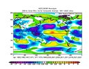
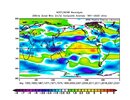
It’s honestly a little troubling to see how close both the low frequency atmosphere and ocean base state is to 2011 as we head towards the spring.
We’re probably in for a real nasty tornado season across the conus
View attachment 169263
View attachment 169264
View attachment 169265
View attachment 169266
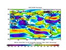
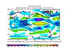
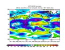
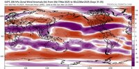
 www.facebook.com
I love to pick on Glenn “No Snow For You” Burns, but he’s really honking the cold pattern on FB
This is unprecedented! Normally, we would see a disruption of the POLAR VORTEX every other year or so. THIS NEXT POLAR VORTEX EVENT WILL MAKE 10 THIS WINTER!
The significant cold will intensify across the Northern Plains on Sunday and gradually spread south and east across the United States next week. By mid-week, the Arctic cold pool will reach deep South to the Gulf and East Coast by Friday. Brutal cold days and locally historic, record-low temperatures are forecast.
Active Polar Vortex above North America takes no break. Next week, its southern lobe will generate another significant, frigid cold Arctic Blast from Canada into the United States, sending temperatures back into the deep freeze 40-50 °F below average. Then, another significant Arctic cold outbreak follows next week. The frigid cold air mass has maintained over much of Canada and the northern U.S. over the last two weeks and is forecast to plunge far south across the nation in the coming days. Temperatures are forecast to push back into a deep freeze, with 40 to more than 50 degrees F below normal for tens of millions across the North American continent.
The significant cold will intensify across the Northern Plains on Sunday and gradually spread south and east across the United States next week. By mid-week, the Arctic cold pool will reach deep South to the Gulf and East Coast by Friday. Brutal cold days and locally historic, record-low temperatures are expected.
www.facebook.com
Has tornado alley really shifted east?
It has literally led the way. We getting an inch or two
This might actually nearly verify… wow that’s one of my better callsMy honest Feb forecast View attachment 167222
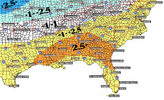
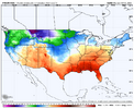
Wouldnt it be hilarious this one was such a tease no one even tracks the rest of them until HR 84 and thats when we all get 6 feet12z GFS says March starts like a lion. Big winter storm hr 318ish. It will happen. It just wants to snow this year!
Hold on now…where’s the high pressure placement lol.
It will create its own cold air and rates will overcome the BL! Literally can't go wrong!Hold on now…where’s the high pressure placement lol
12z GFS says March starts like a lion. Big winter storm hr 318ish. It will happen. It just wants to snow this year!
