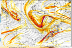
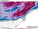
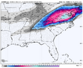
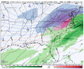
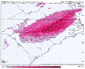
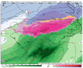
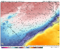
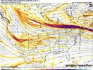
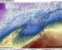
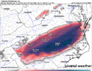
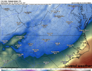
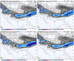
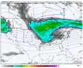
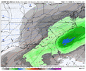
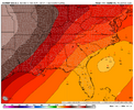
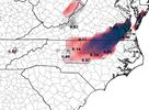
UK absolutely explodes between hour 144-150. Looked a lot like what the Canadian has been doing
-
Hello, please take a minute to check out our awesome content, contributed by the wonderful members of our community. We hope you'll add your own thoughts and opinions by making a free account!
You are using an out of date browser. It may not display this or other websites correctly.
You should upgrade or use an alternative browser.
You should upgrade or use an alternative browser.
Pattern Failboat February
- Thread starter SD
- Start date
WolfpackHomer91
Member
This is a classic old school Miller A storm. Youll get a good front end thump, then pounded with sleet piedmont east
Why ive waited to see ukmet all afternoon. Its notorious for sniffing these out 5ish days out. Canadian gives it even more credibility.
Could still be wrong, but its a eye catcher for me.
Could still be wrong, but its a eye catcher for me.
idk about that "less snow" part! 6-12 inches across most of NCUkmet is about to be a significant winter storm, just more sleet/ice. Stronger wedge but less snow
NBAcentel
Member
Those eps runs a couple days ago was highlighting the 85 corridor for ice with a legit signal, it’s kinda being reflected now constantly by OP models other then the GFS again
It’s starting to look like probably the biggest nor’easter we’ve seen in quite a while is a likely scenario at this point. Even if that doesn’t equate to snow in your own backyard, you love to see it.This is a classic old school Miller A storm. Youll get a good front end thump, then pounded with sleet piedmont east
WolfpackHomer91
Member
Alot of that was sleet after the front thump.... South of I-40ishidk about that "less snow" part! 6-12 inches across most of NC
JP152
Member
NBAcentel
Member
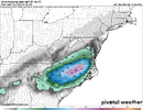
Looks like the euro is going for something worse then December 2002, perhaps over a 24hr freezing rain event
SOSLights out NCView attachment 168859
NBAcentel
Member
Crazy part is this lines up with the EPS from last nightLights out NCView attachment 168859
WolfpackHomer91
Member
That would be a 1/4 - .4" Forecast 85 Corridor and around a 1/2 - 3/4" Forecast In that max zone imo. Bad , but not unworldlyLights out NCView attachment 168859
NBAcentel
Member
WolfpackHomer91
Member
One thing of note imo…. All 4 Models seem within relative agreement of LP placement , regardless of Strength and Or Surface output. That’s solid step 1 , the rest we can iron out, but atleast for now there’s not one in KY and one In Bermuda and 1 where we want it. Even as bad as surface was on GFS the LP was in a good spot
Sent from my iPhone using Tapatalk
Sent from my iPhone using Tapatalk
Yep and all models have precip now with surface temps in the 20s. If this holds, a bunch of us better hope the temps are colder aloft or we about to get that ice storm we've been saying for years we're due. Long way to go still
NBAcentel
Member
EC AI/graphcast looked decent as well, more snowy. But they are just like any OP model at this range.
Cad Wedge NC
Member
Que the northwest/amped trend ....
Edit: 06z gfs says what storm? ..... nothing to see here. Bottom line, we are not trending in the right direction. 12z runs will be interesting.
Edit: 06z gfs says what storm? ..... nothing to see here. Bottom line, we are not trending in the right direction. 12z runs will be interesting.
Last edited:
Mega Frost Morning.
Last edited:
Blue_Ridge_Escarpment
Member
Gives you 2-3 inches of snowQue the northwest/amped trend ....
Edit: 06z gfs says what storm? ..... nothing to see here. Bottom line, we are not trending in the right direction. 12z runs will be interesting.
MichaelJ
Member
Liked your post because I have no idea what you meantMega Frist Morning.
Give me some solid trends around the 72hr mark and I'll bite. I could see some ice for climo areas but that's about it. Bring on spring. A for cold C for snow average to below average winter for the foothills.
MichaelJ
Member
What is the danger here is how fast that blue blob in Canada moves East, we really need it to come a little more West or else we could see an Outer Banks storm, not that there is anything wrong about that (Did I do that right to not piss the far Eastern crowd rain/cold?) 
Bigedd09
Member
6Z Euro quite icey but not as amped
GeorgiaGirl
Member
This period always looked more favorable north of I-40 unless some energy was snuck in underneath the first wave or this phased in the right way.
Honestly, the 6z GFS seemed probably close to a phase, but it would’ve been more helpful as a bomb for the MA/NE.
Honestly, the 6z GFS seemed probably close to a phase, but it would’ve been more helpful as a bomb for the MA/NE.
packfan98
Moderator
CNCsnwfan1210
Member
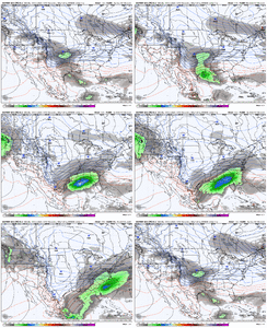
Much better run on the 6z eps. Colder and further south with all the main players. Here’s where it ended up.
View attachment 168873
View attachment 168874
Yes much better than the 00z run, that’s what we want overall
Sent from my iPhone using Tapatalk
belowfreezing
Member
Big thanks to everyone who contributes to the Forum. How are the trends this morning for the storm 5-6 days out? See some are skeptical and others encouraged.
That’s a legit track.Much better run on the 6z eps. Colder and further south with all the main players. Here’s where it ended up.
View attachment 168873
View attachment 168874
I really think we have some wild runs still to come for areas further South with this one. The trailing energy opening up the window for a late bloomer is going to throw a wrench.
Bigedd09
Member
Love how the QPF expands further west. Wish the run could've kept going
WolfpackHomer91
Member
Big thanks to everyone who contributes to the Forum. How are the trends this morning for the storm 5-6 days out? See some are skeptical and others encouraged.
Still on track for Mixed bag I95 and west in NC … VA Looks more snowy, SC hanging by a thread (JMO)
Sent from my iPhone using Tapatalk
Yep. You can see that is what the GFS, bless its heart, is “trying” to do. Other models are consolidating the energy more. I’m in Raleigh, so of course, I’m hoping for a late phase with this energy, then it’s boom boom time.I really think we have some wild runs still to come for areas further South with this one. The trailing energy opening up the window for a late bloomer is going to throw a wrench.

