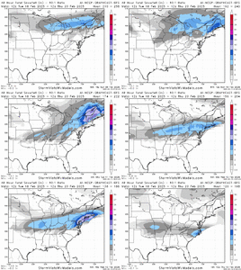
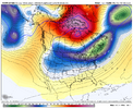
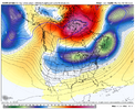
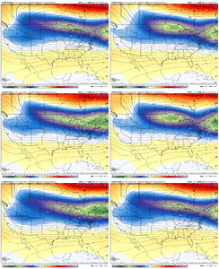
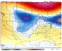
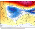
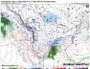
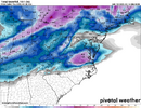
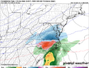
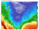
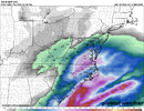
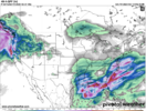
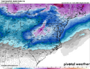
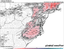
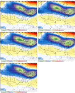
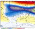
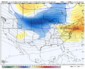
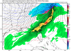
Is this looking like a miller-B (xfer) from Alabama to off the SC coastMan there’s a lot left to be desired with that H5 look on the EC AI. My Mind sees every possibility, aka stronger confluence/sharper southern wave with more digging and a tad earlier phaseView attachment 168800View attachment 168801View attachment 168802View attachment 168803
-
Hello, please take a minute to check out our awesome content, contributed by the wonderful members of our community. We hope you'll add your own thoughts and opinions by making a free account!
You are using an out of date browser. It may not display this or other websites correctly.
You should upgrade or use an alternative browser.
You should upgrade or use an alternative browser.
Pattern Failboat February
- Thread starter SD
- Start date
NBAcentel
Member
Sent that to a mid Atlantic/SNE chat. The reaction was amazing
Cad Wedge NC
Member
Is it done trending? ..... or are we looking at even more suppression?
iGRXY
Member
NBAcentel
Member
Cad Wedge NC
Member
Can't believe somebody in the south is going to steal Boston's snow. Don't see that every day.Sent that to a mid Atlantic/SNE chat. The reaction was amazing
NBAcentel
Member
WolfpackHomer91
Member
CIPS analogs are interesting. Some decent events. Favors I85 and northwest for heavier accumulating snows. Some duds in there as well
Sent from my iPhone using Tapatalk
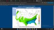
Checkout #6..... 02/12/2004 .... Im sure @griteater and a few others in CLT area will remember that one
NBAcentel
Member
Cad Wedge NC
Member
#9 says hello .... just saying,View attachment 168810
Checkout #6..... 02/12/2004 .... Im sure @griteater and a few others in CLT area will remember that one
CNCsnwfan1210
Member
SLP trying to pop south of the LA coast
Sent from my iPhone using Tapatalk
Looks like southern wave is faster when the northern stream pinches off further west, still decent hit for NC as it comes in quickerThis icon run looks rather similar to the 18z euro View attachment 168811View attachment 168812
NBAcentel
Member
LickWx
Member
CNCsnwfan1210
Member
Icon with another ZR lollipop over the 85 corridor into RDU View attachment 168817View attachment 168818
Tight gradient going from 1 inch to 6 inches of snow within a 3 county distance. Amazing what a couple tweaks could do with this system.
Sent from my iPhone using Tapatalk
Never know, but I’m not concerned with cold suppression…but a weak storm is possibleIs it done trending? ..... or are we looking at even more suppression?
NBAcentel
Member
The southern stream wave orientation was definitely preferable on the 12z icon though
Takeaway after comparing this run to previous, and other ops, we have some wiggle room with the overall synoptic setup to still get a storm. Small changes aren’t going to make or break it, at-least not yet.
Icon is broad / weak with the southern stream wave, but tightens up a bit and goes negative tilt late to the benefit of E NCICON spit out a very funky precip footprint. that donut hole over north GA seems a bit sus, IMO
View attachment 168821
So was the TPV as well, seemed to suppress heights on eastern seaboard better. Everything about this run was a little different, placement of he tpv and speed/orientation of the southern wave. One good thing, is the final outcome was still wintry precip, even if it was lighter amounts and more ice. I always like it when different means result in similar endsThe southern stream wave orientation was definitely preferable on the 12z icon though
NBAcentel
Member
Yup. Im 100% expecting a GFS run that isn’t as great as 18z, lots of small changes right under the big block that’s gonna make these runs look better or worse rather easy, so not holding my breath if the GFS isn’t as favorable. Still a great time for relying heavy on ens because this is a setup where a small donut in the northern stream might appear on a OP which changes an outcome but not on the ens or vise versa, and we should be paying attention to the main players right now (50/50, the southern stream wave, the elongated trough under the block, and something that could have a bigger influence in a couple days on modeling is that S/W moving on shore on the western coast). Just lots of changes to be expectedSo was the TPV as well, seemed to suppress heights on eastern seaboard better. Everything about this run was a little different, placement of he tpv and speed/orientation of the southern wave. One good thing, is the final outcome was still wintry precip, even if it was lighter amounts and more ice. I always like it when different means result in similar ends
NBAcentel
Member
Tsappfrog20
Member
At hr108 it keeps that low/ piece of energy over Nevada
Sent from my iPhone using Tapatalk
Sent from my iPhone using Tapatalk
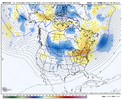
Well this looks like a run that is “not as great as 18z”Yup. Im 100% expecting a GFS run that isn’t as great as 18z, lots of small changes right under the big block that’s gonna make these runs look better or worse rather easy, so not holding my breath if the GFS isn’t as favorable. Still a great time for relying heavy on ens because this is a setup where a small donut in the northern stream might appear on a OP which changes an outcome but not on the ens or vise versa, and we should be paying attention to the main players right now (50/50, the southern stream wave, the elongated trough under the block, and something that could have a bigger influence in a couple days on modeling is that S/W moving on shore on the western coast). Just lots of changes to be expected
NBAcentel
Member
Iceagewhereartthou
Member
Good post. Those western areas have a really hard time with this; seems like by the time the cold makes it that far west (if at all) the precip is ending. Another concern I have for western areas is most guidance is insistent on a very pronounced dry slot. Got a late blooming transfer to the coast and skips NEGA and Western Upstate. We really need a sooner bloomer with a better cold press.One thing about the PV being farther east with more ridging in between(like the euro stuff shows)... that's a huge help for CAD and surface cold. So it's not the worst thing if we keep that separation, imo, as long as we keep the height field low enough for snow in the mid-levels, and that seems to be possible with the crazy block mashing everything south.
It's sorta hard to know what to root for really, other than just hoping for a lower height field over us in general out ahead of the storm.
I'm personally very concerned about surface temps where I live because the more NNE oriented CAD feeds with the parent high way to our west generally leaves Oconee/Pickens county a few degree's warmer than places further East. It's especially awful for Oconee county.
NBAcentel
Member
This run is quite awful in fact, back to the earlier runs of the day type awful
Feels like we’re approaching that timeframe where we get a sizeable move north with temp profiles then spend the next 4-5 days battling back in 25 mile increments fighting for our lives and sanity every 6-12 hours.
For the hobby
For the hobby
If we get a slp off the coast of Ga like the GFS is showing and we rain, man we really do suck
Yeah the handling of the TPV across S Canada and N U.S. is really jumpy between runs right now. We’re on to the CMC and ensemblesThis run is quite awful in fact, back to the earlier runs of the day type awful
broken025
Member
You could just take out all of your words there except the last 5If we get a slp off the coast of Ga like the GFS is showing and we rain, man we really do suck
WolfpackHomer91
Member
Ok, thats not that bad...its still there and like @RBR71 said that track and Placement rain would be hell of a weird outcome. Id much rather changes like this than .... oh ---- its gone or man wth its in Beckley Wv
Don't think we're gonna like the CMC much betterYeah the handling of the TPV across S Canada and N U.S. is really jumpy between runs right now. We’re on to the CMC and ensembles

