It especially shouldn't be expected when the poster outright wishes the state with the most members doesn't get any snow and then calls them insufferable lol.This is a life rule of mine - nice gestures should always be appreciated and never expected. Someone may give of their time and graciously post the info you are looking for, but you CAN NOT demand for others to spoon feed you. If you want it bad enough, you'll do the research and go find it yourself
-
Hello, please take a minute to check out our awesome content, contributed by the wonderful members of our community. We hope you'll add your own thoughts and opinions by making a free account!
You are using an out of date browser. It may not display this or other websites correctly.
You should upgrade or use an alternative browser.
You should upgrade or use an alternative browser.
Pattern Failboat February
- Thread starter SD
- Start date
CNCsnwfan1210
Member
Yep slightly colder on that run
Sent from my iPhone using Tapatalk
Cad Wedge NC
Member
Charlotte's all-time record low has been reached 3 different times once on Feb 14th..... So much for the "it can't get cold because of sun angle" argumentgive me the coldest week in late feb vs the coldest week then. I am very curious now
OK, I'll bite. What questions do you have? And be nice to me; I'm in NC.I’m trying to ask questions about things and nobody is responding I’m trying to be nice
Sent from my iPhone using Tapatalk
NBAcentel
Member
packfan98
Moderator
Take a break. See you tomorrow.Also I’m trolling lol I’m not serious
Sent from my iPhone using Tapatalk
Please troll in the Complaining thread. I think I wrote a rule about that.Also I’m trolling lol I’m not serious
Sent from my iPhone using Tapatalk
NBAcentel
Member
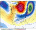
I’d still prefer the 50/50 low trend on the euro suite to quit regardless because if you lose it, you allow a higher chance of WAA in all levels if you get a slowing trend with the main S/WSuch a weird trend. The 50/50 is scooting out, but the main shortwave is starting to angle itself into a favorable position allowing height falls further east regardless because of the block above. Wiggle room I guess View attachment 168782
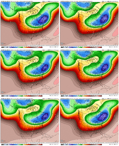
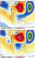
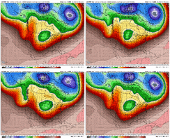
Here is a comparison of the 18z GEFS vs 12z EPS. EPS has the bigger / wider retrograded ridge over Hudson Bay, and it helps to separate the TPV underneath with one piece over MN and the Dakotas and the other piece as the 50/50 low. EPS is also less progressive (not as far east) with the west coast ridge. EPS preferred for the VA crowd. GEFS for folks farther SE.

JP152
Member
As modeled there is strong and plentiful Arctic HP to our N and NW next week. Cold air will be in place. The thermal boundary will be displaced along/off the SE coast. Pretty solid signal for a coastal storm- exact details on the evolution and proximity to the coast yet to be worked out.
If this is considered banter, I will accept the punishment  . There are so many examples of late winter snowstorms in the south. Most notably March of 1993. The sun angle had little to no impact on the amount of snow, and the duration the snow stayed in the ground. Most of the south were stuck at home with no electricity for a week. To keep this on topic, the models are starting to have some agreement. I was just getting ready to crawl back in my hole for southernwx hibernation.
Last edited:
I definitely didn't have this evolution on my bingo card.Such a weird trend. The 50/50 is scooting out, but the main shortwave is starting to angle itself into a favorable position allowing height falls further east regardless because of the block above. Wiggle room I guess View attachment 168782
NBAcentel
Member
Height field looks more suppressed on the 18z EPS…
WolfpackHomer91
Member
If this is considered banter, I will accept the punishment. There are so many examples of late winter snowstorms in the south. Most notably March of 1993. The sun angle had little to no impact on the amount of snow, and the duration the snow stayed in the ground. Most of the south were stuck at home with no electricity for a week. To keep this on topic, the models are started to have some agreement. I was just getting ready to crawl back in my hole for southernwx hibernation.
March 2009….. was the GOAT rained like you’d need an Arc all day on Sunday … changed to snow That night 6-10” ULL came through…. It was like 75 5 days later.
Sent from my iPhone using Tapatalk
NBAcentel
Member
Drizzle Snizzle
Member
March 2009 definitely an example of how you really need it to snow hard during the daytime for it to accumulate. We had thunder snow and moderate snow off and on all day and it accumulated only half an inch. You need heavy snow during the daytime in Late Feb and March. Light to moderate snow won’t cut it .March 2009….. was the GOAT rained like you’d need an Arc all day on Sunday … changed to snow That night 6-10” ULL came through…. It was like 75 5 days later.
Sent from my iPhone using Tapatalk
The GEFS move of kicking the western TPV piece east and 'melting' it (ha) across the GLakes and into the 50/50 low pretty much achieves the desired result in the end of lowering the east coast heights, if not in a traditional manner. If you get that though, you could have challenges with storm strength with the southern wave having to carry more of the heavy lifting for the stormI’d still prefer the 50/50 low trend on the euro suite to quit regardless because if you lose it, you allow a higher chance of WAA in all levels if you get a slowing trend with the main S/W
My Grid forecast. Got to love when they throw in wintery precip, although I've seen this many times before to no avail.
Wednesday
A chance of rain and snow. Mostly cloudy, with a high near 41. Chance of precipitation is 50%.
Wednesday Night
A chance of rain, snow, and freezing rain. Mostly cloudy, with a low around 26. Chance of precipitation is 50%.
Thursday
A chance of snow and freezing rain. Mostly sunny, with a high near 42. Chance of precipitation is 40%.
RAH:
CLIPPED FROM LONG RANGE DISCUSSION>>>>>
The next southern stream shortwave will then move from the southern Plains
and Deep South on Wednesday and Wednesday night, spawning a surface
low that both the GFS and ECMWF depict moving just off the Southeast
US coast. With a cold dry air mass in place ahead of the system and
a favorable storm track, will have to watch for potential frozen
precipitation, a signal that is supported by many GEFS/EPS/CMC
ensemble members. Too early to determine any details at this time,
but the climatologically-favored areas over the northern and western
Piedmont appear most likely to experience snow or ice. Capped POPs
in the chance range at this time as there are still significant
timing differences among the models, with the GFS depicting a mainly
Wednesday event while the ECMWF delays it until Wednesday
night/Thursday.
NBAcentel
Member
I like the 18z EPS better imo vs the 12z
Tsappfrog20
Member
My Grid forecast. Got to love when they throw in wintery precip, although I've seen this many times before to no avail.
Wednesday
A chance of rain and snow. Mostly cloudy, with a high near 41. Chance of precipitation is 50%.
Wednesday Night
A chance of rain, snow, and freezing rain. Mostly cloudy, with a low around 26. Chance of precipitation is 50%.
Thursday
A chance of snow and freezing rain. Mostly sunny, with a high near 42. Chance of precipitation is 40%.
RAH:
CLIPPED FROM LONG RANGE DISCUSSION>>>>>
The next southern stream shortwave will then move from the southern Plains
and Deep South on Wednesday and Wednesday night, spawning a surface
low that both the GFS and ECMWF depict moving just off the Southeast
US coast. With a cold dry air mass in place ahead of the system and
a favorable storm track, will have to watch for potential frozen
precipitation, a signal that is supported by many GEFS/EPS/CMC
ensemble members. Too early to determine any details at this time,
but the climatologically-favored areas over the northern and western
Piedmont appear most likely to experience snow or ice. Capped POPs
in the chance range at this time as there are still significant
timing differences among the models, with the GFS depicting a mainly
Wednesday event while the ECMWF delays it until Wednesday
night/Thursday.
This was also put out before the latest gfs came out
Sent from my iPhone using Tapatalk
Tsappfrog20
Member
I like the 18z EPS better imo vs the 12z
Would you share it and share why you like it better
Sent from my iPhone using Tapatalk
broken025
Member
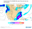
Anyone have the 18z euro AI purple blob map?
NBAcentel
Member
It’s overall further east with the northern stream S/W which reduced the height field out in the SE. This means a shorter window of WAA in general, the more you hang it back into the plains, the higher risk you run of some sort of ptype issue which was somewhat evident runs back. The further east it is, the more you can have a storm evolution with cooler mid levels especially if we continue this trend (not entirely wedge driven either but just from the S/W). Also the 50/50 tail is nosing slightly more into the NE but not a major change with it.Would you share it and share why you like it better
Sent from my iPhone using Tapatalk
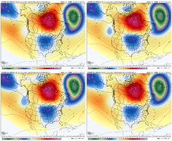
rburrel2
Member
One thing about the PV being farther east with more ridging in between(like the euro stuff shows)... that's a huge help for CAD and surface cold. So it's not the worst thing if we keep that separation, imo, as long as we keep the height field low enough for snow in the mid-levels, and that seems to be possible with the crazy block mashing everything south.
It's sorta hard to know what to root for really, other than just hoping for a lower height field over us in general out ahead of the storm.
I'm personally very concerned about surface temps where I live because the more NNE oriented CAD feeds with the parent high way to our west generally leaves Oconee/Pickens county a few degree's warmer than places further East. It's especially awful for Oconee county.
rburrel2
Member
NBAcentel
Member
Nomanslandva
Member
Before we get to the mid week system, I am a little worried about the wind Sunday after all this rain.
packfan98
Moderator
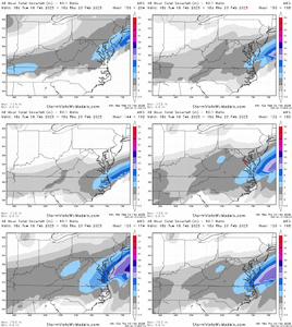
Is the next storm on the 23rd cold enough for snow on the AIFS?AI is a light-mod event for most of NC with a ENC maxima View attachment 168790View attachment 168791View attachment 168792View attachment 168793View attachment 168794
The Ukmet used to be so good at phased storms. Not sure if its lost its fastball past few years. They change these models to much, cant disect their strengths , weakness anymore. Interested to see what it coughs up tonight.
Pops
Member
Got any earlier frames?thanksAI is a light-mod event for most of NC with a ENC maxima View attachment 168790View attachment 168791View attachment 168792View attachment 168793View attachment 168794
There’s more to it than that. It snowed in 2015 on one of the last days of February in the early afternoon and every flake stuck due to it being cold beforehand. Nothing earth shattering but cold enough.March 2009 definitely an example of how you really need it to snow hard during the daytime for it to accumulate. We had thunder snow and moderate snow off and on all day and it accumulated only half an inch. You need heavy snow during the daytime in Late Feb and March. Light to moderate snow won’t cut it .
rburrel2
Member
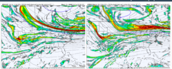
I'm loving that the 18z GFS and 18z ICON have the southern vort in the exact same spot over Nevada/Arizona at hr 120. I actually think the icon is more conducive for that vort to slip in to the base of the developing cut off and amplifying a bit more. I think if it kept running you would have seen an absolute hammer develop like what the Pangu had,(but no chance of it cutting with how far south and east the main lobe is.)

Tsappfrog20
Member
I'm loving that the 18z GFS and 18z ICON have the southern vort in the exact same spot over Nevada/Arizona at hr 120. I actually think the icon is more conducive for that vort to slip in to the base of the developing cut off and amplifying a bit more. I think if it kept running you would have seen an absolute hammer develop like what the Pangu had.
View attachment 168797
This is exactly what jwall shared on twitter
Sent from my iPhone using Tapatalk
NBAcentel
Member
CNCsnwfan1210
Member
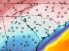
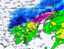
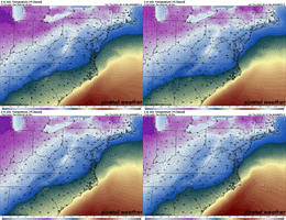
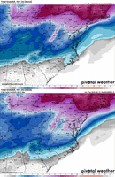
18z MOGREPS is a pretty big increase over 12z also in general it’s trending way colder the last several runs and continuing View attachment 168798View attachment 168799
1 inch mean down into central SC, looks much better overall
Sent from my iPhone using Tapatalk
NBAcentel
Member
CNCsnwfan1210
Member
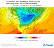
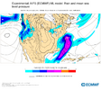
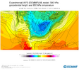
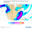
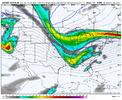
Man there’s a lot left to be desired with that H5 look on the EC AI. My Mind sees every possibility, aka stronger confluence/sharper southern wave with more digging and a tad earlier phaseView attachment 168800View attachment 168801View attachment 168802View attachment 168803
The ceiling potential on this setup is on up there, the challenging part is connecting the aforementioned dots…it’ll be interesting watching the trends with this system in the coming days.
Sent from my iPhone using Tapatalk
Tsappfrog20
Member
Alright friends if this is not allowed here it can be deleted or moved however if you are not following [mention]Mitch West [/mention] on his YouTube page you need to! Mitch does a fantastic job with his thoughts and analysis of all things weather!!
 youtube.com
Sent from my iPhone using Tapatalk
Mitch West Weather
Hey! Thanks for stopping by. My name is Mitch and I am a weather enthusiast. I post videos and talk weather for the Eastern US! (Specialize in the Southeast!) I am also a storm chaser! Follow me on Twitter, link is in my cover photo!
Sent from my iPhone using Tapatalk

 . There are so many examples of late winter snowstorms in the south. Most notably March of 1993. The sun angle had little to no impact on the amount of snow, and the duration the snow stayed in the ground. Most of the south were stuck at home with no electricity for a week. To keep this on topic, the models are started to have some agreement. I was just getting ready to crawl back in my hole for southernwx hibernation.
