belowfreezing
Member
Thanks Wolfpack. Fingers crossed
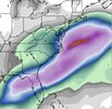
PinnedFeels like we’re approaching that timeframe where we get a sizeable move north with temp profiles then spend the next 4-5 days battling back in 25 mile increments fighting for our lives and sanity every 6-12 hours.
For the hobby
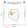
How long has it been since the MJO scooted through the warm phases and wants to MC Hammer in 8, 1, 2?
View attachment 168886
View attachment 168887
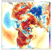
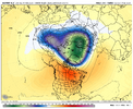
GEFS says not so fast! Big cold in Canada just waiting to head south.Not sure it’s helping anymore. Long range looks warm and zonal. I think next week is our last chance imo.
View attachment 169087
Those NC totals have to be including the 19th/20th storm too, right?View attachment 169218
Little sneaky gulf coast special
they're dueView attachment 169218
Little sneaky gulf coast special
ok, I laughedthey're due
View attachment 169218
Little sneaky gulf coast special
I’m gonna be honest, I didn’t expect that from the euro today. lol
33 and moderate Rain currently.
After mid week 40 hour rain at 32.5 - 34
We are under the same power outage. I hope that a bigger one doesn’t happen next week. We’ve seen sleet save us from a big ice storm on several occasions the past decade.And under a power outage now till 5pm. LOL
That 10 inch plus euro op run just now,gonna make up for all this.
We are under the same power outage. I hope that a bigger one doesn’t happen next week. We’ve seen sleet save us from a big ice storm on several occasions the past decade.
What are you doing here? Get over in the storm thread.It’s honestly a little troubling to see how close both the low frequency atmosphere and ocean base state is to 2011 as we head towards the spring.
We’re probably in for a real nasty tornado season across the conus
View attachment 169263
View attachment 169264
View attachment 169265
View attachment 169266
It's been a while since the east coast had a severe weather season to write home about. I think you are right about that. We are due.It’s honestly a little troubling to see how close both the low frequency atmosphere and ocean base state is to 2011 as we head towards the spring.
We’re probably in for a real nasty tornado season across the conus
View attachment 169263
View attachment 169264
View attachment 169265
View attachment 169266
Unforgettable severe season ‘11It’s honestly a little troubling to see how close both the low frequency atmosphere and ocean base state is to 2011 as we head towards the spring.
We’re probably in for a real nasty tornado season across the conus
View attachment 169263
View attachment 169264
View attachment 169265
View attachment 169266
High Wind Warning for tomorrow. I'm going to post this on X, if you don't mind. The colors are awesome.Btw for tomorrow there are some insane wind gust potential and I know I know this will not verify. But been a while since I've seen these type of numbers thrown out
View attachment 169282
View attachment 169283
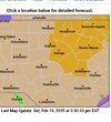
it is giving such intense Helene flashbacks, and im feeling heartbrokenHorrific flooding up on VA/WVA line today. Still water rescues going on. One town completely under water.
Onset ice?That shortwave behind needs to be watched imo. Not far off on the GFS if you move pieces a little bit
