ATLwxfan
Member
I don’t know if it’s one of the 3 latest, but I do know that ATL had 7.9” during the 3/24/83 storm. This is the same one that gave CLT 10.3”
Ok we’re good. Plenty of time left lol
Sent from my iPhone using Tapatalk
I don’t know if it’s one of the 3 latest, but I do know that ATL had 7.9” during the 3/24/83 storm. This is the same one that gave CLT 10.3”
What’s odd about that storm is that it was an overrunning southern slider event with a sharp cut off on the northern edge… Hickory over to Greensboro got nothing from it. You would think that a storm with that type of amounts so late in the season would have come from an ULLOk we’re good. Plenty of time left lol
Sent from my iPhone using Tapatalk


Colder pattern established in March , in the se. That’s funny . Good luckIt won’t be fun initially but this evolution is going to play in the favor of cold ..come early mid month of march that -PNA will falter and with all the blocking overtop thats currently being modeled across all models, mischief will happen. Colder looks will probably pop up as we get closer past the first week of march. Enough for a widespread south east winter storm? Probably not. But I don’t think we can take winter weather off the table for someone in the SE in march. Euro weeklies hint at it and so does the GEFS extended. It’s only a matter of time before a colder pattern gets established, the question will be how effective will it be at making some winter weather happen come week 2 and on in March. View attachment 133444
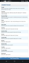
April 25th, 1910 1.5” so anything is possible. We got a few inches in April 1987 I believe too up in acworth.What were the top three latest accumulating snows for ATL? Do your thing SouthernWx.
Sent from my iPhone using Tapatalk
Eh from what I've seen the nam is generally too low at 2m when it's warmNAM isnt buying record heat

AlwaysEh from what I've seen the nam is generally too low at 2m when it's warm
seems like a decent bet. This is the classic rdu sensor is hotter than anyone setupGoing with 83 RAH, 85 FAY, 81 CLT, 79 GSO
seems like a decent bet. This is the classic rdu sensor is hotter than anyone setup

Mother nature sure tries to even things out. OddIt's crazy how the all time record for February was in 1977 which was an extremely cold winter.
Sent from my iPhone using Tapatalk
Mother nature sure tries to even things out. Odd
oh great. going to call this march pattern the pallbearer so it can let us down one more timeIt won’t be fun initially but this evolution is going to play in the favor of cold ..come early mid month of march that -PNA will falter and with all the blocking overtop thats currently being modeled across all models, mischief will happen. Colder looks will probably pop up as we get closer past the first week of march. Enough for a widespread south east winter storm? Probably not. But I don’t think we can take winter weather off the table for someone in the SE in march. Euro weeklies hint at it and so does the GEFS extended. It’s only a matter of time before a colder pattern gets established, the question will be how effective will it be at making some winter weather happen come week 2 and on in March. View attachment 133444


NWS now has GSO tomorrow topping out at 79 and RDU at 82. No surprise there.Looks like the Canadian model(s) are the only ones showing temps 80+ for GSO and RDU. Actually for almost all of NC and SC. I thought it might have been a bit overdone.
TW
Yeah, the 6z 3k NAM has midafternoon temps only in the low 70s for RDU. The GFS and European are in the mid 70s. Canadian (as stated above) has mid 80s for RDU.NWS now has GSO tomorrow topping out at 79 and RDU at 82. No surprise there.
TW
Nam is always way to cold, it was off by 7 degrees yesterday for example, it’s a known cold biasYeah, the 6z 3k NAM has midafternoon temps only in the low 70s for RDU. The GFS and European are in the mid 70s. Canadian (as stated above) has mid 80s for RDU.
a lot of high temp forecasting is simply figuring out how deep boundary layer mixing gets during the day, since mixing will bring those air parcels at 850mb or wherever down adiabatically.Nam is always way to cold, it was off by 7 degrees yesterday for example, it’s a known cold bias


GSP doesn’t seem to be too excited about the idea of setting monthly records tomorrow. They note that the guidance that is pushing highs up over February records also start the day with clear skies… they expect that there will be cloud cover that will take most of the morning to burn off.a lot of high temp forecasting is simply figuring out how deep boundary layer mixing gets during the day, since mixing will bring those air parcels at 850mb or wherever down adiabatically.
NAM 3km- puts boundary layer at 925mb Thursday afternoon for Richmond. Temp? 75.
Different model- some WRF model- Boundary layer is around 890mb at same time. Temp? 77.
Nam in my experience underestimates the height of where the boundary layer gets to, whereas the GFS is better or can overestimate sometimes. That's where this nam bias comes from.
But generally that's where a lot of discrepancies will come from, and it's all about just how the model renders turbulence and microphysics and those things are pretty hard to get right. I bet a lot of the NWS forecasts are betting that with how windy it is most models will underestimate the amount of mixing (and don't forget to add some downsloping in their for good measure)
That and cloud cover, but I think ya'll know this, if there's more clouds than forecasted Thursday (totally possible) then the highs will not be all time monthly records. lol.
I've been wondering about this. 850s are much more supportive of 80-85 today than tomorrowI bet we're warmer today here than tomorrow.


when it's cooler from georgia to VA like this - it's really all about differences in how the model is resolving how deep the boundary layer gets. guarantee you the rdps is a solid 100mb deeper than nam.There's a small difference between the NAM and RDPS.
12z RDPS (midafternoon tomorrow):
View attachment 133488
12z NAM (midafternoon tomorrow):
View attachment 133487
That's crazy as KCAE was also 82.Currently 82 in Chattanooga. Warmest ever in February.
Why wait till next year? You could head on down to Immokalee FL and get it now.Looking forward to next winter when we can get into the 90s.