-
Hello, please take a minute to check out our awesome content, contributed by the wonderful members of our community. We hope you'll add your own thoughts and opinions by making a free account!
You are using an out of date browser. It may not display this or other websites correctly.
You should upgrade or use an alternative browser.
You should upgrade or use an alternative browser.
Pattern Fail or Fab February 2023 Pattern Thread
- Thread starter Metwannabe
- Start date
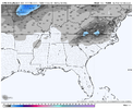
IIRC, UKMET can be bad with BL temps being too warm, so I’d be interested in seeing what the limiting factor was. If the mid/upper levels are cold enough and it’s only surface temps that are blanking us, I think there’s reason to doubt it.That’s very discouraging View attachment 132293
I was reminded of that storm, too. Also won’t help that we’re going to see record-breaking warm temperatures later this week, so the ground will be sizzling. Of course, if all we get is rain it won’t matter.These types of setups, as modeled, are always very fickle and rate driven. Usually a very narrow strip of accumulation with a few lucky lollipops strewn in. Areas outside that strip will see flakes fall, but if the rates aren’t there, little or nothing will accumulate. I remember a similar setup (maybe March 2010 shown below?) when I was home for spring break and local mets were calling for 2-5 inches. I watched it snow for about 3 hours and it never stuck at my house. This setup as modeled would be even more marginal. This would probably be a radar watching/ nowcasting type of event, if it were to play out.
View attachment 132296
packfan98
Moderator
It was the track. Too amped up and west.IIRC, UKMET can be bad with BL temps being too warm, so I’d be interested in seeing what the limiting factor was. If the mid/upper levels are cold enough and it’s only surface temps that are blanking us, I think there’s reason to doubt it.
man it's been a while since we've had a ULL magic storm roll along. these storms are like placing a +450 anytime touchdown scorer bet instead of taking the spread (can you tell i'm listening to a superbowl gambling podcast [my forecast- chiefs +1.5]). I think everyone here kind of intrinsically understands the foundation of these storms can be made out of balsa wood but if it hits, you could be in for great rates and possible thundersnow. some decent model consensus of something weird happening
ATLwxfan
Member
Pound town.
Gonna enjoy that run until Webb posts.
Sent from my iPhone using Tapatalk
Gonna enjoy that run until Webb posts.
Sent from my iPhone using Tapatalk
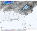
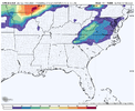
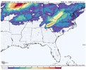
Even on the potentially over enthusiastic gfs you can see that it ties the snow to the intense banded precip and it's surrounded by rain. I would hate it for gsp and rah if the gfs verified since it's a bust waiting to happen and they would have no choice but to throw out best guesses on WSW and WWAs but the corridor of any decent accumulations would be far smaller than the advisory coverageThese types of setups, as modeled, are always very fickle and rate driven. Usually a very narrow strip of accumulation with a few lucky lollipops strewn in. Areas outside that strip will see flakes fall, but if the rates aren’t there, little or nothing will accumulate. I remember a similar setup (maybe March 2010 shown below?) when I was home for spring break and local mets were calling for 2-5 inches. I watched it snow for about 3 hours and it never stuck at my house. This setup as modeled would be even more marginal. This would probably be a radar watching/ nowcasting type of event, if it were to play out.
View attachment 132296
I'm not sure why but I really don't recall ever scoring a good event with an ULL, seems those bands are always somewhere elseEven on the potentially over enthusiastic gfs you can see that it ties the snow to the intense banded precip and it's surrounded by rain. I would hate it for gsp and rah if the gfs verified since it's a bust waiting to happen and they would have no choice but to throw out next guesses on WSW and WWAs but the corridor of any decent accumulations would be farb smaller than the advisory coverage
Last edited:
I'm with you. I've been screwed by them more than snowed in. I still have a screenshot from 2009 when my mom sent me a picture of the radar with a green dot over my house amongst the white.I'm not sure why but I really don't recall every scoring a good event with an ULL, seems those bands are always somewhere else
I think the overall issue besides the BL not being great is the pattern is going to want to be progressive either biasing this east or not closing at all. We've toyed around with this look more than once the last 2 winters with obviously not much to show for it. This is the first time the models have dumped enough southwest to cut it off over the deep south vs along the coastal plain or offshore. I'm more concerned about getting something like the 12z Canadian or 0z euro where it's too late than I am BL temps right now
Cary_Snow95
Member
They’ll be over Roxboro, so I’d take a trip there.I'm not sure why but I really don't recall ever scoring a good event with an ULL, seems those bands are always somewhere else
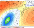
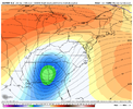
I gotta say I do like the trends, what a major change today from yesterdayThis is gonna be close for NC it’s drifting SE View attachment 132306
Bruh...


CNCsnwfan1210
Member


Sent from my SM-A136U1 using Tapatalk
packfan98
Moderator
Perfect pass for NC. Let's see what the surface shows.Bruh...

That's a great track for the I40 to the VA border corridorBruh...


