Blue_Ridge_Escarpment
Member
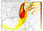
It’s definitely playing catch-up. Maybe by 12Z tomorrow it will be there!Look at this 3 run trend but we are calling it reliable lolView attachment 132286
It’s definitely playing catch-up. Maybe by 12Z tomorrow it will be there!Look at this 3 run trend but we are calling it reliable lolView attachment 132286
Looks like Virginia is the favored spot right now.

Another high country special. Shocker!That’s very discouraging View attachment 132293
A blend of CMC/UK would probably get you a NC paste bomb.That’s very discouraging View attachment 132293
packfan - it sounds like you may be infected with the fearcasting disease. It’s an affliction that causes forecasts to be made out of fear instead of sound judgement. It is commonly found on weather boards among members with a long history of being let down by late model adjustments, particularly during winter. Although a serious disease, it’s not quite as severe as its cousin, the bittercasting diseasemy suspicion is that it ends back up in northern Virginia.
No fear here. Just sharing my thoughts. Others might have these weather afflictions, but my immunity has built up after following every model run for 20 years.packfan - it sounds like you may be infected with the fearcasting disease. It’s an affliction that causes forecasts to be made out of fear instead of sound judgement. It is commonly found on weather boards among members with a long history of being let down by late model adjustments, particularly during winter. Although a serious disease, it’s not quite as severe as it’s cousin, the bittercasting disease
I guess that UKMet run from yesterday wasn’t quite so crazy after all huh
I was told it was not going to snow and that we were going to torch the rest of the winter. So, I haven't been paying much attention.
You had to go and jinks it for me didn't ya!!! ? Not licking any chops around here, way to far out for that! lol The models will change half a dozen times between now and Saturday. But at least we got something encouraging to look at for a few hours anyway!@BIG FROSTY licking his chops while everyone else will be licking wounds
Not sure about upper air and surface temps, but it looks close. I would say, being five days out, that just having a low off our coast is a good sign. Just need some basic agreement right now.I don't know if this is good or not. Someone smarter than me can explain.View attachment 132297
Looks good to me. ?

