-
Hello, please take a minute to check out our awesome content, contributed by the wonderful members of our community. We hope you'll add your own thoughts and opinions by making a free account!
You are using an out of date browser. It may not display this or other websites correctly.
You should upgrade or use an alternative browser.
You should upgrade or use an alternative browser.
Pattern Fabulous February
- Thread starter PEA_RIDGE
- Start date
Kylo
Member
Kylo
Member
Kylo
Member
olhausen
Member
12z Euro looked like it holds on to the cold in the long range. I didn’t like seeing the warmer air on the models towards the end of the runs the last few days. After that fabulous February of 2015 the last two February’s have been a mess. I really hope we can have at least a near normal February this year and hopefully below normal.
Edit: I forgot we have had 3 February’s since 2015. I believe the 2016 February was ok or at least better then the last 2.
Edit: I forgot we have had 3 February’s since 2015. I believe the 2016 February was ok or at least better then the last 2.
The block north of AK, if it remains in place and disconnected from the western ridge for a long time will do us no favors. It needs to do its thing and weaken on off.12z Euro looked like it holds on to the cold in the long range. I didn’t like seeing the warmer air on the models towards the end of the runs the last few days. After that fabulous February of 2015 the last two February’s have been a mess. I really hope we can have at least a near normal February this year and hopefully below normal.
Kylo
Member
Kylo
Member
This has been head faking for a couple of weeks now but looks to have better agreement. Maybe coincide with favorable tropics just in time.
Stormlover
Member
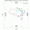
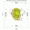
The MJO forecasts keep upping the amps and delaying the return to the COD. Whereas as of last week, the GEFS/EPS has a low amp that returned to the COD 1/26-7, today’s forecasts have a higher amp that is still outside the COD through 2/6. Frustrating to follow these. The GEFS is way different from just yesterday, which had it curl back into the right side of the COD before 2/5!
“once the pattern reloads on both the weeklies and cfs the ridge axis out west is still too far west to work without the NAO part. I am not sure where this is going but I’m very confident that the idea that “we can make this workable somehow without the NAO” isn’t going to happen. Everything indicates the ridge axis in the pac is likely to remain west of where we need it absent blocking. No blocking no dice. So when I hear people talking about being skeptical that the NAO helps but being “ok” with that I have my doubts. I really think we need the NAO or we are going to continue this cutter pattern.” this is from PSUHoffman a very knowledgeable MA poster
This is kind of where I’m at right now as well
This is kind of where I’m at right now as well
Kylo
Member
Much better.
B
Brick Tamland
Guest
Well, guess we will have to see if the great pattern for winter storms that was hyped up for the last two weeks of January will produce in February or just be hype. It has been the latter for NC so far. Glad we got the big storm in early December here. But the bad thing about that it seems we can't get more than one big storm here each winter, and for some reason most of the time when we get that big storm we don't get anything else here for the rest of winter.
Euro showing potential at the first of February. Interesting. looking at MSLP its similar to 26-28 event atm with low getting shoved south then trying to run the coast
Kylo
Member
Folks are going to love, love, love the 12Z EPS for 2/4+ as a +PNA gets reestablished just in time for peak climo snowfall for much of the SE, especially deep south. Remember when some models were suggesting -PNA then? Maybe being helped by the weak El Nino and colder MJO phases.
Kylo
Member
SnowNiner
Member
Really nice setup, as of now, for day 8. EPS mean really beefed up. Posting both day 6 and day 9 to see the difference.
View attachment 12999View attachment 13000
View attachment 13003
Wow, that's a pretty darn nice look right there. Retrograde the trough just a toooouch to the west to get us a more SW flow and you'd be spot on. But thats nit picking. Nice EPS look. Hopefully it holds/gets better.
We have been taking about it all winter about how the models love to kill the west coast ridge too fast.
B
Brick Tamland
Guest
I want to believe it, but after what the models showed here in the long range for here this weekend and the middle of next week versus what they show now, it is hard to get too excited.
I want to believe it, but after what the models showed here in the long range for here this weekend and the middle of next week versus what they show now, it is hard to get too excited.
Brick, what has already happened is largely irrelevant. Why? IF the +PNA/-EPO/-AO/Greenland Block/cold MJO pattern shown on the EPS in the 11-15 and going forward were to verify, you'd have a perfect pattern just in time for peak El Nino climo. What more could you ask for to at least give you a good opportunity? That doesn't mean it will happen obviously. But again, you couldn't ask for a much better pattern.
Reminder: weeklies out within an hour though I may not see them for 2 hours+.
Edit: Note that today's GEFS based PNA went up pretty sharply from recent days' forecasts, which had it going down to neutral. This is what we want to see. The AO remains strongly negative for most of the 2 weeks. The NAO remains neutral but a nice Greenland Block is progged.
Last edited:
pcbjr
Member
Lovin' every word you post, Larry ... no wading through the weeds at ant-level ...Brick, what has already happened is largely irrelevant. Why? IF the +PNA/-EPO/-AO/Greenland Block/cold MJO pattern shown on the EPS in the 11-15 and going forward were to verify, you'd have a perfect pattern just in time for peak El Nino climo. What more could you ask for to at least give you a good opportunity? That doesn't mean it will happen obviously. But again, you couldn't ask for a much better pattern.
Reminder: weeklies out within an hour though I may not see them for 2 hours+.
Edit: Note that today's GEFS based PNA went up pretty sharply from recent days' forecasts, which had it going down to neutral. This is what we want to see. The AO remains strongly negative for most of the 2 weeks. The NAO remains neutral but a nice Greenland Block is progged.
pcbjr
Member
Webberweather53
Meteorologist
Brick, what has already happened is largely irrelevant. Why? IF the +PNA/-EPO/-AO/Greenland Block/cold MJO pattern shown on the EPS in the 11-15 and going forward were to verify, you'd have a perfect pattern just in time for peak El Nino climo. What more could you ask for to at least give you a good opportunity? That doesn't mean it will happen obviously. But again, you couldn't ask for a much better pattern.
Reminder: weeklies out within an hour though I may not see them for 2 hours+.
Edit: Note that today's GEFS based PNA went up pretty sharply from recent days' forecasts, which had it going down to neutral. This is what we want to see. The AO remains strongly negative for most of the 2 weeks. The NAO remains neutral but a nice Greenland Block is progged.
I just looked at the weeklies and they're pretty awesome btw. This huge vortex over eastern North America next week triggers a downstream over the North Atlantic that reaches Europe later in Week 2 and pops a ridge over Scandinavia that retrogrades towards Greenland in weeks 3-4, at least we have Pacific subseasonal forcing to corroborate it this time.
Webberweather53
Meteorologist
Brick, what has already happened is largely irrelevant. Why? IF the +PNA/-EPO/-AO/Greenland Block/cold MJO pattern shown on the EPS in the 11-15 and going forward were to verify, you'd have a perfect pattern just in time for peak El Nino climo. What more could you ask for to at least give you a good opportunity? That doesn't mean it will happen obviously. But again, you couldn't ask for a much better pattern.
Reminder: weeklies out within an hour though I may not see them for 2 hours+.
Edit: Note that today's GEFS based PNA went up pretty sharply from recent days' forecasts, which had it going down to neutral. This is what we want to see. The AO remains strongly negative for most of the 2 weeks. The NAO remains neutral but a nice Greenland Block is progged.


GFS also showing something brewing in the gulf inside 200hr..time to start putting the general pieces together
The only consistent outcome is no snow. We've seen dozens of potential storms in the 7-10 day range but zero actual storms for most of the board. The clock is ticking and my mower blades need sharpening.I want to believe it, but after what the models showed here in the long range for here this weekend and the middle of next week versus what they show now, it is hard to get too excited.
18z gfs is the first run that didn't destroy the vortex in SE canada and evacuate it into NW canada. The eps looks a little more similar. We may have some warm days in the first afternoon of feb but I'm not sure we are going to have a locked warm period
Sent from my SM-G955U using Tapatalk
Sent from my SM-G955U using Tapatalk
Days 21-25 (Feb 14-18) were particularly interesting to me on the weeklies because after a relaxation of the cold just before then, the cold comes back pretty solidly along with near normal precip. Being that this is the climo peak for especially deep SE snowstorms, this bodes well for @Stormsfury and others for POTENTIAL. Even @pcbjr shouid keep one eye on this period just in case. And not to forget about @Brick Tamland, he should have his hopes up to some extent for a possibility.
ForsythSnow
Moderator
I'm guessing by that we won't have as large of a chance up here in ATL and even upstate SC? Maybe if we get a decent enough system it could affect us too? Probably best to wait and see if anything shows up when we get there.Days 21-25 (Feb 14-18) were particularly interesting to me on the weeklies because after a relaxation of the cold just before then, the cold comes back pretty solidly along with near normal precip. Being that this is the climo peak for especially deep SE snowstorms, this bodes well for @Stormsfury and others for POTENTIAL. Even @pcbjr shouid keep one eye on this period just in case. And not to forget about @Brick Tamland, he should have his hopes up to some extent for a possibility.
I'm guessing by that we won't have as large of a chance up here in ATL and even upstate SC? Maybe if we get a decent enough system it could affect us too? Probably best to wait and see if anything shows up when we get there.
It really bodes well for all speculationwise/potential. Yeah, we’re taking days 21-25, which is still way out there. But fwiw, it hinted that there could be a pretty far south Miller A.
Webberweather53
Meteorologist
Days 21-25 (Feb 14-18) were particularly interesting to me on the weeklies because after a relaxation of the cold just before then, the cold comes back pretty solidly along with near normal precip. Being that this is the climo peak for especially deep SE snowstorms, this bodes well for @Stormsfury and others for POTENTIAL. Even @pcbjr shouid keep one eye on this period just in case. And not to forget about @Brick Tamland, he should have his hopes up to some extent for a possibility.
Yep! Usually the climo in general for the number of storms starts to come down after the beginning of February but the percentage of storms that are big dogs increases the deeper we get into February and thru early March.
Yep! Usually the climo in general for the number of storms starts to come down after the beginning of February but the percentage of storms that are big dogs increases the deeper we get into February and thru early March.
I’ve looked at wintry climo frequency for CAE, CHS, JAX, GNV, and ATL and found a winter max AFTER the first week in Feb and in weeks 2 & 3 for some reason. I don’t know the reason! ATL even had a good bit more in week 4 than week 1!
I bet wintry climo dramatically drops off in week 4 of Feb !I’ve looked at wintry climo frequency for CAE, CHS, JAX, GNV, and ATL and found a winter max AFTER the first week in Feb and in weeks 2 & 3 for some reason. I don’t know the reason!
Webberweather53
Meteorologist
I’ve looked at wintry climo frequency for CAE, CHS, JAX, GNV, and ATL and found a winter max AFTER the first week in Feb and in weeks 2 & 3 for some reason. I don’t know the reason! ATL even had a good bit more in week 4 than week 1!
Almost assuredly it's internal variability, just don't have a large enough sample size of winter storms well south of the I-40 corridor and using a few sparsely scattered observing sites also means you're apt to miss a multitude of minor events that often localize snow amounts between these areas and/or just go flat out unreported. I certainly think there's something physical however to the proportion of bigger storms in the 2nd half of the season, we definitely tend to get more bang for the buck in February & early March when we do score!
I bet wintry climo dramatically drops off in week 4 of Feb !
Not that much of drop at ATL. And don’t forget 2/25/1914, which gave major wintry all the way down here and gave middle GA 2nf heaviest snow in record!


