Seems like GEFS will spit out a run this like every other week so grain of salt.
View attachment 32134
Several big hits skewing that mean that Kylo posted. An active run nevertheless.
![]()
There is a 1047 high coming down right after that 24 hour heat wave in 384 hoursIf we get a winter storm we better enjoy it.
Yep artic air start retrieving back north...If we get a winter storm we better enjoy it.
Oh nellyHopefully that Euro was a big ole' blip run. It decided to dump a big ULL in the west and pump an eastern ridge. If that big ULL is untrue, you can see the western ridge west of it.
Mack? That you?Oh nelly
It’s all being pushed southward it’s transient with no staying power that ridge west of it moving east steadily and will slide that all down our way which is where I see our next storm threatEuro firing warning shots for January pattern repeat. Looks similar to last nights run which was not good. But like @GeorgiaGirl said it could be out to lunch since it’s all contingent on dumping that ULL into the SW
If we get a winter storm we better enjoy it.
Looks like a warm pattern to meThis belongs in the whammy thread.
384 hour 2m temps are a joke. Quit trolling. This is for pattern discussion.
Sent from my iPhone using Tapatalk
Its 10 days away, this is what the euro had for Thursday when it was D10 now we are talking about an outside shot at snow. Its fine to say it looks warm 1 time but time after time after time is a little much. Add to it the pattern is highly chaotic and we are looking at some type of osten shift on horizon for better or worse and you still get these ugly runs.Looks like a warm pattern to me
That's a fairly ugly end of the run. All things being equal with the eamt event coming up along with the strat finally getting squeezed and possibly some Atlantic wave breaks who knows where we finally land.I think part of the model mayhem has to do with how they're handling the strat in the long range, how they deal with the ridging that sandwiches the SPV. Because everything is so coupled, when you have the -EPO and NAO ridging, it might be more able affect the strat and vice versa? You can see it here as the yellows and oranges that correlate to the NAO and EPO regions in the arctic:
![]()
![]()
12z Euro OP strat
![]()
From your recent posts, you appear to be a troll. You need to give some real analysis that adds to the weather discussion. This is your only warning. Further attempts to purposely post something controversial in order to get a rise out of other users will result in a permanent ban.Looks like a warm pattern to me
Which is exactly where I want to be at this time period. LolVery active stormy pattern. Notable snow hole over Tennessee while states on all sides score including the Gulf of Mexico areas.
I know the folks on the warm train will show the day 15 pattern and hug it but when the day 15 pattern shows cold they say the models have been garbage in the extended.
Well this is solid entering Feb. Will see how this evolves once we get into Feb.
View attachment 32168View attachment 32169
I'm not honestly worried about a day 15 -EPO ruining our pattern. That feature has been a long range phantom all year. We may fail long range but that most likely wont be why.I know the folks on the warm train will show the day 15 pattern and hug it but when the day 15 pattern shows cold they say the models have been garbage in the extended.
Well this is solid entering Feb. Will see how this evolves once we get into Feb.
View attachment 32168View attachment 32169
I don't know who you're referring to, but don't you think that an overall cold bias of all models the last few weeks+ is a good reason for these folks to think that a warm run has a better chance to verify more closely than a cold run? If not, why not?
Fool me once, shame on you. Fool me twice, shame on me. Fool me a bunch of times, I'll never learn.
Regardless, I still think a BN dominated period (2-3 weeks) will finally reach the SE 2/20 or later. In the meantime, no extended torch is in sight, regardless. We'll be much better off the next few weeks than we were most of Dec-1/18 imo. The MJO forecasts are one of the reasons for this plus the other tellies are not nearly as bad as they were recently. The EPS HDDs nationally have ben trending higher. So, the US as a whole is trending colder.
I don't know who you're referring to, but don't you think that an overall cold bias of all models the last few weeks+ is a good reason for these folks to think that a warm run has a better chance to verify more closely than a cold run? If not, why not?
Fool me once, shame on you. Fool me twice, shame on me. Fool me a bunch of times, I'll never learn.
Regardless, I still think a BN dominated period (2-3 weeks) will finally reach the SE 2/20 or later. In the meantime, no extended torch is in sight, regardless. We'll be much better off the next few weeks than we were most of Dec-1/18 imo. The MJO forecasts are one of the reasons for this plus the other tellies are not nearly as bad as they were recently. The EPS HDDs nationally have been trending higher. So, the US as a whole is trending colder.
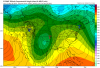
What do you mean by fooled? The models indicated a BN period after the 20th and we got that.
Yeah, the GEFS busted on the EPO forecast but EPS never bit.
Has it gone as planned...probably not but it hasn’t been as torched as some preach.
I get it, your biased warm, and maybe I’m biased cold. I appreciate everyone’s opinions.
View attachment 32180View attachment 32181
Colder this run due to more of a NS interaction, still no phase but if things trend colder this could still turn out to be a decent snow event.View attachment 32198
This is certainly getting interesting
Was that the same storm that showed up on the 12z run?Big CAD storm on the 18z GFS this run.
Is this a serious question or another troll post? I think I know the answer and @packfan98 has already issued a very friendly warningCould someone please describe to me how a mow can go north then back to the south?
Yes I'm trying to learn.Is this a serious question or another troll post? I think I know the answer and @packfan98 has already issued a very friendly warning
Ok, so look at the 1002 isobar line and how elongated it is. To me it is ripples of low pressure withing a broader area. So, it didn't move SW, it developed a new center there. But that's if you believe the GFSYes I'm trying to learn.