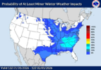
When you start worrying about the progression of a wave and whether it’s going to have time to turn the corner or not or get shunted to Turks and Caicos just remember the storm we’re in right now went from granddaddy long fetch with suppressed heights across the south to a Ohio Valley interior NE crush job and a warm nose into VA. Small gradual changes make all the difference
-
Hello, please take a minute to check out our awesome content, contributed by the wonderful members of our community. We hope you'll add your own thoughts and opinions by making a free account!
You are using an out of date browser. It may not display this or other websites correctly.
You should upgrade or use an alternative browser.
You should upgrade or use an alternative browser.
Pattern Fab Feb
- Thread starter SD
- Start date
SegTindo
Member
When you start worrying about the progression of a wave and whether it’s going to have time to turn the corner or not or get shunted to Turks and Caicos just remember the storm we’re in right now went from granddaddy long fetch with suppressed heights across the south to a Ohio Valley interior NE crush job and a warm nose into VA. Small gradual changes make all the difference
Oh I thought they cashed in at least that’s what the models said
Sent from my iPhone using Tapatalk
SegTindo
Member
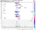
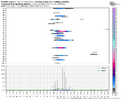
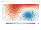
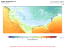
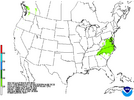
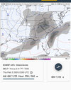
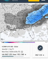
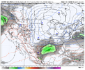
Holy cow what a setup on the WeatherNext ensemble
View attachment 188898
View attachment 188899
View attachment 188900
What’s that blue blob? It that bad?
Sent from my iPhone using Tapatalk
@KyloGHoly cow what a setup on the WeatherNext ensemble
View attachment 188898
View attachment 188899
View attachment 188900
Cad Wedge NC
Member
Man just scoot it down here just to make your boy happy. Sheesh
CNCsnwfan1210
Member
Man just scoot it down here just to make your boy happy. Sheesh
I see some green specks in SC too, it’s trying
Sent from my iPhone using Tapatalk
SegTindo
Member
The GFS and the GEFS aren’t looking good at this point in time plenty of time to switch it up tho!

Sent from my iPhone using Tapatalk

Sent from my iPhone using Tapatalk
rburrel2
Member
SegTindo
Member
Do you have a full loop?
Sent from my iPhone using Tapatalk
rburrel2
Member
SegTindo
Member
Well, that’s a signal View attachment 188914
SE AL/ S GA/N Florida Panhandle and South Carolina
This is our storm!!! Let’s pull it in!!
Sent from my iPhone using Tapatalk
6 days out. Lets go!Well, that’s a signal View attachment 188914
We’ve got the euro and weathernext on board, can’t ask for anything better at this point. Really excited about this oneWell, that’s a signal View attachment 188914
SegTindo
Member
We’ve got the euro and weathernext on board, can’t ask for anything better at this point. Really excited about this one
I need at least the gfs or one of the ai models so I’ll feel comfortable
Sent from my iPhone using Tapatalk
Gfs AI ens had it I believeI need at least the gfs or one of the ai models so I’ll feel comfortable
Sent from my iPhone using Tapatalk
SegTindo
Member
Gfs AI ens had it I believe
So we got two models on our so far could be worse but we can beat the odds
Sent from my iPhone using Tapatalk
trackersacker
Member
lexxnchloe
Member
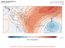
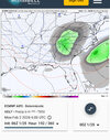
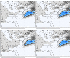
I gotta admit, it comforts me to see the Euro AI and its ensembles, the weathernext, and euro/eps looking better as the GEFS starts to look like  . Hopefully today will be a good trend day. Let’s build it up some back west today
SegTindo
Member
I gotta admit, it comforts me to see the Euro AI and its ensembles, the weathernext, and euro/eps looking better as the GEFS starts to look like. Hopefully today will be a good trend day. Let’s build it up some back west today
Amen to that
But watch out the GEFS likes to surprise you at random moments lol
Sent from my iPhone using Tapatalk
Pops
Member
Wow,pretty good sign there,hope ops catch on
whatalife
Moderator
Hopefully our time to shine brother.Strong storm signal on the Euro suites for this coming weekend. Don’t hate that. View attachment 188968View attachment 188969
Out of curiosity why is your user name on northgeorgiawx?
NEGaweather
Member

Sent from my iPhone using Tapatalk
rusrius
Member
It's been way too long.Strong storm signal on the Euro suites for this coming weekend. Don’t hate that. View attachment 188968View attachment 188969
packfan98
Moderator
We will probably create a storm thread after the 12z runs today before we lose power…
SegTindo
Member

Sent from my iPhone using Tapatalk
How do I pull that up?
Sent from my iPhone using Tapatalk
NEGaweather
Member
How do I pull that up?
Sent from my iPhone using Tapatalk
Weatherbell under metograms
Sent from my iPhone using Tapatalk
Need to name this one, for good mojoWe will probably create a storm thread after the 12z runs today before we lose power…
Brandon10
Member
Wouldn't be surprised to see a low pop off NC on Thursday. Clipper diving from NW and seems to transfer energy. These sometimes lead to small snow events east of the mountains.
Pops
Member
Could you post muscle shoals Alabama or Huntsville please?
Sent from my iPhone using Tapatalk
NEGaweather
Member
Could you post muscle shoals Alabama or Huntsville please?

Sent from my iPhone using Tapatalk
SegTindo
Member

Sorry for the image quality but here it is!
Sent from my iPhone using Tapatalk
SnowNiner
Member
00z runs were looking like a bit of a downgrade............except, the Euro and EPS improved, the AI GFS was interesting...
And.....the WeatherNext Ensemble had its best run yet!
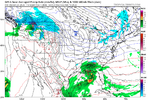
I don't have 500mb, but at the start of the loop, our storm wave of interest is hitting the west coast, and you can follow it along with the curvature in the dashed thickness lines as it dives SE into TX. That's how a healthy wave in split flow with an extending Pac Jet should behave. Also, the northern stream / TPV (purple and blue) elongates across the Great Lakes and dives down right behind our storm wave. All of this looks really good actually.
View attachment 188868
View attachment 188871
Here is WeatherNext with snowfall increasing next weekend
View attachment 188870
Then on the Euro, I like how the TPV over the Great Lakes continues to trend toward spreading out west to east / elongating here, instead of the deep, suppressing plunge to the SE
View attachment 188869
Just a really great signal showing up overnight from the best models right now, so much so the wpc is taking notice. Can’t ask for a better signal at this point. Gfs can kick rocks, they’ll come around. Wondering what the ukmet is doing though as it was the first to crush our snow dreams for this weekend.
Storm5
Member
Signal still there all you ask for 6-7 days away . Long way to go

 . Hopefully today will be a good trend day. Let’s build it up some back west today
