• Hello, please take a minute to check out our awesome content, contributed by the wonderful members of our community. We hope you'll add your own thoughts and opinions by making a free account!

Pattern Elevation Micro-climatology (SE Mountain Weather)

Nearing Blizzard Warning conditions above 4,000ft in Watauga.
URGENT - WINTER WEATHER MESSAGE
National Weather Service Blacksburg VA
1053 AM EST Wed Feb 26 2020

...Strong Winds, Rapidly Falling Temperatures, and Accumulating
Snow Showers This Evening and Overnight...

Ashe-Watauga-Grayson-
Including the cities of West Jefferson, Boone, Independence,
Whitetop, Troutdale, and Volney
1053 AM EST Wed Feb 26 2020

...WINTER WEATHER ADVISORY REMAINS IN EFFECT FROM 6 PM THIS
EVENING TO NOON EST THURSDAY ABOVE 3500 FEET...

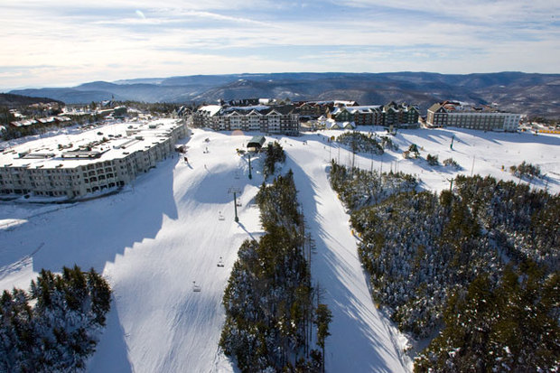
* WHAT...Snow expected above 3500 feet. Total snow accumulations
of 1 to 3 inches, with amounts up to 5 inches above 4000 feet.
Winds gusting as high as 55 mph.
 
Damage appears to be occurring. Upgraded to High Wind Warnings 60mph in mtns.
 
Watauga County Schools 2 hour delay with option to close.
 
Absolutely beautiful day in Boone with all the snow and sunshine. And here comes another winter weather advisory for heavy snow at times.
 
3k NAM shows convective line starts in Wilkes/Surry and hits all of NC down East with rain/grauple. Then turning to Friday night/Saturday morning, I think some snow showers will break containment for the foothills.
 
this is near perfect weather for ski resorts until spring next week. No snow in the lower elevations will help bring people in. Good thing the rain looks to stay west or else we would be dealing with more flooding concerns. Warm air should help melt it before any concerns arise
 
I wouldn’t rule out a dusting for the foothills by Saturday morning.
 
GA microclimate high peaks are amazing. Woody Gap is one of my favorites. The roads are always treated and it’s a quick ride up from Dahlonega. When there is rain at the base you get big snow at the top.
 
Anyone know what the latest is on the Hemlock trees? Are they still dying off rapidly due to the woody adelgid?
 
Snowy start to April above 4,500ft. 18z GFS smokes Ashe County NC on April Fools Day. Cold rain elsewhere.
 
WPC needs to show at least some chance if NWS Blacksburg is talking deform zone. Models are trending colder above 4,500ft.
 
Interesting it’s snowing now on Beech MTN way ahead of schedule
 
Webcams are pretty at this lunch time hour. Spring snow inbound.
 
WPC folds last second. Introduces some low chances of 1” and 2” snow amounts for western NC. If it was winter then these short range models showing half a foot could have actually verified given the position of the coastal low later on. Oh well something is better than nothing.
 
Lol Beech is getting smoked everything turning white despite NWS Blacksburg forecast. They missed the timing by over 12 hours.
 
Brad P said up to half a foot in the smokies. Not sure about that but still snowing
 
Back
Top