Cmon SPC, what’s the holdup?
-
Hello, please take a minute to check out our awesome content, contributed by the wonderful members of our community. We hope you'll add your own thoughts and opinions by making a free account!
You are using an out of date browser. It may not display this or other websites correctly.
You should upgrade or use an alternative browser.
You should upgrade or use an alternative browser.
Severe DEEP SOUTH Severe Weather threat 18-20th
- Thread starter Xtreme Weather
- Start date
-
- Tags
- hail severe weather tornado
- Status
- Not open for further replies.
Wxwamm
Member
Waiting until the top of the hour I figure..Cmon SPC, what’s the holdup?
SPC is probably on spring break.Cmon SPC, what’s the holdup?
Phillip l
Member
I just downloaded RadarScope. Someone teach me how to use it?
There is a group on facebook, very good info. I’m sure they will be extremely active today.
I love how Glenn Burns posts a county Map of Georgia so people can learn what county they are in.
You’d be surprised! No one around here knows anything!
As far as this threat, looking menacing from the SPC. I’m now in the enhanced area with a hatched area for tornados, yikes! I’m just hoping and praying that it doesn’t come overnight but it’s looking like it will.
Webberweather53
Meteorologist
Here's a very crude analysis of where the warm front, prefrontal trough, and dry line are currently located across Dixie and the lower MS Valley. The storm near and just north of Birmingham likely fired at a triple point where the warm front merged w/ this cold front aloft or prefrontal trough extending from north-central AL down to the Gulf coast. The primary forcing associated with the dry line (in orange) is still way back over northern MS and will take a few more hours to reach northern AL. Those in central GA need to keep a close eye on the location of the warm front (in red) and this prefrontal trough (in black) because this could be a focal point for isolated supercells outside the MDT risk area in northern Alabama as we're currently seeing near Birmingham.

Cmon SPC, what’s the holdup?
Probably the BMX sounding that showed weak low level shear for the time being.
It will come when it's needed.
RobertRath
Member
Probably the BMX sounding that showed weak low level shear for the time being.
Just north of Birmingham in Walker county. Getting cool easterly winds at the surface. Is there any significance to this?
Just north of Birmingham in Walker county. Getting cool easterly winds at the surface. Is there any significance to this?
Probably not in the end.
W
WeatherLC
Guest
How long will it take for the warm front to move into N GA web?Here's a very crude analysis of where the warm front, prefrontal trough, and dry line are currently located across Dixie and the lower MS Valley. The storm near and just north of Birmingham likely fired at a triple point where the warm front merged w/ this cold front aloft or prefrontal trough extending from north-central AL down to the Gulf coast. The primary forcing associated with the dry line (in orange) is still way back over northern MS and will take a few more hours to reach northern AL. Those in central GA need to keep a close eye on the location of the warm front (in red) and this prefrontal trough (in black) because this could be a focal point for isolated supercells outside the MDT risk area in northern Alabama as we're currently seeing near Birmingham.
View attachment 4600
Webberweather53
Meteorologist
How long will it take for the warm front to move into N GA web?
The warm front likely won't pass through Atlanta until later this evening, by then the main concern may be damaging winds in association w/ the MCS that will evolve from the large-scale merging of the supercell's cold pools. The passage of the warm front in conjunction w/ this prefrontal trough is more of a concern for areas like Macon to kick off an isolated supercell or two. Thankfully, the storm relative helicity won't be as favorable here as it is in northern Alabama closer to the surface low but hail, strong winds, and perhaps a tornado can't be entirely ruled out with the supercell or two that develops south of Atlanta (if any)
Webber, how long do you think it will be until the warm front moves into the Carrollton, GA area ?
W
WeatherLC
Guest
He just answered that.Webber, how long do you think it will be until the warm front moves into the Carrollton, GA area ?
No he didnt. He said when the warm front would move through Atlanta and N GA.He just answered that.
Bright sunny and 77 degrees Shelby County Airport Shelby County Alabama
Sent from my Pixel 2 using Tapatalk
Sent from my Pixel 2 using Tapatalk
 Tornado watch going to be issue soon.
Webberweather53
Meteorologist
No he didnt. He said when the warm front would move through Atlanta and N GA.
The warm front is knocking on your doorstep, looks like the low level stratus deck has cleared the next county immediately to your south so it won't be long in all likelihood.
Webberweather53
Meteorologist
Here we go, convective initiation is occurring just SE of Memphis along the dry line in northern MS, this should the focal point of the supercells that will enter northern AL and far NE MS later this evening. Buckle up.

ForsythSnow
Moderator
The clouds are still a long ways from being over up here. I've seen almost clear on Sat imagery only for the sky to still be full of thick clouds. Now Alabama is a different story.The warm front is knocking on your doorstep, looks like the low level stratus deck has cleared the next county immediately to your south so it won't be long in all likelihood.

Webberweather53
Meteorologist
The clouds are still a long ways from being over up here. I've seen almost clear on Sat imagery only for the sky to still be full of thick clouds. Now Alabama is a different story.
There's some stratus and leftover fractured cumulus from yesterday's convection and storms firing in Alabama that are shrouding the location of the low-level thick stratus that's over top the warm front but it looks to be making some progress into western GA. The smattering gravity waves just southwest of Atlanta and north of Columbus, GA are indicative of the nose of the warm front mixing stable air immediately along and out in front of it which creates gravity waves, leads to forward propagation of the warm front and progressively destabilizes the atmosphere, and I wouldn't be shocked if a few isolated spots are seeing some kelvin-helmholtz instability given the strong low-mid level and deep layer shear.
Webberweather53
Meteorologist
Starting to see some cB towers fire along the prefrontal trough in southeastern Alabama in the warm sector, those in south-central GA (Columbus, Macon, etc.) need to keep a close eye on the evolution of these guys fixing to close in on Columbus, GA because one or two, in spite of the less than ideal low-level SRH (which will limit the threat for tornadoes), the deep layer shear is sufficient to maintain supercells.
ForsythSnow
Moderator
Yeah, that storm headed towards Carrollton looks nasty. Just got severe warned and I'm watching it, as I think it may be developing rotation on the back end.Starting to see some cB towers fire along the prefrontal trough in southeastern Alabama in the warm sector, those in south-central GA (Columbus, Macon, etc.) need to keep a close eye on the evolution of these guys fixing to close in on Columbus, GA because one or two, in spite of the less than ideal low-level SRH (which will limit the threat for tornadoes), the deep layer shear is sufficient to maintain supercells.
To add on, that storm appears to be shooting vertically as well, which isn't a good sign since that indicates a strong updraft.
Webberweather53
Meteorologist
Yeah, that storm headed towards Carrollton looks nasty. Just got severe warned and I'm watching it, as I think it may be developing rotation on the back end.
Yeah that storm has since begun to remove itself further from the prefrontal trough but the cells developing out in the inflow region to its southeast could be hampering intensification of the supercell than what we'd otherwise observe.
Ron Burgundy
Member
Worried about that one. Headed right for downtown ATL on it’s current track.Yeah, that storm headed towards Carrollton looks nasty. Just got severe warned and I'm watching it, as I think it may be developing rotation on the back end.
To add on, that storm appears to be shooting vertically as well, which isn't a good sign since that indicates a strong updraft.
Yeah, that storm headed towards Carrollton looks nasty. Just got severe warned and I'm watching it, as I think it may be developing rotation on the back end.
To add on, that storm appears to be shooting vertically as well, which isn't a good sign since that indicates a strong updraft.
Looks like it has a pretty nasty hail core as well!!!
Webberweather53
Meteorologist
Worried about that one. Headed right for downtown ATL on it’s current track.
It really depends on the intensity of the supercell in the long run, if it intensifies further and its cold pool becomes stronger/more mature it may miss Atlanta to the south

Webberweather53
Meteorologist
Doesn't look like much on radar right now, but the cell just north of the FL-AL border west of Dothan has some seriously high cloud tops on GOES-16 imagery, even more so than the supercell headed into GA along the I-20 corridor further to north.
Headed through Douglas County soon. I may get lucky and take the north side of what rolls through.Worried about that one. Headed right for downtown ATL on it’s current track.
Webberweather53
Meteorologist
The HRRR really seems to hate Columbia, SC the last few runs. A nice MCV moves over head bringing w/ it the potential for damaging winds, hail, and an isolated tornado in the wee hours of the morning esp from the midlands of SC and points south. We'll just have to wait and see how the convection over MS, AL, TN, and GA evolves upstream late this evening to assess the threat for severe further east in the Carolinas.

Wxwamm
Member
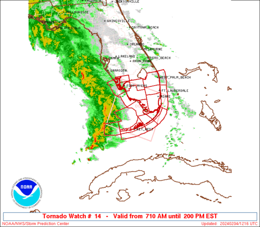
PDS!!!!!! Tornado watch just issued .. for North and Central AL!!!!!!
Good sized dry and warm slug of air at 850mb moving into AL from MS. Watch that area to see if any mixing down occurrs over the next few hours.
 Ok guys. Eyes open!!!
RollTide18
Member
Are those the probs worth a high risk?
Webberweather53
Meteorologist
Huntsville, AL and the surrounding area is going to be in big trouble if one of these cells in northern MS becomes dominant because the warm front is still draped over them...
I didn't expect them to issue a PDS tornado watch.
jaymackd3
Member
yeah I'm afraid it's about to get real soon enough around here.Huntsville, AL and the surrounding area is going to be in big trouble if one of these cells in northern MS becomes dominant because the warm front is still draped over them...
There is a new Tornado Watch.
ForsythSnow
Moderator
Here we go. Looks like classic supercells forming in MS right now. I expect tornado warnings in the next 20 minutes on at least one.
- Status
- Not open for further replies.