• Hello, please take a minute to check out our awesome content, contributed by the wonderful members of our community. We hope you'll add your own thoughts and opinions by making a free account!

Pattern December to Remember

Based on an analysis I did of temperature anomalies in January in Atlanta covering a 40 or so year period, the coldest when averaged out (so doesn’t guarantee anything but it is what I prefer to see for the best chance for cold MJOwise) was when the MJO was either just outside or inside the circle in phase 8 covering amplitudes 0.5 to 1.5 (inside circle just means amplitude under 1.0). Actually, for each and every one of the 8 phases during that 40 January period, Atlanta (and the bulk of the SE US by extension) was colder when comparing low amp to high amp as this RMM diagram with my handwritten anomalies clearly shows (no, this wasn’t for 1978….I used that one because I wanted a blank one to write on and this period in 1978 was missing RMM data):

View attachment 97326

What I prefer to see is a slow moving counterclockwise rotation just outside or inside the circle from 6 to 7 to 8 to 1 to 2 to 3.
... and lest you wonder, Folks, here's the link ... http://blog.southernwx.com/2017/01/...phase-inside-the-left-side-of-circle-coldest/

great little write-up by Larry ... ?
 
I'm gonna need to see an accum map for this paste job
Meh, next

sn10_acc.us_ma.png
 
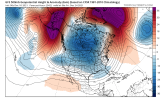
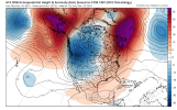
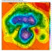
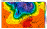
The 12Z runs have an interesting teleconnections solutions. All of the models show the AO going negative, the NAO going negative strongly, the EPO and WPO also going heavily negative. I still keeps the PNA negative but everything else is lining up nicely for the period of Dec 20 to Jan 10th 2022 as the MJO looks to head into 7, then 8, and then into one. For the SE, 7 is cool, 8 and 1 are cold for Dec/Jan
 
The 12Z runs have an interesting teleconnections solutions. All of the models show the AO going negative, the NAO going negative strongly, the EPO and WPO also going heavily negative. I still keeps the PNA negative but everything else is lining up nicely for the period of Dec 20 to Jan 10th 2022 as the MJO looks to head into 7, then 8, and then into one. For the SE, 7 is cool, 8 and 1 are cold for Dec/Jan
Looks good almost, but without a +PNA we may as well have Barney Fife at quarterback ...
 
Hilarious! But the good news is that we might just get that +PNA eventually if it does go into MJO 8 because I think that phase is decently correlated with a +PNA. ?
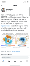
In my opinion that -PNA is there because the ridge in the EPO region is in the wrong place. The -AO and-NAO is not going to do anything to save us from that. It will I guess keep us average to slightly below but nothing crazy and likely won't get most of us what we want. Maybe phase 8, IF we get there will push the ridge eastward in a more favorable location. I think it's a 50/50 shot but the Euro stalling in phase 7 and looping back is a real possibility also.
 

Yeah, the Bleaklies (based on 0Z) are back to being their typical purely bleak. And as @Myfrotho704_ showed, even the latest CFS (12Z) is pretty bleak for most of its run except the last week, when it finally cools to near normal. What happened to all of those cold late Dec to mid Jan weeks on earlier CFS runs? Fortunately both of these models suck since the CFS often turns on a dime from one run to the next (like it did here to much warmer) and the Bleaklies are almost always bleak.
Anyway, enjoy the wx because it is the only wx you’ve got. ? The model twists and turns will keep us entertained, regardless.
Possibly record warm January? And February?
 
I honestly feel like the SE has a much better chance of seeing record heat than a snowstorm in January and February. I’m sticking to my guns and saying March will deliver for some

Even in cold year betting against Jan-Feb with March is setting yourself up for disappointment. Sure it happens, but if climo tells us anything it’s to not hope for snow in March.
 
Here's the link to the ACCESS-S2 Monthly MJO forecast from the Australian BOM

http://www.bom.gov.au/climate/enso/#tabs=Tropics

In a La Nina winter w/ a slow-moving MJO wave like this, the NAO usually goes deeply negative when we reach phase 8. We should arrive there around or just before New Years, which is generally consistent w/ the circulation pattern on NWP models atm.
View attachment 97316

Webber, who has the best track record with mjo rmm? Which one is most accurate in your opinion? I've heard the Australian mjo chart isnt that accurate fwiw
 
A strong +PNA can be a good and bad. Yes, a taller western ridge would allow colder air to push to the southeast, but a strong +PNA can also mean suppression and suppression is a nightmare here in the southeast when deep cold air is in place. A weaker +PNA would be better (weak ridging over the southwestern US to prevent lower heights to the east from causing suppression. A -NAO/AO combo with a -PNA/netrual and a -EPO should allow cold air across much of the country with transitional warmth east of the Rockies at times due to surface high pressures pushing off to the east. With the cold air that's predicted, there's definitely going to be cold surface high pressures coming south from Canada. Sure, we could see CAD/overrunning events in the near future.
 
A strong +PNA can be a good and bad. Yes, a taller western ridge would allow colder air to push to the southeast, but a strong +PNA can also mean suppression and suppression is a nightmare here in the southeast when deep cold air is in place. A weaker +PNA would be better (weak ridging over the southwestern US to prevent lower heights to the east from causing suppression. A -NAO/AO combo with a -PNA/netrual and a -EPO should allow cold air across much of the country with transitional warmth east of the Rockies at times due to surface high pressures pushing off to the east. With the cold air that's predicted, there's definitely going to be cold surface high pressures coming south from Canada. Sure, we could see CAD/overrunning events in the near future.

Yeah, for very shallow Arctic cold/CAD wedging ice for the CAD areas including Atlanta, a +PNA is often not present and sometimes there’s a -PNA. But for a more durable and serious cold pattern and the best chance for a classic widespread major Miller A snow (deeper cold), a +PNA is often present. I’ve studied the stats for Atlanta. What happens is that the mean trough for, say, an AL/GA/Carolinas Miller A snowstorm is closer to the Mississippi River thus allowing for enough Gulf moisture to funnel up via WSW to SW H5 flow along with a surface low that travels ENE in the N GOM.
 
Yeah, for very shallow Arctic cold/CAD wedging ice for the CAD areas including Atlanta, a +PNA is often not present and sometimes there’s a -PNA. But for a more durable and serious cold pattern and the best chance for a classic widespread major Miller A snow (deeper cold), a +PNA is often present. I’ve studied the stats for Atlanta. What happens is that the mean trough for, say, an AL/GA/Carolinas Miller A snowstorm is closer to the Mississippi River thus allowing for enough Gulf moisture to funnel up via WSW to SW H5 flow along with a surface low that travels ENE in the N GOM.
I'm hoping the -NAO develops. Like I said it won't cause a +PNA, but even if we get stuck in a pattern like last year with a -NAO and a bad Pacific we may can still thread the needle unlike last year. Reason being the drier air and lower dewpoints this year and a lot more cold available in Canada and the northern US may give us just enough cold air this year.
 
Back
Top