• Hello, please take a minute to check out our awesome content, contributed by the wonderful members of our community. We hope you'll add your own thoughts and opinions by making a free account!

Pattern December to Remember

I believe we're going to torch all the way through December. Then, after that, it's going to be nothing but hot as far as the eye can see until January is over. Then for February, it's going to record-setting hot, finally cooling off by late March. Going to be the number one hottest winter on record, and it isn't even going to be close, until it's beaten next year.
I actually 100% agree with you. I personally think I March will be the best chance we something for most of the people on this board.
 
I believe we're going to torch all the way through December. Then, after that, it's going to be nothing but hot as far as the eye can see until January is over. Then for February, it's going to record-setting hot, finally cooling off by late March. Going to be the number one hottest winter on record, and it isn't even going to be close, until it's beaten next year.
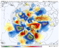
I literally can't find anything working in our favor for the next 10 days at least. But I'm not kicking the can to January mainly because my leg is worn out from all the can kicking of the last few years. While unlikely as it is I'm going to pull for an epic reversal the second half of December. That can and has happened! Also JB told me I'd average below normal for December. That means the flip will be epic to erase the burn of the 1st half!
 
If the Charlotte area doesn’t have a top 3 warmest December y’all can ban me for the rest of winter.
Though I think it’s gonna definitely be a warm month overall, there’s a couple reasons why I think top 3 might be pushing. The current top 3 were wall to wall warm months with each probably having 25 days or more with highs above 65, while it looks like we may see a number of instances this year where CAD keeps temperatures down. Also, if you remember 2015 wasn’t just warm… it was quite humid at times as well thanks to that raging STJ you see with a strong El Niño. This time we’re looking at a much drier airmass overall which will allow even mild days to cool off quick after dark… we may see a good bit 35 in the morning to 65 in afternoon type days. 2015 had a lot of nights with lows in the 50s and even 60s… I remember walking outside on Christmas Eve night that year and it felt like south Florida.
 
But yesterday everyone was riding the trough train when showed cooler...

You know what they say" New Day; New Pattern."
Agreed. Much too early to say record breaking warm December. Today is dec 1. Haha. nothing is for certain after day 5 right now. KING Euro
 
I believe we're going to torch all the way through December. Then, after that, it's going to be nothing but hot as far as the eye can see until January is over. Then for February, it's going to record-setting hot, finally cooling off by late March. Going to be the number one hottest winter on record, and it isn't even going to be close, until it's beaten next year.
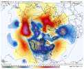
Knowing our luck, there won't be any ridge to speak of come spring time, lol. Of course, by then climatology won't be in favor for snow storms, not unless we cash out on a late season snow storm by a freak of nature. As we know it, there can be quite significant snows in March. It will be interesting what plays out with the stubborn ridging. These past several winters has not been in our favor, but one of these winters (maybe not this winter either) our luck will return eventually.
 
Though I think it’s gonna definitely be a warm month overall, there’s a couple reasons why I think top 3 might be pushing. The current top 3 were wall to wall warm months with each probably having 25 days or more with highs above 65, while it looks like we may see a number of instances this year where CAD keeps temperatures down. Also, if you remember 2015 wasn’t just warm… it was quite humid at times as well thanks to that raging STJ you see with a strong El Niño. This time we’re looking at a much drier airmass overall which will allow even mild days to cool off quick after dark… we may see a good bit 35 in the morning to 65 in afternoon type days. 2015 had a lot of nights with lows in the 50s and even 60s… I remember walking outside on Christmas Eve night that year and it felt like south Florida.
I agree 100% the overnight lows will not allow that with the dry air. This dry weather may be a blessing deeper into winter. I remember last year several modeled threats had dews in the upper 20s leading up to the event. That had failure written all over it. We rely heavily on evaporational cooling around these parts. I've already had dews lower than all of last winter and it wasn't even close.
 
Agreed. Much too early to say record breaking warm December. Today is dec 1. Haha. nothing is for certain after day 5 right now. KING Euro
The model fluctuations run to run within even the same suite are pretty epic right now. Have to favor warm but the euro shows how we can at least temper that back closer to avg
 
Agreed. Much too early to say record breaking warm December. Today is dec 1. Haha. nothing is for certain after day 5 right now. KING Euro
Oh no, you have me confused. We gonna bake. I was making fun of the hype train when the Euro threw a single trough out there. Saw 1 dang cooler run / run delta and lost theirs minds.
 
Oh no, you have me confused. We gonna bake. I was making fun of the hype train when the Euro threw a single trough out there. Saw 1 dang cooler run / run delta and lost theirs minds.
Same can be said about the GFS and it's warmer solution. That model flips back and forth every run now. Half the time it doesn't even agree with its own ensembles.
 
Eps alternates cool/warm through D8 then a short torch/SER followed by a quick brief cool off then it goes mega torch to end out the run. Might be a little more support for a -NAO/EPO as you get past D10 and really out to 2 weeks but meh noise and it still wasn't pretty
 
Eps alternates cool/warm through D8 then a short torch/SER followed by a quick brief cool off then it goes mega torch to end out the run. Might be a little more support for a -NAO/EPO as you get past D10 and really out to 2 weeks but meh noise and it still wasn't pretty

I looked at the mjo charts and one will be right one will be wrong. All it takes is one winter storm to get our averages here. Interesting model volatility still. All we have is optimism right now. Dont look anything will avoid us torching for a while, but the million dollar question is for how long? If the warm phases typically are 4-6, how can the mjo get to phase 7, which is usually cooler? We really don't want it stuck in warm phases all winter. SD, I guess we have a ways to go still? Lol
 
Last edited:
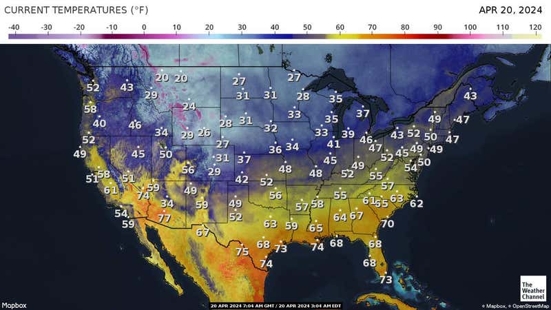
acttemp_1280x720.jpg
Just ridiculous....
 
I looked at the mjo charts and one will be right one will be wrong. All it takes is one winter storm to get our averages here. Interesting model volatility still. All we have is optimism right now. Dont look anything will avoid us torching for a while, but the million dollar question is for how long? If the warm phases typically are 4-6, how can the mjo get to phase 7, which is usually cooler? We really don't want it stuck in warm phases all winter. SD, I guess we have a ways to go still? Lol
P7 isn't bad as a NDJ phase it can get the SER a little excited in DEC but not much. This post by webb yesterday describes our issues with the mjo.
Destructive interference between the MJO and ENSO will make the favorable, cooler MJO phases harder to come by and less amplified for the time being, the one benefit of being in a neutral ENSO state or El Nino is that Pacific-W Hem MJO is more frequent + stronger. In the long run, we'll need to dislodge the MJO from the Maritime Continent-West Pacific to avoid getting consistently torched in mid-late winter, not entirely sure if that's going to happen this year.
 
60s all the way into Montana close to the Canadian border.

The chinook/Foehn wind on the lee (eastern) side of the Rockies is mostly responsible for that. Even simply having just a strong westerly wind can cause temperatures to warm several tens of degrees in a matter of a few hours downwind of the Rockies from Alberta to Colorado. Compressional warming is mainly driving this phenomena and can also cause even the deepest snow pack to sublimate/melt rather quickly in those areas. For ex, it's not totally unheard of for places as far north as Calgary to not have snow on the ground in the middle of winter as result of this Foehn wind.
 
The chinook/Foehn wind on the lee (eastern) side of the Rockies is mostly responsible for that. Even simply having just a strong westerly wind can cause temperatures to warm several tens of degrees in a matter of a few hours downwind of the Rockies from Alberta to Colorado. Compressional warming is mainly driving this phenomena and can also cause even the deepest snow pack to sublimate/melt rather quickly in those areas. For ex, it's not totally unheard of for places as far north as Calgary to not have snow on the ground in the middle of winter as result of this Foehn wind.

Webber, how can we dislodge the mjo from the warm phases during mid-late winter so we dont blowtorch all winter? I think that's a viable question. Will it take a SSW event of epic proportions, pdo to weaken, nina to weaken? Just trying to get some clarity. Looks like we are already blowtorching for this time of year lol. Also, I believe we are in an east based niña currently and -qbo regime. If the winter is warm, we have to accept it but it takes one storm to make our winter, especially in the south?
 
The chinook/Foehn wind on the lee (eastern) side of the Rockies is mostly responsible for that. Even simply having just a strong westerly wind can cause temperatures to warm several tens of degrees in a matter of a few hours downwind of the Rockies from Alberta to Colorado. Compressional warming is mainly driving this phenomena and can also cause even the deepest snow pack to sublimate/melt rather quickly in those areas. For ex, it's not totally unheard of for places as far north as Calgary to not have snow on the ground in the middle of winter as result of this Foehn wind.
I’ve actually seen this happen first hand once on a trip Montana. Went from low 20s and an 8 inch snowpack to low 70s in the afternoon and snow cover gone by 5pm. It literally experiencing 3 seasons in one day.
 
Hour 324? May as well flip a coin. Heads trough west, tails ECT.

My, my such Debbie Downers for day one of winter.

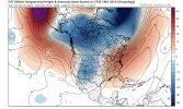
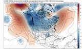
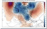
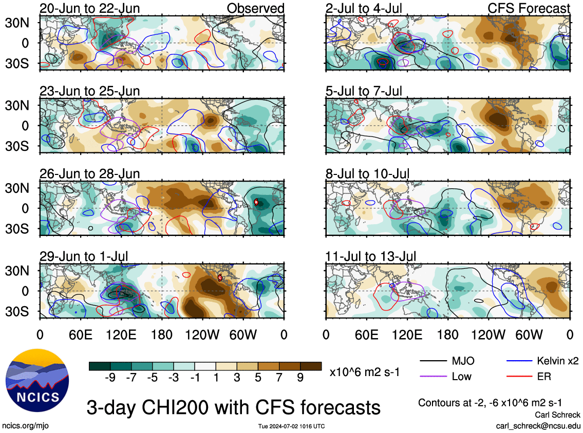
Not really a coin toss/guess in this case. Ensemble mean patterns are the only thing of value at this range and that's why it was worth posting over an operational run which has zero value beyond day 7-10. Also, as mentioned earlier, this pattern is entirely consistent with what you expect during West Pacific MJO events in December (usually very warm). These MJO events are one of the few phenomena that lend itself to some predictability this far out, because they evolve over periods of weeks, sometimes a month or two (not days as do synoptic weather systems).
 
Can kind of make out 2 quasi-distinct MJO waves in the Western Pacific in both the analysis + forecast fields through Dec 10 on the CFSv2. The first wave is north of the equator in the NW Pacific, having already developed a few days ago, whereas the second wave forms out of the South Pacific Convergence Zone (SPCZ) in a more classic manner for this time of the year, which is a big reason why you see models like the EPS showing the MJO completing a loop-de-loop in phase 6 through mid-month.

The GFS & CFS try to push the wave out into the Central pacific by the 3rd week of the month, but these models have a habit of progressing MJO waves far too quickly across the Maritime Continent & Western Pacific and I think they're a bit fast once again (& thus too fast w/ the pattern change away from the SE US ridge thereafter). Furthermore, the La Nina will help decelerate this MJO wave as the advection by the background flow (i.e. westerly jet stream) is weaker than usual, and enhanced convection underneath the ENSO standing wave over the Maritime continent will favor increasing amplitude of the MJO (again favoring even more warmth in the east-central US mid-month), which augments the downstream planetary wave pattern, also helping to slow the wave down (as those waves obtain higher amplitudes and tend to retrogress westward in the means). All of this points to an extended warm-up that could last through the 3rd week of the month (dec 14-21) and while we're talking pretty far out, confidence is higher than usual in the outlook during week 2 & may grow more w/ time for later week 2 outlooks once the models initialize a more amplified MJO wave. (which is supported by literature)

chi200.cfs.all.global.3.png
 
Back
Top