• Hello, please take a minute to check out our awesome content, contributed by the wonderful members of our community. We hope you'll add your own thoughts and opinions by making a free account!

Pattern December to Remember

I’d honestly much rather torch for the first part of December or even most of it. I worry about starting off December with massive cold fronts and then flipping to warm to start off January when that’s our best time for snow average wise. I know a cold December doesn’t necessarily mean a warm January and vise versa but it does seem like when we are cold in late December and early January that the warmth ends up coming to us at the worst time. Just don’t give me the 2016-2017 winter #worst winter ever.

Actually as you may have even hinted, there’s a pretty good partial positive correlation of Dec to Jan temps and a good bit higher correlation than that of Nov to winter.

The last time I posted (yesterday), the two major ensembles had been trending significantly colder for 12/4-10 since Tuesday/Wednesday runs. Suddenly, the last couple of runs have reversed a lot of that, especially latter portion, though some of that cooling remains in the 12/4-7 period. And now the end of the runs going to 12/12 are warmer (AN to NN). So, was that a big tease?

So, not good trend for cold lovers but I just read some posts looking forward to a warmup due to so much cold this month. So, they’ll be happy though not me as I almost always root for cold/BN regardless of month. Plus, models go back and forth. So, we’ll see if they reverse back again.

Looking to mid to late Dec, the wonderful MJO runs continue to suggest a path that would be favorable for cold to return to the SE for much of mid to late December if the PMA/AO/NAO would cooperate. Before that, the 4 indices strongly favor warmth in the SE. So, warmth then should be expected. Today’s runs do suggest the PNA may return toward the current + in two weeks. That would be a big help.

Note that the current cold is accompanied by a great combo of +PNA, -NAO, and slight -AO and thus it is solidly cold in the SE despite having an MJO on the right side of the diagram (though it being low amp inside circle right side vs high amp right side keeps it from being a warm forcing as that’s more neutral).

In the meantime, I’m enjoying the current cold!
 
Really starting to fear drought conditions for most east Half country … if the ridge gets strong in central plains like long range starting pick up on. By next spring going In to next summer it could get seriously dry
 
Not yet. But it’s getting much closer to it

No matter how warm the pattern, it almost always can reverse the other way quickly. Nothing ever locks in for long periods. Winter is nothing like the doldrums of summer thank goodness. There’s always changes potentially on the horizon.

But right now, enjoy the cold as it is the only cold you get. ?
 
I don't think even the Southern Appalachians get below 32 in December on this GFS run... nice.
Yeah it looks like a lot of folks will be running their AC some in the LR (..lots of dewpoints in the 60s). Lets hope the GFS is wrong.
 
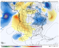
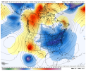
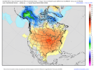
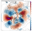
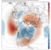
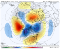
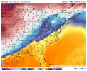
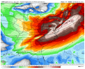
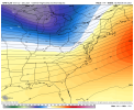
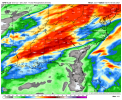
This is why I have a feeling (even though this still isn’t an ideal snow pattern) these operationals have gone way too warm at least at this range I mean this is night and day here and I have a feeling there will be some pull back in the coming days 17544FA0-51FC-441F-9391-270717655F62.jpeg9637EE3C-FF9C-41B8-A21B-EC875CBC45FD.jpeg
 
If the pattern really is trending warmer, we cant believe the rmm charts on the mjo with it going possibly into more colder phases later imo.
 
This is why I have a feeling (even though this still isn’t an ideal snow pattern) these operationals have gone way too warm at least at this range I mean this is night and day here and I have a feeling there will be some pull back in the coming days View attachment 96104View attachment 96105
Honestly I think it would be very much expected to see the Ops pull back on the warmth. This goes back to why you just can’t take anything beyond 5–7 days too seriously. Everyone had to know that some of the crazy cold that yesterday’s operational models were showing had very little chance of actually happening… much like crazy warm solutions have little chance of verifying either. I wouldn’t be at all suprised if we stay in this progressive pattern for the time being, though I could see the cold shots getting a little colder as we follow climo. I do think we are going into a bit more of an active pattern as we go into 12/6-12/10 time frame
 
If the pattern really is trending warmer, we cant believe the rmm charts on the mjo with it going possibly into more colder phases later imo.

The GEFS has remained consistent on a path toward low amp 7 & 8. But phases that tend to be cold aren’t an end all be all by any means. It typically needs help from some or all of the +PNA, -AO, and -NAO, especially the +PNA. The latest GEFS still suggests the current solid +PNA will go to solid -PNA next week but it also suggests a rise back to neutral and then maybe positive late in the week after (~2 weeks out). We’ll see.
 
The GEFS has remained consistent on a path toward low amp 7 & 8. But phases that tend to be cold aren’t an end all be all by any means. It typically needs help from some or all of the +PNA, -AO, and -NAO, especially the +PNA. The latest GEFS still suggests the current solid +PNA will go to solid -PNA next week but it also suggests a rise back to neutral and then maybe positive late in the week after (~2 weeks out). We’ll see.
Have you by any chance looked at the CFS today?? I haven’t been able to get it to load for some reason. Obviously it has its flaws but it does start to get pretty good with overall patterns in the last few days of the month
 
Back
Top