• Hello, please take a minute to check out our awesome content, contributed by the wonderful members of our community. We hope you'll add your own thoughts and opinions by making a free account!

Pattern December to Remember

La nina is killing us and it looks to keep the same dominant pattern throughout this years winter. As with last year all we can do is hope for something to pop between quick cool downs. Again, maybe February saves some of us when the pattern starts to relax some.

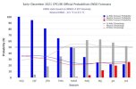
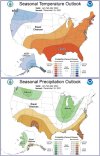
Latest seasonal forecast:
aaaa1.jpg

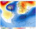
Look familiar?
aaaa2.jpg

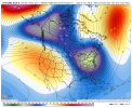
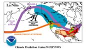
Do I dare say "just wait until next year"?
aaaa3.jpg
 
La nina is killing us and it looks to keep the same dominant pattern throughout this years winter. As with last year all we can do is hope for something to pop between quick cool downs. Again, maybe February saves some of us when the pattern starts to relax some.

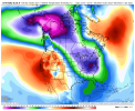
Latest seasonal forecast:
View attachment 98353

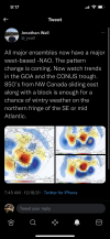
Look familiar?
View attachment 98354

Do I dare say "just wait until next year"?
View attachment 98355
My only hope is that the pattern flips sometime in early Jan as many are expecting and we are given a 2-3 week window. La Ninas and February usually means warmth for the SE,especially for the Carolinas due to the SE ridge that comes with most La Ninas.
 
Last edited:
I notice some things, we’re loosing the pacific rex look and just turning it into a more classic ridge>-PNA trough combo, more rex I’ve noticed delays the more conus trough type of look but means a stronger 50/50 low and cool Carolinas , but the more W>E ridge trough combo I’ve noticed speeds up the conus trough look with cold finally making it, but means medium term more ridging and more torching
 
My only hope is that the pattern flips sometime in early Jan as many are expecting and we are given a 2-3 week window. La Ninas and February usually means warmth for the SE,especially for the Carolinas due to the SE ridge that comes with most La Ninas.
If the -NAO is indeed west based and has any staying power I would imagine we'd see some favorable H5 looks. Even last year had some great H5 looks and good storm tracks. The -NAO got a bad rap last year by some. Mostly the youngsters who were like 10 years old the last time we had one in 09-10 and first part of 10-11. Those two winters were good. Looking back at some of the great winters of the 60s and 70s in the east they had a -NAO. The lack of cold ruined it last year. And we still had some very close calls. I'm sure someone can dig up a winter somewhere that had a west based -NAO that never got a favorable H5 pattern, but it has to be rare. So this year if it has any staying power with the cold available I feel decent about a window with a good pattern. It very well may not snow due to bad timing and lack of moisture but we'll see.
 
Yeah it seems that basing forecasting on where the MJO is headed in January is a fools errand. The most reliable indicator it seems is pattern persistence. Sure it has to change eventually but that might be March for all we know.


Sent from my iPhone using Tapatalk
 
My only hope is that the pattern flips sometime in early Jan as many are expecting and we are given a 2-3 week window. La Ninas and February usually means warmth for the SE,especially for the Carolinas due to the SE ridge that comes with most La Ninas.
Yeah. I'm sure we will. At least I'm hopeful of that (being a cold weather lover). There have been some good la nina winter events (...1996). I just think our chances will be less with this ongoing la nina.
 
The cancel winter everyday crowd is quite annoying especially when things are going right for a decent pattern change with cold and more snowy potential pattern December 27- January 3rd when we’re just getting into good climo months to get snowfall?? I assume they are just trolling because anyone who comes in here and actually digests the content would understand were in a good spot right now in seeing a very good pattern change
 
Yeah it seems that basing forecasting on where the MJO is headed in January is a fools errand. The most reliable indicator it seems is pattern persistence. Sure it has to change eventually but that might be March for all we know.


Sent from my iPhone using Tapatalk
I wouldn't think it would take long. It's hard to get ridging in the EPO and NAO regions at the same time to start with. Much less sustain it. These weird looks the models are spitting out is during this time frame we have both. My opinion we'll lose one come January. If it's the NAO we may have problems but it's anyone's guess at this point.
 
Yeah. I'm sure we will. At least I'm hopeful of that (being a cold weather lover). There have been some good la nina winter events (...1996). I just think our chances will be less with this ongoing la nina.
Like said earlier don’t see why people are shocked of this pattern with the La Niña way it’s setting up and been. The number one analog was 11 12 winter going in this winter , seems be following suit .
 
Yeah it seems that basing forecasting on where the MJO is headed in January is a fools errand. The most reliable indicator it seems is pattern persistence. Sure it has to change eventually but that might be March for all we know.


Sent from my iPhone using Tapatalk

It's not if you know what you're doing. As for the latter, that's nonsense.
 
Like said earlier don’t see why people are shocked of this pattern with the La Niña way it’s setting up and been. The number one analog was 11 12 winter going in this winter , seems be following suit .
It's definitely not 11-12 in my opinion. We were way colder in November this year that 2011. We probably will be warmer this December than December 2011 which sucks. But that winter was dominated by deep AK vortex and not even a sign of a -NAO. In the end we may indeed end up warmer that that year with not even a sleet pellet. But if we do we're going to do it in a different way.
 
I wouldn't think it would take long. It's hard to get ridging in the EPO and NAO regions at the same time to start with. Much less sustain it. These weird looks the models are spitting out is during this time frame we have both. My opinion we'll lose one come January. If it's the NAO we may have problems but it's anyone's guess at this point.
Probably the -NAO we’re gonna couple it to the strat per models, I have a good feeling about Jan
 
Here’s the answer: These 5 periods are the only two week plus long cold periods at ATL since 1950 that were during a -PNA:

- 12/29/1967-1/13/1968: 0.2” + 2 Ts of SN
- 12/1/1968-1/16/1969: 3 Ts of SN
- 12/27/1978-1/9/1979: 2 Ts of SN
- 1/24/1979- 2/21/1979: major ZR & 4.4” of sleet from different storms
- 11/27/2010-12/25/2010: 1.3” Christmas snow (only measurable one on record?) plus 3 other trace to 0.1” wintry events.

So, what did these rare five periods have in common to be able to get that longlasting cold during a -PNA? A -AO and a -NAO were both present every time with them being quite strong during most of these 5 periods. A -EPO was present only during 3 of the 5 periods….so, not crucial. ENSO wasn’t crucial. The key is the strong -AO and -NAO. Furthermore, note the multiple wintry precip events during all 5 periods.

This is relevant in case we never get out of the -PNA to see if there’d still be much hope for sustained cold in the SE. Whereas a +PNA would certainly be most preferred, these five periods show that given both a strong enough -AO and -NAO it is still a reasonable possibility.
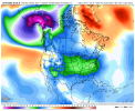
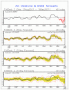
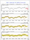
Both the AO and NAO forecasts are even more negative today per GEFS, our best hope for a persistently cold couple of weeks even if we don’t lose the -PNA although even it is still forecasted to approach neutral in 2 weeks:

AF6EB179-03A1-4FBC-887B-601F37865007.gif521D2FF8-FBAF-4736-ABB7-30ECE0514E0B.gif
 
The cancel winter everyday crowd is quite annoying especially when things are going right for a decent pattern change with cold and more snowy potential pattern December 27- January 3rd when we’re just getting into good climo months to get snowfall?? I assume they are just trolling because anyone who comes in here and actually digests the content would understand were in a good spot right now in seeing a very good pattern change
A snowy pattern for I-40 and North maybe. I don't see anything to be optimistic about for the I-10 and I-20 crew.
 
Been gone for a day come back to 8 pages of mjo and pattern change talk....ugh I miss the old days 8 pages back in the day meant gold!!! Anyway nice to see some changes on goofy. Just remember he didn't get that name for nothing. I'd like to see some consistency before I bite on the cold. And cold like its showing usually means cold/dry suppression city all day long. Most good storms for NC come with Marginal cold air.
 
Been gone for a day come back to 8 pages of mjo and pattern change talk....ugh I miss the old days 8 pages back in the day meant gold!!! Anyway nice to see some changes on goofy. Just remember he didn't get that name for nothing. I'd like to see some consistency before I bite on the cold. And cold like its showing usually means cold/dry suppression city all day long. Most good storms for NC come with Marginal cold air.

It's honestly a good thing this forum is so active now, as it shows this place is growing at a rather rapid pace.
 
Probably the -NAO we’re gonna couple it to the strat per models, I have a good feeling about Jan
Yeah if it couples it should be around for few weeks. That along with a favorable MJO pass to move that Aluetian ridge/-EPO thing, or whatever you call it more east we would be in business.
 
Ok so I got a bit bitter by saying March but I guess it seems as though last year we got into the right phases but the pacific didn’t participate.

But I guess we had a few periods of cold last year so there’s that.


Sent from my iPhone using Tapatalk
 
It's honestly a good thing this forum is so active now, as it shows this place is growing at a rather rapid pace.
Southern WX is by far the best weather weenie site there is. A perfect blend of valid scientific analysis and enthusiast banter allowed keeps this forum informative and friendly. Not to mention that, unlike some other site, the SE is more than N. Carolina here too.
 
Ok so I got a bit bitter by saying March but I guess it seems as though last year we got into the right phases but the pacific didn’t participate.

But I guess we had a few periods of cold last year so there’s that.


Sent from my iPhone using Tapatalk
It's a rare winter that has prolonged cold and multiple winter storms in our little piece of the earth. All we need for a memorable winter is a couple of good periods to thread the needle with that's always a must in the deep south to get a memorable storm or two.
 
It's a rare winter that has prolonged cold and multiple winter storms in our little piece of the earth. All we need for a memorable winter is a couple of good periods to thread the needle with that's always a must in the deep south to get a memorable storm or two.

Never have truer words been said.


Sent from my iPhone using Tapatalk
 
Eric high key called it from 3 weeks ago. A significant change was unlikely until early January and that’s right where this is heading. Per usual, models rushed the pattern change and showed fake cold shots that quickly turned to torches. Models are correcting and maintaining our ridge for another two weeks like we thought
 
Back
Top