bigstick10
Member
Might as well be hour 584.And it always will be..
Might as well be hour 584.And it always will be..
I doubt it’s this intense .. we’ve seen the Gfs overdo the SER intensity this year .. CAD will find a way somehowThis is a straight up roast, days of upper 70s over upper 50s. Pacific is more rexed so this gfs run might be slightly with the nice look at the end of the run View attachment 98374
Yeah go ahead call it January needs a prayer …. LolNo January thread at this moment. One of the mods will be opening one up in a few days. Please be patient.

Idk, 2-3 maybe. Not super warm to end the month so it’s not bad. I’ll take some rain with warmth. Definitely not a torch. January will be different.Not a freeze in sight. Wow. How many freezes have you had this month ?
Won’t happen. EverAtlanta has only had 1 freeze so far and that was 32. Would be something if that's the only freeze they get all winter.
We Definitely shouldn’t cancel winter before Christmas. Even in the worst of winters somewhere in the southeast will get a snow or two by the end of the season.The cancel winter everyday crowd is quite annoying especially when things are going right for a decent pattern change with cold and more snowy potential pattern December 27- January 3rd when we’re just getting into good climo months to get snowfall?? I assume they are just trolling because anyone who comes in here and actually digests the content would understand were in a good spot right now in seeing a very good pattern change
It’s a different winter now though. Y’all have been hollering about CAD and no torch . Yet to happen . Last year was a different animal.I doubt it’s this intense .. we’ve seen the Gfs overdo the SER intensity this year .. CAD will find a way somehow
Colder in Iowa than the N. Pole. The GFS sure knows how to keep us entertained!

At Hartsfield ? Who knows anymore lol. I think it’s possible actually . If Raleigh made it through an entire January with no freeze in the 1930s then the giant UHI of Hartsfield could pull off under 10 freezes perhaps .Won’t happen. Ever
Don’t show lizard man he’ll get cranky!lol wudge View attachment 98393
Im serious , where is your wedge ? It’s been repeated since November , yet the models have proven right . It’s been a torch . You can’t use last year to forecast this year exactly the same .Don’t show lizard man he’ll get cranky!
Euro for example is back as well! Beneficial rains continue! Anything will help also check out the @Myfrotho704_ special!Also watch this next Tuesday- Wednesday system to start creeping back into the picture .. some models and ensemble members latching onto it again and bringing beneficial rain to the area.. this type of thing usually happens on models with storms modeled off the SE coast during the winter months


Sleet showing up over Gastonia.Euro for example is back as well! Beneficial rains continue! Anything will help also check out the @Myfrotho704_ special!View attachment 98394View attachment 98395


Looks similar to last spring lolYou can't ask for a more perfect blocking orientation than this:
View attachment 98403
The old Dolphin look! Hope it works out better than the hockey stick pattern!?Looks like the EPS is speeding up the process this run ! View attachment 98398
Yeah Canada is fixing get cold for sure how that look. Question will be still how will the pacific corporates get it further south .View attachment 98399
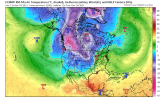
Day 10 Euro. Don’t hate it, it has another massive winter storm for Pacific NW. we need to se that move on through. I do like the blocking going on up north. Hopefully we will see enough movement around the Aleutians to start moving that super cold air mass south, then I would assume the blocking would keep it over our neck of the woods for awhile.
