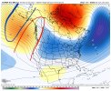
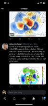
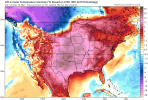
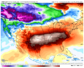
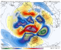
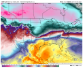
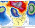
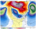
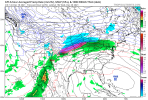
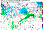
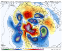
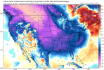
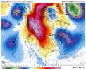
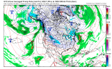
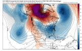
That feeling when you haven’t logged in for a few hours and you come back to 3-4 new pages in the monthly thread. Come to papa.Been gone for a day come back to 8 pages of mjo and pattern change talk....ugh I miss the old days 8 pages back in the day meant gold!!! Anyway nice to see some changes on goofy. Just remember he didn't get that name for nothing. I'd like to see some consistency before I bite on the cold. And cold like its showing usually means cold/dry suppression city all day long. Most good storms for NC come with Marginal cold air.
-
Hello, please take a minute to check out our awesome content, contributed by the wonderful members of our community. We hope you'll add your own thoughts and opinions by making a free account!
You are using an out of date browser. It may not display this or other websites correctly.
You should upgrade or use an alternative browser.
You should upgrade or use an alternative browser.
Pattern December to Remember
- Thread starter SD
- Start date
IDK. Could just be the avatar? ?I left American because no one would talk to me.
Cary_Snow95
Member
Me too! Have you heard about the 11-12 analogs? I heard it for the first time today!I'll stop. I'm sorry
L
Logan Is An Idiot 02
Guest
Definitely comes back a lot faster than cold
View attachment 98372
It’s wild how fast the torch came back on the gfs
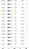
So yet again, even though most of the daylight hours willl be spent in the 50s, today's official high will be 71*F at DFW (set at midnight).
Also, yesterday's high was 78*F, with a daily departure of +21.4*F above average.
Also, yesterday's high was 78*F, with a daily departure of +21.4*F above average.
Also, there's a chance DFW could go the entire month of December without a sub-50*F high, which would really be crazy (not sure that's ever happened before).
Sunday, with a current forecast high in the upper 40s, might be our best shot.
In fact, our "coldest" high to-date has only been 59*F .
Sunday, with a current forecast high in the upper 40s, might be our best shot.
In fact, our "coldest" high to-date has only been 59*F .
Everytime BTR gets an overnight front, I wait with baited breath for the temps to fall PRE-midnight. Any temp drop after midnight will be to no avail in my book. The daily high will still have the ugly stain of a sultry temp for all generations to see in the airport almanac for that date. Maybe I'm just melodramatic about arbitrary weather cycles at my local NWS reporting station. ?So yet again, even though most of the daylight hours willl be spent in the 50s, today's official high will be 71*F at DFW (set at midnight).
Also, yesterday's high was 78*F, with a daily departure of +21.4*F above average.
NBAcentel
Member
ATLwxfan
Member
Mesoscales keeping ATL in the mid 40’s for highs Monday and Wed. So that’ll feel like December at least.
Sent from my iPhone using Tapatalk
Sent from my iPhone using Tapatalk
NoSnowATL
Member
NBAcentel
Member
Dewpoint Dan
Member
Not a freeze in sight. Wow. How many freezes have you had this month ?
Cad Wedge NC
Member
I will believe it when I see it. I am still in denial....View attachment 98372
It’s wild how fast the torch came back on the gfs
Cary_Snow95
Member
With the gfs losing the confluence over the NE, the euro and gfs are in agreement. Ridge is gonna take over. Enjoy the warm weather, it’ll flip first ten days of JanuaryI will believe it when I see it. I am still in denial....
D
Deleted member 1449
Guest
Watch as the -NAO block hooks up with the SE block and drops all the cold in the northern Rockies and upper midwest.
bigstick10
Member
Thunder with torrential rain in ATL right now.
NBAcentel
Member
bigstick10
Member
That is the damn airport, I have had about 11 freezing mornings. 26.6 a few days ago.Not a freeze in sight. Wow. How many freezes have you had this month ?
Edit: 8 at 30-31, 1 below 30-26.6
NBAcentel
Member
ATLwxfan
Member
Not a freeze in sight. Wow. How many freezes have you had this month ?
Luckily in Alpharetta we’ve had a three freeze’s including a day where we went from 28 to 70. Two solid opportunities for mega frost this week.
Sent from my iPhone using Tapatalk
We try to keep a family oriented atmosphere.?It could be worse. The reason I left American was because the GFS has a good 12in snow event, and not a single poster talked about it over there. I love this site!
Dewpoint Dan
Member
Atlanta has only had 1 freeze so far and that was 32. Would be something if that's the only freeze they get all winter.That is the damn airport, I have had about 11 freezing mornings. 26.6 a few days ago.
D
Deleted member 1449
Guest
I stand corrected. Watch as the -AO connects with the PNA ridge.


accu35
Member
Score one for us southerners.
D
Deleted member 609
Guest
bigstick10
Member
I seriously doubt that will happen.Atlanta has only had 1 freeze so far and that was 32. Would be something if that's the only freeze they get all winter.
It’s going to flip you just gotta be patient.I seriously doubt that will happen.
tennessee storm
Member
Well least it’s fun to look at . That far outGoodness, 1070 hPa high coming out of Canada.
View attachment 98386
No January thread at this moment. One of the mods will be opening one up in a few days. Please be patient.Wrong thread. This is for January !
L
Logan Is An Idiot 02
Guest
Seems like it’s always at hour 384.Goodness, 1070 hPa high coming out of Canada.
View attachment 98386
Going to see energy in the southern stream with that look as well. Very nice pattern.1070 HP with a strong west based - NAO, and a +PNA? Wow! That would be a good way to lock most of Country in the freezer for quite sometime.View attachment 98384View attachment 98387
NBAcentel
Member
This has been showing up at the end of ensembles nowSeems like it’s always at hour 384.
cd2play
Member
And it always will be.Seems like it’s always at hour 384.

