Webberweather53
Meteorologist
The EPS has been playing catch-up for a while now. I expect the LR/week 2 to trend cooler as it adjusts to this -NAO
Let's make it happen captain. Squeeze and trap all that cold nice and south east. ?
View attachment 97773


I don't recall ever seeing anything like this. This looks good for NC. Not so good for GA, though. We would get cold rain. I'm rooting for you guys! Maybe I can take a road trip and chase one of your snow storms after Christmas.Let's make it happen captain. Squeeze and trap all that cold nice and south east. ?
View attachment 97773
That is what I am talking about, but I got the ---- beat out of me,,,lol.
Is this going to be like the time we were in the 30s on NAM/ Nicky land but actually were upper 40s in real life ?
The nams may be on to something with the clouds but I'm not sure I'd go that coolIs this going to be like the time we were in the 30s on NAM/ Nicky land but actually were upper 40s in real life ?
Extended warmth? ive been freezing my butt off for days nowRelax, seriously, don't get too worked up about "extended warmth", the reality is we don't have a clue what the end of the month into January will bring. There is tons of volatility in the pattern moving forward and maybe we torch but we could easily winter storm and if your expecting wall to wall cold in hot 'lanta then your setting yourself up for major disappointment, regardless the year or state of the climate.
I've enjoyed the pattern this month. Some nice days to get out and do things then some true winter/Christmas like days. Big W in my bookExtended warmth ive been freezing my butt off for days now
Oh I bet they are , I just know how they tend to be too cold sometimes .The nams may be on to something with the clouds but I'm not sure I'd go that cool
I believe you’re thinking of the late DGEX.Oh I bet they are , I just know how they tend to be too cold sometimes .
I loved the DGEX its was complete trash but it sure would put out some fantasy snow totals. Ahh the old days....2000'sI believe you’re thinking of the late DGEX.
Sheesh we are really torching out here! Upper 30s/low-mid 40s they all feel the same. COLD.

Yeah wouldn't surprise me at all if they bust low 5-10 degrees from this 12z run unless we get stuck into low clouds and drizzle that might be hard to break this time of yearOh I bet they are , I just know how they tend to be too cold sometimes .
Plenty of torch coming Thursday-Saturday. Wouldn't be surprised if RDU has a +20 or 2 daily anom in there. I'm thinking 73/55 Friday 74/62 Saturday maybe a record high minSheesh we are really torching out here! Upper 30s/low-mid 40s they all feel the same. COLD.
Saturday is gonna make a run at 80 in Wilmington again. Another warm humid beach day in December . Love to see itPlenty of torch coming Thursday-Saturday. Wouldn't be surprised if RDU has a +20 or 2 daily anom in there. I'm thinking 73/55 Friday 74/62 Saturday maybe a record high min
I can't wait. I'm cold. I need to thaw for a few days.Plenty of torch coming Thursday-Saturday. Wouldn't be surprised if RDU has a +20 or 2 daily anom in there. I'm thinking 73/55 Friday 74/62 Saturday maybe a record high min
Good I'm off Friday with plans to play a round of golf.Plenty of torch coming Thursday-Saturday. Wouldn't be surprised if RDU has a +20 or 2 daily anom in there. I'm thinking 73/55 Friday 74/62 Saturday maybe a record high min
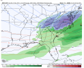
Yep. High is weaker and cold air source is warmer (at hour 156).GFS gonna back off from next weeks Ice wonder what the gefs will show
I definitely could see an ice storm brewing with that look. I despise ice though so im goodThe general pattern is still supportive of CAD thoView attachment 97787


Where in the GFS wheelhouse now it might be sniffing something out. Well see. Interesting trends no doubt.

GFS going for the split.


Gefs with more ridging in the nao regionView attachment 97797

