NBAcentel
Member
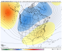
Looks reasonable , SE us will alternate between CAD/ Warmth in between/ and glancing blows from all that cold air over the plains. What ya know it’s winter.Weather penis pointed right at the US
View attachment 97800
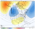
This isn’t bad, GEFS is far less torchy then the GFS
View attachment 97801
Oth that’s some nice stuff for our cad source region
Yep, imagine there are some members that are frigid and some a little torchy but I do like the trends.View attachment 97814
Christmas from the gefs mean looks avg but with as much variability thrre is that's kind of expected
Seems like we do this every time we build a -nao.
I knew the -NAO was going to save us again this yearGEFS backing off on the warmer pattern it had around this time largely thanks to that stronger -NAO.

Gefs still chugging along at 342 with a -epo, -nao, 50/50View attachment 97818
Changes howSome changes in the eps through 192 but nothing eye popping

What fro saidChanges how
I don't think you can hate that look if you live roughly along the I40 corridor, in the wedge regions, and even in the eastern Carolinas. Good potential to string out some fronts and overrun here as long as we don't drop systems too far down the WCVerbatim this isn't far off from something pretty good. It's a transitory pattern w/ bouts of warm and cold marked by potential CAD events.

I don't think you can hate that look if you live roughly along the I40 corridor, in the wedge regions, and even in the eastern Carolinas. Good potential to string out some fronts and overrun here as long as we don't drop systems too far down the WC

I just looked at the individual members. The ones that are cold around here Christmas day are generally warm after Christmas and the ones that warm Christmas day are cold after. Good timesLooks like lots of back and forth (probably seasonable-seasonably warm overall here verbatim), but yeah it's not that far off from being a good pattern.
EPS is having a hard time w/ the -NAO

5,19, or 23 please!


Yeah I'm hoping that block can retrograde into west based. East based favors cutters and with that Pacific block too far west the SER is already going to try to rain on our parade and force cutters. Sure we may get lucky with perfectly time a Miller B/CAD event but if the Greenland block moves west I'd feel better.. Maybe an unpopular opinion here but I wish that Pacific ridge would weaken some if it's not going to move into a more favorable location. Then the -PNA and SER wouldn't try to flex as hard and we could deal with a less than ideal location of the NAO. The trade off would likely be less cold air available though. It just shows how difficult it is to get frozen precip here. There is no slam dunk pattern for us and a little luck is always involved. Good thing that it usually all comes together once or twice a year some kind of way.Would love to see the Atlantic block shift west. It looks like it wants to stay east based so far. That would help I think too considering the pacific ridge is so far west.
Model consensus has MJO backing up to phase 6 before going back the normal counterclockwise route back through 7. More delays on eventually getting (hopefully) to 8. Extended Euro takes til January 10th and bc Euro doesn’t get there at all through the 30 day run! Even the bc GEFS doesn’t get there til 12/26.
Edit: GEFS suggests -NAO/-AO by late week and likely holding for awhile but PNA stays negative.
