-
Hello, please take a minute to check out our awesome content, contributed by the wonderful members of our community. We hope you'll add your own thoughts and opinions by making a free account!
You are using an out of date browser. It may not display this or other websites correctly.
You should upgrade or use an alternative browser.
You should upgrade or use an alternative browser.
Pattern December to Remember
- Thread starter SD
- Start date
I remember way back January of 77, I live in northwest middle tn we got at least a trace of snow 4 days in a row. We got a good snow every 3-5 days for most of january. In fact we missed the entire month of January. The morning we were to go back to school started a incredible 4 weeks that is only rivaled by 78 and 85 here.
Blue_Ridge_Escarpment
Member
Looks great. I’ll be on the OBX ?
cd2play
Member
Definitely won't ever see schools miss an entire month again thanks to Virtual Learning.I remember way back January of 77, I live in northwest middle tn we got at least a trace of snow 4 days in a row. We got a good snow every 3-5 days for most of january. In fact we missed the entire month of January. The morning we were to go back to school started a incredible 4 weeks that is only rivaled by 78 and 85 here.
You want COLD move very far west!
Sent from my iPhone using Tapatalk
Sent from my iPhone using Tapatalk
Yummy heavy downpours of sleet reported to my s/w
Wouldn’t be surprised to see a flake western Wilkes and Surry before all sleet.
A bad enough ice storm could stop things for awhile.Definitely won't ever see schools miss an entire month again thanks to Virtual Learning.
bigstick10
Member
From KATL/KFFC: This makes me barf...
The main attraction of the extended is that the southeast remains in
a regime of deep southwesterly flow throughout the weekend into next
week, and temperatures will reflect that. Expect highs to creep up
into the upper 60s to mid 70s by Sunday, 10-15 degrees above average
for late December, and lows will follow suit: in the mid 40s to low
50s, as much as 15-20 degrees above average. It's definitely looking
like a t-shirt Christmas this year!
- Joined
- Jan 23, 2021
- Messages
- 4,603
- Reaction score
- 15,199
- Location
- Lebanon Township, Durham County NC
Not everybody can live in places of culture like Wake Forest.Sure it wasn't bullets?
Dewpoint Dan
Member
I used to think Wake Forest University was located in Wake Forest. ?Not everybody can live in places of culture like Wake Forest.
Blue_Ridge_Escarpment
Member
Had a decent sleet shower when I was in Asheville around 6 PM.
A little late posting … in Jasper, GA I saw nothing but cold rain today. However my wife heard some folks had snow over in Big Canoe just to the NE. Around here, it appears at over 3,000 ft may have had some light snow. Have no reports of any accumulation.
I loved today’s breezy, cloudy, and quite cool day. The high was only 48, the first only in the 40s this season. Yesterday’s high was 50 as was one day in November. The only disappointing thing was lighter than expected rainfall, but the good news was that allowed for a dry period to go take a robust stroll in the refreshing chill.
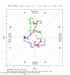
The MJO has remained in phase 7 for quite awhile and is expected to be there for a good bit longer per models. There have been other very long periods in 7. I’ll post them later. But they normally eventually still progress counterclockwise.
The MJO has remained in phase 7 for quite awhile and is expected to be there for a good bit longer per models. There have been other very long periods in 7. I’ll post them later. But they normally eventually still progress counterclockwise.
I stand corrected. We were in phase 6 for 15 of the 20 days so far this month. As of yesterday, we had been in 7 only 2 days in a row and 4 days this month.
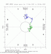
Models are unanimous now in keeping the MJO in 7 for the next 14+ days. I’m going to assume it will turn out to be 19 more days to make it an even 3 straight weeks in 7.
Last edited:
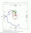
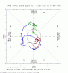
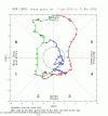
Interesting that those top two stayed in phase 6-7 in the heart of our winter and finally made the favorable progression just in time for the month of March when climo gets out of our favor in a hurry .. but we’re now going to be making that hopefully favorable progression at a time of peak climo .. can’t not like that at this point .. only key now is getting there .. I just hate that I have to keep looking at all the out dated comments of “oh lord look a ridge this is utterly TERRIBLE if you like snow and cold wow winter is canceled officially in late December! Cause I said so!” For the next two weeks ?Between phases 6 and 7, it will likely end up 5+ straight weeks in those phases. Sometimes it takes seemingly forever, but past cases of long periods in one or both of 6 and 7 suggest it will very likely eventually rotate to 8-1-2:
View attachment 98774View attachment 98775View attachment 98776View attachment 98777
cd2play
Member
Per my calculations, if it follows those analogs, we would get to phase 8 around mid-February.Between phases 6 and 7, it will likely end up 5+ straight weeks in those phases. Sometimes it takes seemingly forever, but past cases of long periods in one or both of 6 and 7 suggest it will very likely eventually rotate to 8-1-2:
View attachment 98774View attachment 98775View attachment 98776View attachment 98777
Per my calculations, if it follows those analogs, we would get to phase 8 around mid-February.
I don’t see why you say that. See Nick’s post just above. Phase 6 was entered way back on 12/2. It should get there by no later than January 15th imo.
I’ll take 70s and sun over 32.9 mud rain for Christmas weekend. Very rare to get a white Christmas so might as well be good weather for travel. Might even do a outside cookout this year ?
L
Logan Is An Idiot 02
Guest
I don’t see anything great about the GEFSThere will be fans of the 6Z GEFS and I’m not just talking about the end for a change. Also, the end of the 0Z EPS is nice!
I don’t see anything great about the GEFS
Hint: don’t focus on your backyard and on the exact output because it isn’t that it is BN, but rather on how different the pattern is vs earlier runs and the overall cooler temperatures in much of the country after day 10 vs earlier runs with a weaker SER that doesn’t hold well. Maybe I should have posted this in the January thread.
Webberweather53
Meteorologist
Hint: don’t focus on your backyard and on the exact output because it isn’t that it is BN, but rather on how different the pattern is vs earlier runs and the overall cooler temperatures in much of the country after day 10 vs earlier runs with a weaker SER that doesn’t hold well. Maybe I should have posted this in the January thread.
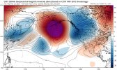
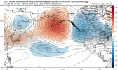
The pattern isn’t any different though from what we have in late Dec. The GOA ridge is literally in the exact same spot from start to finish. Perhaps if we get lucky, the Siberian vortex will undergo a cyclonic wave break and force it into the Bering Sea.
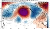
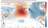
The pattern isn’t any different though from what we have in late Dec. The GOA ridge is literally in the exact same spot from start to finish. Perhaps if we get lucky, the Siberian vortex will undergo a cyclonic wave break and force it into the Bering Sea.
View attachment 98788
View attachment 98789
Webb, did you mean to post the 0Z CMC ensemble instead of the 6Z GEFS? And yes, I realize the GOA ridge is still there. So, not a major pattern change. But the SER isn’t as strong and that kills the torch and gives closer to normal temperatures. Plus there’s decent cross polar flow and what looks like more of a -EPO perhaps.
Webberweather53
Meteorologist
Webb, did you mean to post the 0Z CMC ensemble instead of the 6Z GEFS? And yes, I realize the GOA ridge is still there. So, not a major pattern change. But the SER isn’t as strong and that kills the torch and gives closer to normal temperatures. Plus there’s decent cross polar flow and what looks like more of a -EPO perhaps.
The se ridge and temp anomalies aren’t as strong because of the artifact of increased spread and damping with range in the ensemble means.
There could be more -EPO if we see the Siberian Vortex undergo a cyclonic wave break (tilting negative in the process and forcing height rises downstream over Alaska and the Bering Sea), but those are hard to forecast more than a week or so out
Webberweather53
Meteorologist
Webb, did you mean to post the 0Z CMC ensemble instead of the 6Z GEFS? And yes, I realize the GOA ridge is still there. So, not a major pattern change. But the SER isn’t as strong and that kills the torch and gives closer to normal temperatures. Plus there’s decent cross polar flow and what looks like more of a -EPO perhaps.
It honestly doesn’t matter what model I show, they all depict the GOA ridge in about the same spot as it is now. The one slightly encouraging sign on both ensembles is it does look like the E Asia vortex is in a slightly more favorable spot to create -EPO and this could be undersold on the models but my confidence in this is pretty low atm
Well, thus far Chattanooga has seen 4 freezes for the month of December with 1 more progged tonight, but that's probably it for the month... last time we only had 5 freezes in December was way back in 1936.
Also, coldest temp season-to-date for Chattanooga is 27. As it stands, that's tied for 3rd warmest minimum for a fall/winter season heading into New Years.
.
Also, coldest temp season-to-date for Chattanooga is 27. As it stands, that's tied for 3rd warmest minimum for a fall/winter season heading into New Years.
.
What a Moon out tonight. So low and Massive
NoSnowATL
Member
Winter snow moon. It’s a good sign.What a Moon out tonight. So low and Massive
Things don't work........Winter snow moon. It’s a good sign.
Oh never mind
Downeastnc
Member
Wonder if they are having trouble with the sensor at PGV temp went from 36 to 45 in 30 mins in the last hr, wind went from calm to NW at 3 but would that warm it up 10 degrees? DP went from 36 to 25 in the same time frame....
22:35 | NW 3 | 10.00 | Fair | CLR | 43 | 25 | 49% | NA | NA | 30.03 | NA | ||||||
| 22 | 22:15 | NW 3 | 10.00 | Fair | CLR | 45 | 27 | 49% | NA | NA | 30.02 | NA | |||||
| 22 | 21:55 | Calm | 10.00 | Fair | CLR | 45 | 27 | 49% | NA | NA | 30.01 | NA | |||||
| 22 | 21:35 | NW 3 | 10.00 | Fair | CLR | 43 | 28 | 57% | NA | NA | 30.00 | NA | |||||
| 22 | 21:15 | Calm | 10.00 | Fair | CLR | 36 | 34 | 93% | NA | NA | 30.00 | NA | |||||
| 22 | 20:55 | Calm | 10.00 | Fair | CLR | 36 | 36 | 100% | NA | NA | 29.99 | NA |
25.7 so far this morning making it the coldest morning this month
Got down to 22.6 at 3:25 am. Chilly.
28 currently. Not sure how cold we got. This will be the last temperature we see below 50 degrees for at least the next 9 days. Let that sink in.
bigstick10
Member
24.7 at my house,,,Yeah pathetic on that thought, might be longer than that even.28 currently. Not sure how cold we got. This will be the last temperature we see below 50 degrees for at least the next 9 days. Let that sink in.
24.6 was my low. Jimmy, I think your lows will dip below 50 the next couple of night but I get your point that it's going to be warm the next week.28 currently. Not sure how cold we got. This will be the last temperature we see below 50 degrees for at least the next 9 days. Let that sink in.
I think the wedge Sunday into Monday might be the shortest wedge time wise I've ever seen
Dang only 25.7 here, really gotta move the Weatherflow ?Got down to 22.6 at 3:25 am. Chilly.

