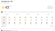
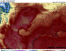
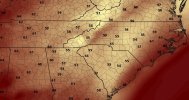
You mean after tonight right? Should be another frosty one tomorrow morning28 currently. Not sure how cold we got. This will be the last temperature we see below 50 degrees for at least the next 9 days. Let that sink in.
-
Hello, please take a minute to check out our awesome content, contributed by the wonderful members of our community. We hope you'll add your own thoughts and opinions by making a free account!
You are using an out of date browser. It may not display this or other websites correctly.
You should upgrade or use an alternative browser.
You should upgrade or use an alternative browser.
Pattern December to Remember
- Thread starter SD
- Start date
Dewpoint Dan
Member
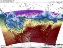
5 straight nights where your morning low is warmer than your average highYeah maybe low 30’s tonight. After that it’s ? time View attachment 98926
Brent
Member
Does anyone know if the west (California) is setting snow records for December? I can’t recall ever seeing such model weenie snow from the GFS usually it’s about drought? I heard even the low elevations will have a white Christmas too. @Webberweather53
What's really crazy about these departures is that they're based off the new 1991 - 2020 average temps, which had already seem a decent tick upward from the previous 30-year averages.
Today looks to overachieve by a few degrees. Currently 76*F at DFW.
cd2play
Member
Appears BNA will end up with an average mean temperature of 50+ this December. The only other years that has happened is 1889 (56.4), 1931 (50.2), 1956 (50.2), and 2015 (53.1) *** averaged 49.6 in Dec 1984, just before the hammer dropped in Jan '85.
1889-90 & 1931-32, January & February continued the exceptionally warm, with very cold air in early March. 2015-16 was followed by a major January snowstorm in much of middle TN, with winter cutting off just after Valentine's Day. We are currently sitting at 50.7 through the 22nd; with the remainder of the month's expected very warm conditions, wondering if it could bump it up to 2015 for 2nd warmest ever.
1889-90 & 1931-32, January & February continued the exceptionally warm, with very cold air in early March. 2015-16 was followed by a major January snowstorm in much of middle TN, with winter cutting off just after Valentine's Day. We are currently sitting at 50.7 through the 22nd; with the remainder of the month's expected very warm conditions, wondering if it could bump it up to 2015 for 2nd warmest ever.
It's not often that we're warmer tham Miami at Christmas time. Highs there will only be in the upper 70s.
Much of OK and TX is also under a moderate to severe drought, which I'm sure is aiding in this feedback loop of warm temps.
Not much chance for improvement either in the forseeable future...
Not much chance for improvement either in the forseeable future...
Avalanche
Member
Sad, sad times.
Interestingly enough, DFW's record high of 80°F for Christmas Day was set just in 2016.
That said, the record high for Christmas Eve (88°F set in 1955) is safe.
That said, the record high for Christmas Eve (88°F set in 1955) is safe.
Last edited:
Brent
Member
Interestingly enough, DFW's record high of 80°F for Christmas Day was set just in 2016.
That said, the recird high for Christmas Eve (88°F set in 1955) is safe.
I believe the day after Christmas record is from 2015... The same day as the Garland Rowlett tornado. I remember how it felt like spring that day
Down to 31 outside. Chilly out there
28.6, another frosty oneDown to 31 outside. Chilly out there
30 this morning. I sure am getting a decent amount of freezes for such a crappy weather month.
Tarheelwx
Member
Same here in Colfax. I believe our avg min for Dec will be much closer to normal than our max.
28.8 this morning spent about 12 hours below freezing last night
BHS1975
Member
28.8 this morning spent about 12 hours below freezing last night
It's gonna be over a week before we get below freezing again.
Sent from my iPhone using Tapatalk
Went from 26 around midnight to 44 and drizzle now!
Blue_Ridge_Escarpment
Member
Such a heavy frost that it looked like a snow this morning. 22 degrees
LickWx
Member
Almost guaranteed to be too cool though is the only thing lol.Yeah, it's also showing 10 degrees cooler for sections of Ga, SC, and NC because of more cloud cover. Nice to be at least cool(ish) for Christmas.
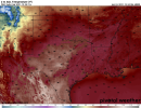
Late afternoon tomorrow:
View attachment 99031
- Joined
- Jan 5, 2017
- Messages
- 3,779
- Reaction score
- 5,990
NAM is already 5 degrees too low for my locale. It does under-estimate quite often, though.Yeah, it's also showing 10 degrees cooler for sections of Ga, SC, and NC because of more cloud cover. Nice to be at least cool(ish) for Christmas.
Late afternoon tomorrow:
View attachment 99031
Dewpoint Dan
Member
Atlanta could have 7 straight days of 70+. Not sure if that's ever happened before in December.
Didn’t someone predict Charlotte would have a top 3 warmest December on record? They’re going to be very close per current forecasts. The warmest are:
55.4 in 2015
54.7 in 1889
53.0 in 1956
50.6 in 1971
Current forecast has 52.9. So, an easy 4th and possible 3rd.
Also, Charlotte is very likely headed to the largest warming from Nov to Dec on record. If they end up with 52.9 and considering Nov was 49.6, the warming would be 3.3. The strongest warming from Nov to Dec on record is only 2.9 (1956) with 1889’s 2.8 in 2nd and 1984’s 2.2 in 3rd.
KATL is clearly headed to their 3rd warmest Dec on record with the current forecast at 55.7. Here are the warmest:
57.6 2015
57.2 1889
54.4 1956
53.7 1984
The 55.7 would be 2.8 warmer than November’s 52.9. However, that much warming would put it only in 4th place with 1889’s warming from Nov to Dec of a whopping 5.5!
*Edited for typo last paragraph about KATL warming Nov to Dec.
Last edited:
NBAcentel
Member
3rd is definitely gonna happen maybe close to 2ndDidn’t someone predict Charlotte would have a top 3 warmest December on record? They’re going to be very close per current forecasts. The warmest are:
55.4 in 2015
54.7 in 1889
53.0 in 1956
50.6 in 1971
Current forecast has 52.9. So, an easy 4th and possible 3rd.
Also, Charlotte is very likely headed to the largest warming from Nov to Dec on record. If they end up with 52.9 and considering Nov was 49.6, the warming would be 3.3. The strongest warming from Nov to Dec on record is only 2.9 (1956) with 1889’s 2.8 in 2nd and 1984’s 2.2 in 3rd.
KATL is clearly headed to their 3rd warmest Dec on record with the current forecast at 55.7. Here are the warmest:
57.6 2015
57.2 1889
54.4 1956
53.7 1984
The 55.7 would be 3.2 warmer than November’s 52.5. However, that much warming would put it only in 2nd place behind 1889’s warming from Nov to Dec of a whopping 5.5!
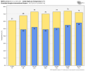
Today's high at DFW was 82°F.
I'm kind of surprised no one pulled the trigger on wind advisories tomorrow.
NBAcentel
Member
Oof that with a fire on grandfather mountainI'm kind of surprised no one pulled the trigger on wind advisories tomorrow.
Yeah tomorrow is a tough fire weather dayOof that with a fire on grandfather mountain
It was horrible in Southern Tennessee. I tried to hunt this evening and it was just way to windy.I'm kind of surprised no one pulled the trigger on wind advisories tomorrow.
Brent
Member
Fire weather here too very windy and dry
Missed the all time December high by 2 degrees due to clouds moving in late but still an insane 78 for late December... Even now it's still well into the 70s
Missed the all time December high by 2 degrees due to clouds moving in late but still an insane 78 for late December... Even now it's still well into the 70s
Looks like Rah NWS playing catch up, probably wake up to an advisory.Yeah tomorrow is a tough fire weather day
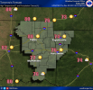
Hazardous Weather Outlook
Hazardous Weather OutlookNational Weather Service Raleigh NC
921 PM EST Fri Dec 24 2021
NCZ011-026>028-040>043-073>078-083>086-088-089-260230-
Halifax-Franklin-Nash-Edgecombe-Chatham-Wake-Johnston-Wilson-Stanly-
Montgomery-Moore-Lee-Harnett-Wayne-Anson-Richmond-Scotland-Hoke-
Cumberland-Sampson-
921 PM EST Fri Dec 24 2021
This Hazardous Weather Outlook is for central North Carolina.
.DAY ONE...Tonight.
Hazardous weather is not expected at this time.
.DAYS TWO THROUGH SEVEN...Saturday through Thursday.
Strong southwesterly winds will frequently gust between 30 and 40 mph Christmas
Day, highest between 10 AM and 4 PM. Isolated gusts between 45 and 50
mph will also be possible, mainly along and east of Interstate 95,
where at least scattered power outages will result. A Wind Advisory
may be needed.
.SPOTTER INFORMATION STATEMENT...
Spotter activation is not expected at this time.
Jessy89
Member

Anyone else see the problem?
Sent from my iPhone using Tapatalk
Someone must be testing out their early Christmas present.
Anyone else see the problem?
Sent from my iPhone using Tapatalk

