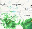
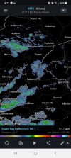
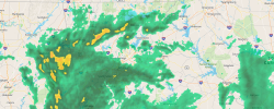
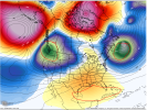
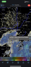
I wouldn’t be at all suprised tomorrow to see some brief sleet or maybe a few snowflakes as the precip moves in. There’s some fairly low dewpoints in the mid levels and temperatures in the area are already in the low to mid 30s.NOAA is saying there's a possibility of unaccumulating snow for the Charlotte area possibly. @Myfrotho704_
View attachment 98655
-
Hello, please take a minute to check out our awesome content, contributed by the wonderful members of our community. We hope you'll add your own thoughts and opinions by making a free account!
You are using an out of date browser. It may not display this or other websites correctly.
You should upgrade or use an alternative browser.
You should upgrade or use an alternative browser.
Pattern December to Remember
- Thread starter SD
- Start date
Jesus, imagine something widespread over the s/e the economic damage would cripple areas
L
Logan Is An Idiot 02
Guest
Jesus, imagine something widespread over the s/e the economic damage would cripple areas
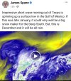
That’s insane. Seems like the west always sees major storms with endless precip. We always have about a 5 hour window of precip while they have 5 days lol
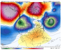
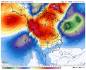
So are we just not discussing the models for the rest of December any more? 
Brent
Member
So are we just not discussing the models for the rest of December any more?
What's their to discuss besides how warm it'll be ?
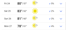
It's just a machine. Energy into the pnw, energy ejected from the PNW across the US and it gets absorbed into the growing low in SE Canada. We get warm days, cool days, some normal days. Kind of sucks the warmest day of the next 7 is Christmas day but at least those with kids will be able to get out and play with the new toys
Some blue showing up on radar east of Atlanta. Anything on mping this morning prob chance of sleet mix Charlotte metro region
ATLwxfan
Member
We will just move along to the 12z GFS. Yeah don’t look.
Sent from my iPhone using Tapatalk
Sent from my iPhone using Tapatalk
L
Logan Is An Idiot 02
Guest
Are we on pace to have a top 3 December this year? In Charlotte?
Man didnt have radar,satelite,wx models , walked outside today would swear a snowstorm was rolling in. Thick clouds and freeze your butt off cold out this morning.
Yep, I saw a ring around the moon last night too and thought the same thing. Things just don't work like they used toMan didnt have radar,satelite,wx models , walked outside today would swear a snowstorm was rolling in. Thick clouds and freeze your butt off cold out this morning.
- Joined
- Jan 2, 2017
- Messages
- 1,566
- Reaction score
- 4,279
B
Brick Tamland
Guest
Yep, I saw a ring around the moon last night too and thought the same thing. Things just don't work like they used to

- Joined
- Jan 2, 2017
- Messages
- 1,566
- Reaction score
- 4,279
That would be NeGa and Rosie from American. I haven't looked over there yetWhos west of Seneca, Lake Hartwell area? Getting virga I suppose
Whos west of Seneca, Lake Hartwell area? Getting virga I suppose
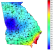
Image for the winter in Northeast Georgia 2021-2022 [save for a desktop background]
41/26 can we at least get a good sleet shower today? I’ll take that as a W for December 2021. EDIT: On a serious note is anyone in far N GA or E AL actually seeing any mixture of sleet or is it just plain cold rain?
Last edited:
No… we’ll probably end up around 10Are we on pace to have a top 3 December this year? In Charlotte?
cd2play
Member
December’s similar to this occurred in 1889, 1931, 2015 and 2019. Probably a few others. Average at BNA so far is 52, top 5 December looking possible.
At least most of us are getting regular chances of rain now compared to the last two or three months. In that regard, the pattern has changed for the better.
FWIW, the warmest December on record was back in 1933 (dust bowl era) with an average temp of 54*F.
After yesterday (and the day before, which both had below normal daily averages), DFW's average temperature sits at 59.8*F.
On top of that, DFW has never recorded a December with an average high above 65*F, and right now it sits at 71*F.
This isn't just a torch, it's an inferno.
After yesterday (and the day before, which both had below normal daily averages), DFW's average temperature sits at 59.8*F.
On top of that, DFW has never recorded a December with an average high above 65*F, and right now it sits at 71*F.
This isn't just a torch, it's an inferno.
FWIW, the warmest December on record was back in 1933 (dust bowl era) with an average temp of 54*F.
After yesterday (and the day before, which both had below normal daily averages), DFW's average temperature sits at 59.8*F.
On top of that, DFW has ever recorded a December with average highs above 65*F, and right now it sits at 71*F.
This isn't just a torch, it's an inferno.
12/19 did break the 50*F+ highs streak though, with only a high of 48*F.
I told my wife this morning that it looked like a snow sky.Man didnt have radar,satelite,wx models , walked outside today would swear a snowstorm was rolling in. Thick clouds and freeze your butt off cold out this morning.
Just to kick us all while we are down on the ground after last nights model runs. The days start getting longer tommorrow.
Honestly though the Official wx seasonal calendar works better for my locaton than the Met seasonal calendar. Sept 21 we really are over the excess heat and humidity as first official day of Fall. Winter usually gets started post Dec 21 more so than Dec 1st. March 21st is probably about a week to 10 days late to officially ring in sping. By June 21 we have had several 90 degree days, but the evenings are still manegable in June. July/August is a whole other ballgame. Sweat getting out of the shower those 2 months.
Honestly though the Official wx seasonal calendar works better for my locaton than the Met seasonal calendar. Sept 21 we really are over the excess heat and humidity as first official day of Fall. Winter usually gets started post Dec 21 more so than Dec 1st. March 21st is probably about a week to 10 days late to officially ring in sping. By June 21 we have had several 90 degree days, but the evenings are still manegable in June. July/August is a whole other ballgame. Sweat getting out of the shower those 2 months.
bigstick10
Member
It is quite chilly today.
Crazy to think that DFW is looking at both an historially warm December and a historically warm February in the same year.
Got both winter extreme covered, haha!
Got both winter extreme covered, haha!
Dewpoint Dan
Member
6 minutes until the winter solstice !
bigstick10
Member
OMG, now we have to worry about sun angle....6 minutes until the winter solstice !
OMG, now we have to worry about sun angle....
Makes no difference when it's never cold enough to snow. ?
smast16
Member
NBAcentel
Member

