• Hello, please take a minute to check out our awesome content, contributed by the wonderful members of our community. We hope you'll add your own thoughts and opinions by making a free account!

Pattern December to Remember

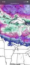
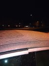
Incoming winter weather advisories tonight! Any ice warrants an advisory and multiple MTN counties are shaded and a sliver of the western foothills.
 
  • Like
Reactions: JJr
Sure it's been warm and more warmth to come but the next 3 days won't get out of the 40's, which is BN. So instead of worrying about the upcoming massive crippling torch, I'm gonna enjoy these next few days of Winter.
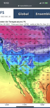
We've got some high end mega frost potential Thursday morning
 
And uncle Larry has chimed in this morning, but he has been saying for a long time it would be late December/early January before any sustained cold and storminess could get into the central and eastern US.


Larry Cosgrove

Larry Cosgrove

Chief Meteorologist,WEATHERAmerica
13m

First, the storm sequence. Then we talk about the east and south advance of Arctic air. Once the current modest shot of Arctic values across Canada, the Midwest and Northeast exits by this weekend, southwesterly flow will allow for a quick warm-up to the right of the Rocky Mountains. While there could be a brief intrusion of cold with an area of low pressure and frontal structure from the south central states to the Eastern Seaboard early next week, this is your basic demand-killer scenario for energy usage. Except in that part of North America west of the Continental Divide. I will warn you that there is potential for some astonishing amounts of rain and snow along the West Coast during the next ten days (graphics in the comment boxes below this post). Each successive storm will tend to push the colder air further inland, and by the week of Christmas and New Year's erode the heat ridge in the Gulf of Mexico and Florida Peninsula. But you will not see a wholesale collapse of the warmth in this progressive 500MB pattern. Instead, a strong positive height anomaly forming in the northern Pacific Basin will edge into Alaska and its Gulf waters. That ridge will push the trough complex to the center of the continent, with northerly flow aloft bringing the frigid air into the Great Plains, Mississippi Valley, and then the Eastern Seaboard. This process will take about 2-3 weeks, and will likely be accompanied by a significant storm of the Colorado/Trinidad "A" type that aims at the lower Great Lakes and St. Lawrence Valley. Again, the process takes time. And with a progressive pattern and an active La Nina, we are bound to see a profound warming in the January Thaw in the middle two weeks of next month. But with any luck, the CFS series scenario of an icebox period Jan 20 - Feb 15 will verify, and make snow and ice fans like me smile.

Good luck with seeing that with a good Niña still effect late winter February ?
 
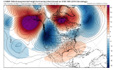
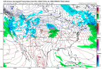
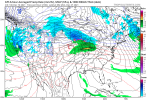
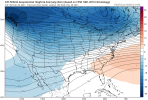
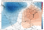
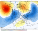
Can we talk about how insane this looks for December standards, this is a May like/early June H5 pattern View attachment 97077View attachment 97078View attachment 97079

Really a bummer for a cold/snow lover like me. Just the worst honestly, but it is what it is. In a Nina I have very little expectations. However I'm keeping a close eye on the mjo. Maybe at the end of the month we can get into phase 8 and things will improve (looks like we've got a shot). Right now it just looks like the best we get is a cold dump out west. Suspect it's going to be there a while. We'll see.

1638886004231.png
 
Really a bummer for a cold/snow lover like me. Just the worst honestly, but it is what it is. In a Nina I have very little expectations. However I'm keeping a close eye on the mjo. Maybe at the end of the month we can get into phase 8 and things will improve (looks like we've got a shot). Right now it just looks like the best we get is a cold dump out west. Suspect it's going to be there a while. We'll see.

View attachment 97082
I like this
D21E4D83-B071-4D60-BEBC-42B82D83B5CC.jpeg
 
Doesn't get any better than phase 7 in January

EMON_phase_MANOM_51m_small.gif
 
Really a bummer for a cold/snow lover like me. Just the worst honestly, but it is what it is. In a Nina I have very little expectations. However I'm keeping a close eye on the mjo. Maybe at the end of the month we can get into phase 8 and things will improve (looks like we've got a shot). Right now it just looks like the best we get is a cold dump out west. Suspect it's going to be there a while. We'll see.

View attachment 97082
I hope the GFS is correct, but the EURO isn't as progressive, it stalls in 6/7.
ECMF_phase_51m_full.gif
 
Gonna be keeping an eye on the MJO the next few weeks. The bias-corrected ECMWF monthly forecast from yesterday is probably one of the more realistic ones overall, keeping the MJO milling around w/ amplitude between phase 6-7 for basically the rest of December, which signals warmth overall in the SE US and cold intruding into the N Rockies + upper Midwest (canonical NINA pattern)

EMON_phase_MANOM_51m_small.gif


The reason I say this is when you breakdown the daily probability (%) of seeing a winter storm in NC (east of the mtns) by MJO phase and month, what really stands out is MJO phase 7 in January w/ nearly a 16% chance of a winter storm per day, higher than any other phase in any month, phase 8 & null are a somewhat close seconds in January. This likely has a lot to do w/ the subtropical jet becoming more active & a -NAO tendency being favored when the MJO moves towards the west-central Pacific (phase 7). If the CFS and EPS + empirical wave propagation for a slow-moving La Nina MJO event (i.e. history) are generally to be believed, we could see this come to fruition in/around early January. I.e. the most favorable window for a winter storm may be in this time period

Chart is shown below: NC Winter Storm Probability by MJO phase & month since 1974.

Most favorable phase overall (red/bold, Jan Phase 7), most favorable phase per month (orange/bold), 2nd & 3rd most favorable (yellow/bold)

View attachment 96701

Data source:
Nov-Mar Daily Teleconnections and NC Winter Storms List (1948-2021)

Going to repost this as a friendly reminder, because I see some recent posts saying they'd rather see MJO phase 8 in the longer-term. Honestly, both phase 7 & 8 are excellent in January and you really can't do any better than January phase 7, which has a one in six chance of producing a winter storm in NC on any given day. Odds are, if we rumble through phase 7 or 8 for a week (or more) in January as the Euro monthly suggests, we'll probably see at least one minor (1"+ snow/sleet or Trace ZR) winter storm somewhere east of the mountains in NC.

capture-jpg.96701
 
We on the eastern side of the ridge probably meaning temps going below forecasted at night and temps going above forecast during the day, a 60-70 over 30-40 type setup

Good news is w/ +EPO, the core of the warm anomalies will be to our north. Definitely well above average but not quite as far above normal as the northern tier of the US will likely experience at least through the next 10 days or so.
 
Back
Top