Webberweather53
Meteorologist
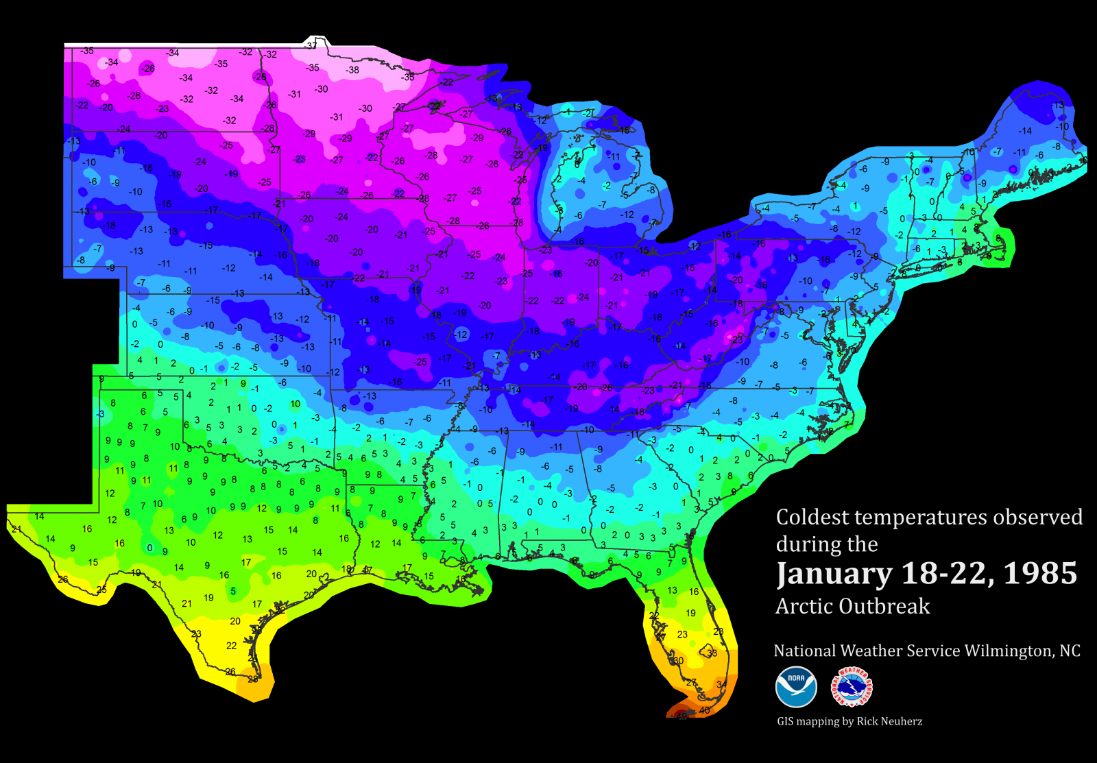
Although Webb is 100% right about the GFS cold bias, others have pointed out that models often have trouble with modeling how far south low level very cold air will go with big and very strong Arctic highs. I think that the major 12/1983 and 1/1982 (snowjam) cold outbreaks are good examples of this. Has this problem been perfected? I don't know but I'd be wary about the possibility of it getting colder than even the coldest GFS runs have shown. This is no ordinary setup. I can't even recall anything like what we're seeing now, all 3 major models repeatedly showing these huge highs. Something highly unusual apparently is going to happen.
See my post immediately above this one in response to Shawn. If you have any questions about what I discussed feel free to ask!