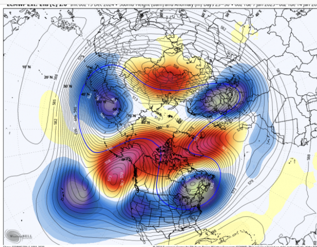
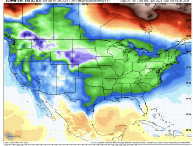
1st half of December Pattern / Temperatures / Snowfall
View attachment 156077
View attachment 156078
View attachment 156079
If this was all like a half wavelength west no one would care about the rest of winter
1st half of December Pattern / Temperatures / Snowfall
View attachment 156077
View attachment 156078
View attachment 156079


In a general sense, if Canada is under mega ridges it usually means we’re under anamolus troughs/lows, and all that wave action is shifted further south than usual. You aren’t gonna set all time record lows in a pattern like that, but it can absolutely be cold enough to snow, especially in prime climo time.Serious question, how? If the source regions are starting out 20 degrees above average I can't see how that's good. We always have temp issues anyway.
Thats what we have to root for. Id be estatic with another half to 1 inch duster right before Christmas and call it a huge win. Plus we should have a good open window to take a shot at a big dog in early to mid January. Thanks for posting.GFS starting to pick up on some clipper snow action again View attachment 156081
You’re right. I’d rather have fantasy storms than none at all.The 18z GFS looks good right at the end of its run (first of January). Of course this is out in fantasy land, but this is what we want to see starting off the new month.
View attachment 156088
Where do you live near? We had nothing just north of Pittsboro.Thats what we have to root for. Id be estatic with another half to 1 inch duster right before Christmas and call it a huge win. Plus we should have a good open window to take a shot at a big dog in early to mid January. Thanks for posting.
I’m just following the majority of the board! Everyone lives and dies by every operational model! Same ole , Same ole!My goodness. Folks tossing in the towel on December 16th. What you say could be true but its a long way from being over.
Nw Randolph County. We had solid 3/4 inch. Sw part of county over an inchWhere do you live near? We had nothing just north of Pittsboro.
Just a note, showed something similar (nothing) until a day or 2 out before the last light event for NC. Columns are not far off from saturation
Please let this happen again
Yeah, I think you’re onto something fro
Nw Randolph County. We had solid 3/4 inch. Sw part of county over an inch
